Planes, Trains and Automobiles or Tunnels, Dams and Natural Wonders!
NOTE: If you have been following our latest trip of Planes, Trains and Automobiles, you know that we were off line while on Amtrak for the past 3 days. So, if this applies to you, you should skip down to Day 20 and read up the site to get current.
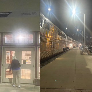
Day 22 – Wednesday – Our night sleeping was MUCH better. We think our theory of sleeping while the train is on flatter terrain is probably correct. That does not mean we did not get thrown around a little, just not as much. Chris still had 4 move hours but reports she slept much better. That doesn't mean we didn't step out in Minot ND.
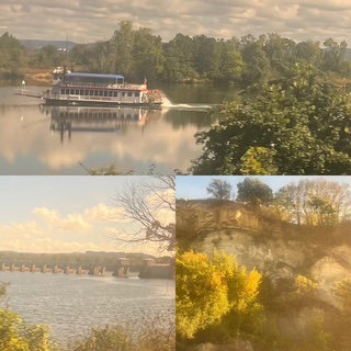
Again, we were up early for breakfast and then visited the Observation car. We were in Minnesota now and looked very Michigan-like. The train joined up with the Mississippi River for quite a while which provided a lot of nice scenery. I saw a Trumpeter swan, 3 turtles (turtles are hard to spot, going 60+ mph on a train so don’ laugh) and Chris spotted a Bald Eagle flying over the Mississippi and thousands of cows. We saw barges and even 1 stern wheeler riverboat!
The ride to Wisconsin was pretty as color is definitely starting to show. We were surprised when we entered a long tunnel, somewhere before the Wisconsin Dells. Who knew there was an active tunnel in central Wisconsin?
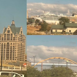
We were able to get out and walk the station platform in Milwaukee which seemed like a nice city from our vantage point.
I forgot to mention that yesterday; the number of freight trains we crossed was amazing. We didn’t count as we didn’t think about it, but it had to have been dozens. A few of them put us behind schedule by an hour as freight trains have priority over passenger trains (stupid, eh?) but Amtrak was able to make up time, so we arrived at Chicago’s Union Station right on schedule. As for today, we saw many more freight trains but not nearly as many as they became less common as we got closer to Chicago. When two trains cross, often both going 50 mph or higher, it is very hard to count cars. I had one opportunity to try as one passed us while we were sitting still and I came up with 125 cars. No idea what the average length of a freight train is, but that 125 seemed about normal to us.
We entered Union Station and, as if we knew where we were going, almost immediately had assistance from the Business Class associate and got us set up in the lounge. Our Pere Marquette train left 1 minute ahead of schedule for Grand Rapids and it was getting dark fast so pictures were nonexistent. However, the train is much newer and nice than the Empire Builder and the down time did provide me with the time needed to type up the last three days of our journey and that is great. TTFN (Ta Ta For Now as Tigger would say).
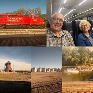
Assorted pictures from Wisconsin and one of us on the Pere Marquette.
We are scheduled to arrive at 11:28 PM (about 50 minutes from now) and if all goes well, we should have an Uber driver waiting for us as well as a short, hot shower and a big comfortable bed.
Update: We DID arrive 2 minutes early in Grand Rapids and Uber was waiting - we were in our house by 11:52 pm. Excellent!
Info on Trip:
7 National Parks in 3 states. We are at 53 National Parks
1,800 miles flown, 2,400 miles ridden and 3,753 miles driven
2 1/2 audio books finished
Day 21 – Tuesday – Our night sleeping was the best simulation of sleeping on a roller coaster that you could ever do! We both wear Apple Watches and one of their features is recording each day which hours and “sees” you moving around for at least 1 full minute during the hour. Well, over last night, Chris recorded 6 different hours which had movement (only ONE that she did not record movement!) and I recorded 4 which is just nuts. NOTE: We were on the lowest level of the train, which they say is the most stable! When we arrived at Spokane around 12:30 am, we woke up so I went outside to watch them couple our two trains together.
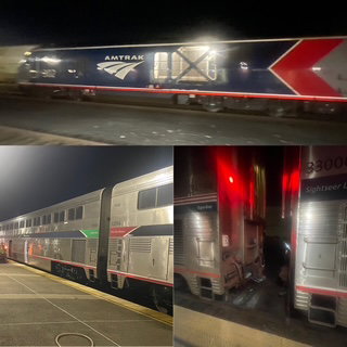
The train leaned, jerked, made lots of noises between it and the rails (but none of the perfectly synchronized (tat, tat, tat) that you might expect being on a train. We woke up at 6:00 and decided going to breakfast sounded good. It is worth mentioning that as crazy bumpy the ride was, we both felt very well rested and it didn’t seem to affect today at all.
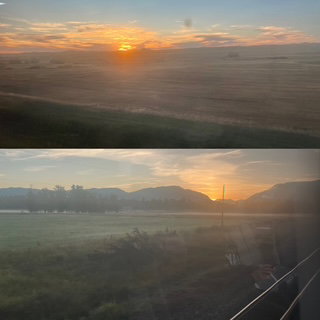
I stepped off the train just in time for a sunrise.
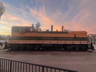
Later in the day as we were discussing our night, we kept going back to our last train ride to Grand Junction CO and not remembering any similar issues with sleeping, it finally occurred to us, that trip we were sleeping in Iowa and Nebraska, two very flat and probably smooth rail states. Last night we were in Idaho and Montana, not flat at all and, as we learned, not smooth either!
The early breakfast was great and helped us land two great seats in the observation car as we entered Glacier National Park. There was quite a bit of fog as the sun rose, but it burned off rather quickly. We saw some deer and something swimming in a lake that was leaving a small wake which we think was a beaver or an otter.
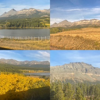
Chris headed back to the room and I stayed a little longer, waiting for the Lodge at East Glacier.
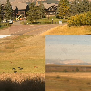
When I joined Chris, we decided to order our lunch to our room, which was very relaxing. I had a Angus burger with a brownie and Chris had a Beyond burger with a butter cake (DELICIOUS!). As the day progressed, we learned that once you leave the Rockies in Montana, the scenery doesn’t change much for about 9 hours (We were in Montana for about 12 hours, it is a very big state). That said, it does provide incredibility multi-colored sagebrush, antelope and lots of grain elevators.
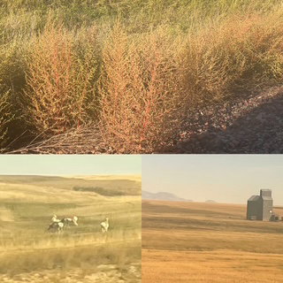
We understand why they call it ‘big sky’ country – since it is so flat and goes on forever, when you look out to the horizon, you see way more sky then you do land! That doesn’t mean it isn’t beautiful and it makes it much easier to spot antelope (which we did on several occasions) and I saw a giant Teepee on the horizon outside Browning but couldn’t get a good picture of it. We started a new audio book, Wild Dark Shores as we finally finished Heroes by Stephen Fry).
For dinner we went to the Dinning car for our 3-course dinner. You sit in groups of four so the couple we sat with was from Fargo and would be getting off the train around 4:00 am tonight. He was a Veteran of the Vietnam War and was a medic/corpsman, she was a bookkeeper. They seemed very nice and having been married 51 years, got along very well. Sunset at Dinner.
While we never felt tired during the day (a quick 30-minute nap didn’t hurt) by the time we were getting ready for bed, we were both a bit slap happy, perhaps more tired than we thought.
The day before when we sat in the roomette for the first time, I was explaining to Chris which side of the train we wanted to sit on for the Columbia River section and the direction the train would be leaving the station. I was my cool analytical self, while the directionally challenged Chris just smiled and disagreed with me. I tried so hard to explain which way the train would be leaving the station, but she just couldn’t get it. After a few quiet minutes, it suddenly occurred to me that she was right! So as today progressed she “reminded” me of that fact a few times, leading to a crescendo during our slap happy bedtime.
Day 20 – Monday – First thing first, I am writing Day 20, 21 and 22 from my seat on Amtrak’s Pere Marquette Chicago to Grand Rapids train. It is 8:00 pm, it’s dark so there is nothing to see or take pictures. So, for the first time in 3 days, I yanked out the laptop and here we go. I will continue to document the trip in the same way, as if I am updating each day as it happened. Hope that makes sense.
Today’s the day we start heading back to Michigan. We made sure we had everything packed and organized and headed to Portland International Airport to return the rental. The drive through downtown was fine and, at this point, we had done it 3 or 4 times, so it was easy to navigate. We bought our last tank of gas ($5.26). It is worth sharing that Portland might have the longest walk from the airport to the rental counter, only surpassed by the walk from the rental return location to the airport!! Our first big decision of the day was to take the light rail back into Portland, transfer to a Streetcar and then walk a few blocks to Union Station OR just get a Lyft and pay a few more $. Having already completed the Portland Airport Rental Trek, we decided to use Lyft. 😊 The Lyft driver was already at the airport and a nice guy so the drive to Union Station went very well.
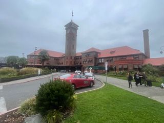
We arrived at Union Station just 4+ hours ahead of departure. Not that we are THAT paranoid, we just had to get the rental back or get charged for an entire day.
The Station is a classic. Built in 1896! Gorgeous on the outside and very nice on the inside.
Since we had a Roomette reserved for the ride home, that gave us access to the First Class lounge: nicer seating, free non-alcoholic drinks, and snacks. The time went by rather quickly.
We boarded the Empire Builder and went straight to our Roomette to find out if it was as small as advertised. It was. 😊 During the day, it had two very roomy seats that faced each other and at night, those seats went flat for one bed and then another bed came down from the ceiling.
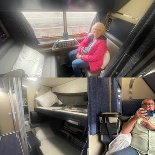
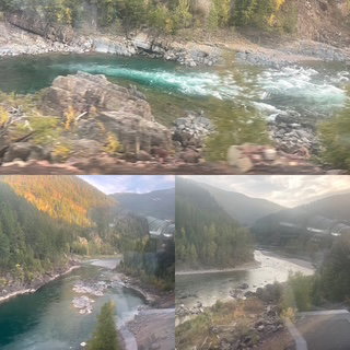
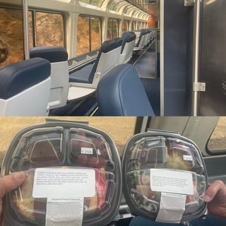
The seats were very comfortable, and we used them most of the time except for the two times we went to the observation car. Which were the first night as we railed along the Columbia River Gorge and the following morning when we reached East Glacier and stayed in the Observation car until we reached West Glacier (along Glacier National Park).
While our tickets came with “first class” meals for both days of the ride, our first dinner tonight was at “take out” dinner because the Empire Builder going east starts at 2 different trains. The Portland Train (ours) has Sleeper cars, coach cars and an Observation car. The Seattle train has a Dining car instead of the Observation car, a sleeper and coach. The two trains meet in Spokane and combined. Thus, the Oregon train provides “to go” dinners as it doesn’t have a dinning car. I had a very good Pastrami sandwich, and Chris had a chicken salad and since we could, we had them in the Observation car!
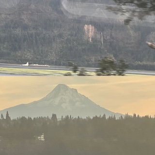
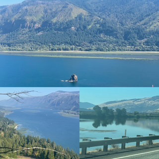
The trip down the gorge was much nicer than I expected. The train is on the WA side of the river, and it seems like much of the scenic beauty is on the Oregon side. That is one of the reasons we drove the Oregon side yesterday and then came back to the WA side, just to get as many angles and views as possible. As it turned out, even though it was just 24 hours earlier that we drove the WA side, it was as if we were a different world from the train. The first “sight” of the trip was that of a dog walker quite a way from civilization walking away from us wearing a thong, we didn’t need to see that much butt. 😊 The road had several small tunnels while the train had many more and a few quite long ones! Sunday was a completely calm day so we did not see any windsurfers that Columbia is known for. Today, wind and white caps (which seems strange on a river) so the wind surfers were out in droves. On top of that, we saw several kite surfers who were literally fling through the air as they jump wave and I would guess, some of them were at least 15 feet in the air, most probably closer to 10.

The scenery from the train was much better too. Yesterday at Vista Point (OR side) the fog limited our visibility to basically nothing. On the train, we could look across the river and see it well. We could also see the Multnomah Falls and had many views of Mt. Hood.
The sunset was hard to get as we were heading east but since the train hugged the coastline, every so often we would get a view back down the river.
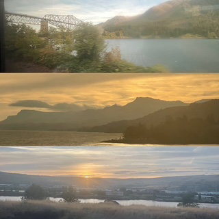
We saw fishing boats and salmon nets and so many other things. As it started getting very dark, we went back to our Roomette to see how the sleeping part of this trip would go. Note: I wasn’t paying close attention to my iPhone storage, and I took so many pictures I filled my iPhone! Chris came to the rescue with her phone and later in the evening, I cleaned my phone to make room.
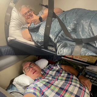
As you can see, Chris made it into the upper bunk (you didn’t think I would even try, right?). My bed was about 2 inches longer than me so as long as I kept my head next to the wall, I was fine. Chris getting into the bunk was something to behold. Not a lot of room up there. Now, the important thing, how was the night sleeping?
Day 19 – Sunday – Our plan today was to go with the flow. We wanted to head to Multnomah Falls and the Columbia River Gorge, but it can be very hard to get parking on weekends, and we decided we didn’t want to get up early just to try and improve the odds. We would just see where the day took us.
We didn’t leave the room until almost 9 and what awaited us? FOG! It was 51 with a high expected around 78 but a nice forecast didn’t matter as we could only see about ½ mile. Given the weather, we decided to take our time and drive the historic scenic route 30 to Multnomah and enjoy what we could and not take the interstate and try to get to the Falls the quickest way. Besides, with this fog, we weren’t sure how much of the falls we would see. The route starts in Troutdale, which is exactly what you expect in a nice town at the start of a scenic / mountain drive.
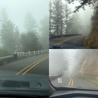
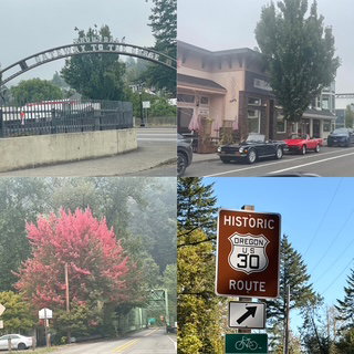
As we drove into the Columbia River Gorge, the fog got thicker. There were times when 100 or 200 yards was probably the best. Our first big stop was at the Vista House at Crown Point. It was built in 1919 on a bluff, 733 feet above the Columbia River and offers incredible panoramic views. Of course, if you have pea soup fog, it offers you cool pictures of the Vista House as if it is in a cloud. 😊 Enjoy the pictures below.
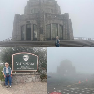
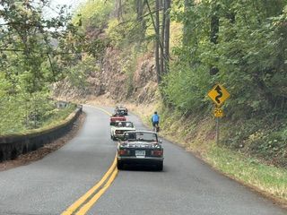
We have learned at least two things on this trip: 1) Washington and Oregon have fog like Michigan has clouds. 2) Unlike MI fog, the fog here can burn off extremely fast. In North Cascades, we could see it disappearing right before our eyes. This comes in handy if you are driving a narrow scenic road. Within minutes of the pictures of Vista House, we drove into a think wooded area and the fog was gone. When we came out of the thick forest, fog was nearly gone all the way across the Columbia Valley. Woo Hoo! Also, we had picked up eight (8) classic Triumph convertibles right behind us. It was strange to look in the mirror on these winding roads and see a parade of these cool small cars.
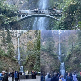
We arrived at Multnomah Falls, probably because it had been zero visibility all morning, there was parking available! Multnomah Falls is the tallest fall in Oregon (620 ft). No fog, sun starting to come over the top of the falls as we arrive, what a view!
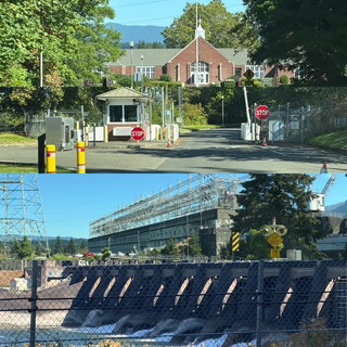
We continue to drive east on 30 to the Bonneville Dam Visitor Center. I had heard that the salmon had started to run at the Multnomah Visitor Center, so we decided to check the dam out. As it turns out, the drive to the dam’s visitor center is worth the time all by itself. You must go through Homeland Security check of your car because the road to the visitor center takes you right over the Locks and the dam (directly next to the power center).
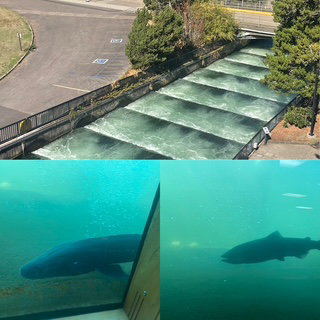
The visitor center was very nice. Told all about the dam (first dam built on the Columbia in 1938) and it has a great fish ladder, both outside and also one inside where you can see through windows into the water of the fish ladder. There were lots of fish – including a Sturgeon!
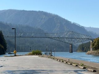
Just up the road was the first bridge across the Columbia, named the Bridge of the Gods.
We continued our drive east. We visited the Oneonta Gorge which has an old car tunnel that is now part of a walking path and horsetail falls.
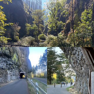
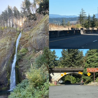
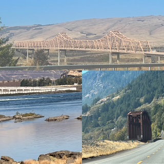
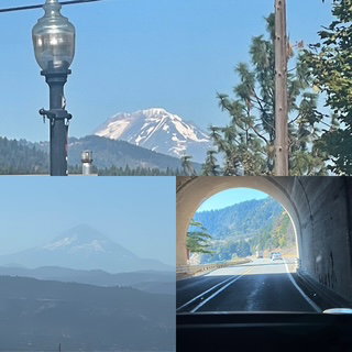
We arrived at Hood River which had 1 of the 2 bridges we might use to cross the Columbia today. We could take the Hood River bridge and then head back toward Portland on the WA side, or we could drive 20 miles further east to The Dalles (that is the name, The Dalles) and cross. Well, you know what we did, right? The drive to The Dalles was special as the terrain totally morphed into a more dry, arid and much less forested. The view across the river and to the WA side and seeing a freight train along the waters edge was incredible. Tomorrow we will be on those rails! The Dalles bridge was another classic steel cantilever bridge and where we started our trip back to Portland. We saw Washington's Mt Baker from the Oregon side and now that we were on the north side, we had several views of Mt. Hood. This is the same side of the river that our train will travel tomorrow. The drive back was very nice as it was all 2 lanes but not as busy as route 30 and had many small tunnels which were had just off to the side a 2nd tunnel for trains.
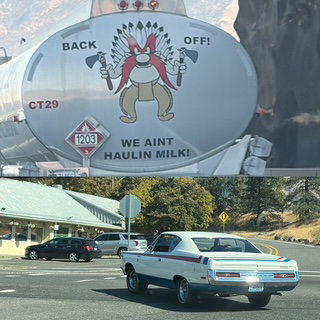
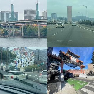
More examples of Portland being Portland...
Tonight we will pack everything up and head to the airport tomorrow late morning. From there we will get to Union Station for our 5:45 train to Chicago/Grand Rapids. We are scheduled to arrive around midnight on Wednesday. The train does not have WIFI and cell service will be extremely rare so it is unlikely any updates will be made until sometime on Thursday.
Day 18 – Saturday – Portland! Today is the day for us to see what we can of the Rose City. We started at Washington Park. This is an amazing park that is only 2 miles from the city center. It is home to some of Portland’s most iconic places, including the Oregon Zoo, Portland Japanese Garden, Hoyt Arboretum, World Forestry Center, and the International Rose Test Garden, which has helped shape the city’s identity as “The Rose City” since 1917. The Park also features historic memorials like the Oregon Holocaust Memorial and Vietnam Veterans of Oregon Memorial, playgrounds, picnic areas, an archery range, tennis courts, a beautifully restored reservoir site, and over 15 miles of hiking trails that connect to Forest Park, the largest urban forest in the U.S. Our first stop was at the Rose Test Garden as it is always open while the Japanese Garden, our primary stop, didn’t open till 10:00 and we wanted to get parking, so we went early.
Temp was 51 and cloudy when we started walking around the Rose Test Garden. The garden is home to more than 10,000 roses representing hundreds of varieties from around the world. I was blown away by the number of different styles and types of roses, some incredibly fragrant. It really was amazing. Just as I thought I saw my favorite, around a corner there was another I had to consider.
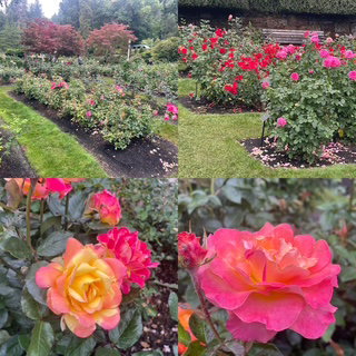
The Japanese Garden is considered the best Japanese Garden outside of Japan. It was quite remarkable. I’ve been to Meijer Garden’s Japanese garden which I thought was good but compared to this one, it’s not even close. I did not expect to have to walk up ½ a mountain to get to it 😊 but it was worth it. It’s worth noting that this garden was founded after WWII with the intent of trying to begin restoring relations between the two countries.
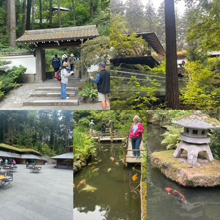
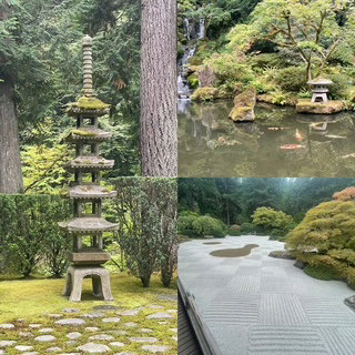
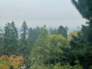
There is a great viewpoint in the Garden where you can see Mt. Hood over the top of the city of Portland. We looked but we couldn’t see it, if you think you see it please let us know.
Next up was the riverfront and the Portland Saturday Market in the heart of Old Town. It was founded in 1974 and has become nearly legendary. I don’t think I would call it legendary, but it was very nice. It had lots of handcrafted art and a great representation of the world in its food vendors. African, Polish, Mediterranean, Cambodian and more. Being the connoisseur that I am, I went for the classic Elephant Ear! It was prepared perfectly, and I know because once upon a time long ago I spent a summer making them as a summer job in college.
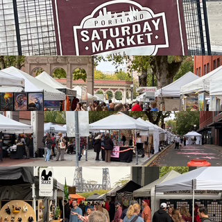
We walked back to our parking spot which – thank goodness it is a Saturday – was very reasonable priced and after dropping off some of our treasures, we decided to walk to the next destination and not move the car. So, off we trekked to Powell City of Books. Along the walk, we went through China town.
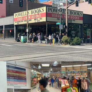
The City of Books is a full city block building that is 4-story high and is the World’s Largest New & Used Book store. It has nine color-coded rooms, over 3,500 different sections and over 4,000,000 books. Chris was in heaven.
By the time we returned to the car, we had walked 5 miles. Pretty fun as we thought today, we might walk less than other days. We headed back to the motel so we could do our final laundry and begin to pack everything up so we can see how things look before we head to the train station on Monday.
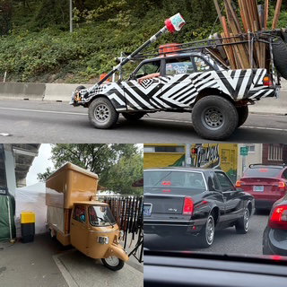
Worth noting that Portland enjoys its reputation of being a little off. Based on these cars, they are!
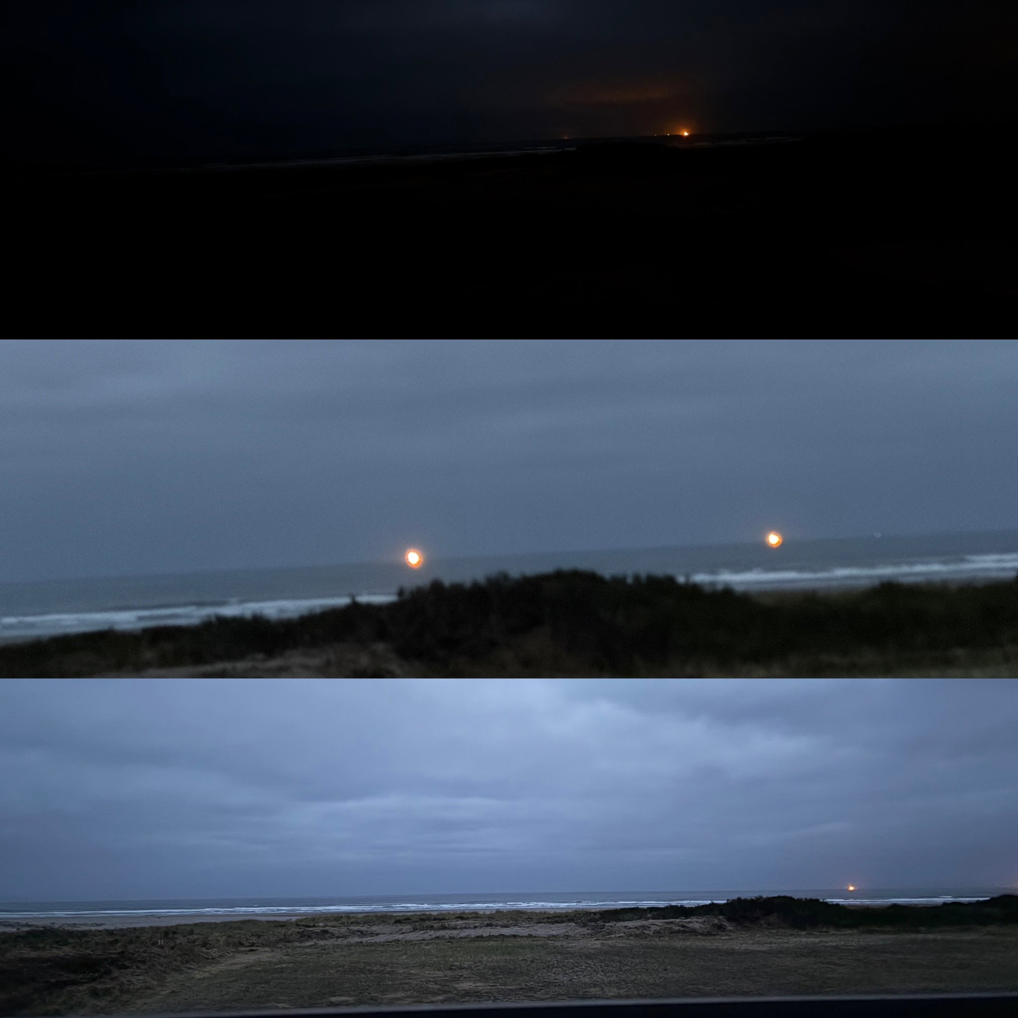
Day 17 – Friday – We left our oceanside retreat this morning to gray, gray skies but dry! In the middle of last night Chris wrapped herself in a blanket and went out on the patio and just listened and enjoyed the ocean waves for about an hour. She said it was great. I slept. 😊 We were hoping for a night sky last night but between 5:00, when we arrived at nearly clear skies until 7:30 sunset, the clouds rolled in very fast. Practically no sunset, zero-night sky and while we thought there might be some sort of sunrise over the back of our unit, nope! Well, I guess I can’t plan everything!
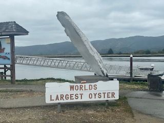
Our first stop on the road today was a classic one. The World’s Largest Oyster!
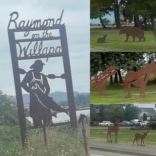
We continue to finish driving the entire west coast. In previous trips, we have driven from San Francisco to San Diego and earlier on this trip we completed from central Oregon to San Francisco. Today we will finish the top of the Olympia Peninsula down to central Oregon. Never really planned to do this but I am glad we did. So much beauty in so many different ways. Our surprise along the way in WA was Raymond on the Willlapa Bay. Originally a logging town from the early 1900’s, it had a lot of character and all along the main road through town, they had many laser iron silhouettes.
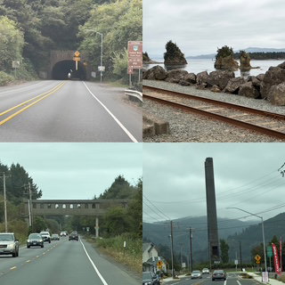
Not sure what day it started but it was definitely bow season this morning. We kept wondering why there were SO MANY pickups parked at nearly every ‘entrance’ to a wooded area until we saw one guy walking out carrying an impressive compound bow.
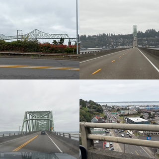
We crossed into Oregon at Astoria. It is 4 miles long and just 2 lanes as it crosses the Columbia River, very impressive. Astoria is famous for the filming site of both The Goonies and Kindergarten Cop.
From Astoria we headed to Seaside. Why? Because they have a “Heroic bronze statue of the two explorers, Lewis and Clark, overlooking the Pacific at the end point of their westward exploration”. Now that might seem like a silly reason, but it turns out Seaside is the Gatlinburg of the Oregon coast. Amazingly busy, tons of tourist stores (including an arcade that had both a bumper car AND a Tilt-a-Whirl INSIDE it! While the statue was fine, driving into the city and finding it was fantastic. They were even hosting a muscle car show, so we saw classic cars all over the place. WAY FUN!
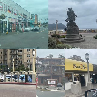
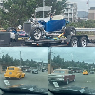
While Seaside was a classic tourist boardwalk stop, our next location is world renowned for its 235 foot tall, Haystack Rock, Cannon Beach. It did not disappoint.
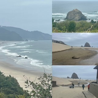
Next up was a shocker to me. It turns out that the Grand Haven, MI Pronto Pup, a local legend “corn dog” place on the shore is not one of a kind. The ORIGINAL (1939!) was created in Rockaway OR and, of course, it is still open. In fact, it was very busy. (note: we saw a Pronto Pup on the main drag at Seaside too!). Like any American Institution, it has on its roof, the World’s Largest Corn Dog and out front it has a mechanical Corn Dog, you can ride. Though a friend offered to pay me if Chris would get a video of me riding the corn dog, I declined.
Our last stop on the coast before heading to Portland was Tillamook. We knew nothing about Tillamook until Nick and Rayla shared their discoveries from one of their earlier vacations. The city is nice but the target is the company Tillamook, which makes incredible cheese and ice cream. They have a HUGE creamery where the public is welcome to come and watch the manufacturing process live, looking down from 2nd story windows into the plant. As cool as that is, it is nothing compared to buying some ice cream! As we sat, enjoying some fabulously creaming ice cream, we realized we had now been to both the Tillamook and Ben & Jerry’s factories. 🏆
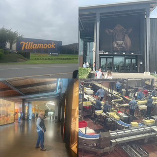
Our final leg was about an hour back over a small range and into the Portland suburbs. Traffic was busy but all of it headed towards us as people were leaving Portland for the weekend. We are now doing something we rarely do, staying in the same motel for 3 nights!!! Can you imagine? We have 2 days to enjoy things in Portland and on the 3rd, we return our rental car and get from the airport to Amtrak’s Union Station downtown.
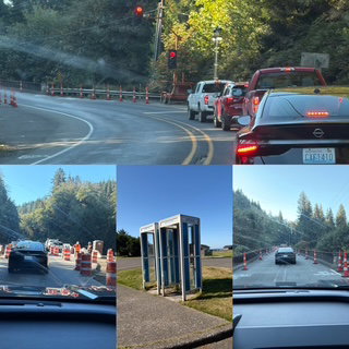
Day 16 – Thursday – Today’s drive was planned to be just about 3 hours. I knew we had things we wanted to do in Olympic NP, so I wanted to leave plenty of time. Our first stop was to see Ruby Beach, the best beach in Olympic. It was only 40 minutes away and we wanted to get there before low tide as we were hoping to see some tide pools. 5 minutes after leaving we hit our first construction site of the day. It was down to one lane with portable traffic lights to control the flow of traffic. It was just a 4- or 5-minute wait so no big deal. About 3 miles further down the road, we hit another one. Chris and I were both wondering, is this how the day is going to go? Well, just a few miles further…. Yeah, this was how the whole drive was going to go ☹ By the time we reached our motel, we had gone through, not 8, not 10, but 12 of that 1 lane zones. Must be our new personal one-day record. Don’t get me wrong we had a great day and we actually hit ONE of those lights green so we ONLY had to stop 11 other times 😊 Oh yeah, one of those 12 construction zones is replacing a bridge and starting next week, they are going to close the bridge all day M-F for 3 weeks. There is ZERO detour available. If you need to get to the other side, you turn around and drive entirely around Olympic NP in a giant circle. We are truly glad we were here THIS week.
As we continue our drive we came across a very rare siting – not 1 but 2 phone booths. They appeared to be working and everything! 😊
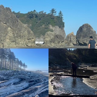
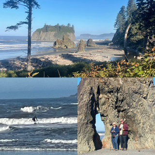
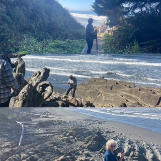
Ruby Beach is incredible. It is about a ¼ of a mile trail of switchbacks to get down to the beach and it is the classic WA rocky beach with many ‘haystacks’ (Iconic rock posts and arches jutting up from the sand) and tons of driftwood on the beach. Of course, driftwood here means entire trunks of trees. One of the highlights of the beach was Chris and I trekking over the Cedar Creek by crossing over some of those drift logs. Happy to report we both made it without falling. When we went back over the creek later to get to the hike to the car, we just walked through the creek at the lowest points and sort of “jumped” over the deepest parts.
The next beach on our list was Beach #4. Yes, Olympic has 4 beaches in a row along 101 named Beach 1, 2 3 & 4. Beach 4 was the specific one listed with the best tide pools. This time, the hike down was about ½ mile. As we reached the bottom, I was shocked to see that there was a great viewing platform about 20 feet above the beach, but I didn’t see how we were supposed to get to the beach (though many people were already on the beach). Chris saw it. There was a rope tied to the platform, and we were supposed to repel down the side. While it didn’t look all that bad, we both didn’t like the idea of starting the hike by repelling down because what If you can’t get back up? Or, what if you die going down? Discretion is the better part of valor as they say so we enjoyed the viewpoint and then headed back up to the car.
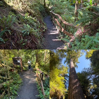
We considered going to the HOH Rainforest but it’s location and the construction on the road pushed us to go to the Quinault Rainforest instead. It was a great hike among the 5 largest trees in the world – after the Redwoods and Sequoias. The rainforest has the world’s largest Western Red Cedar, Yellow Cedar, Sitka Spruce, Mountain Hemlock, and Douglas Fir. The Quinault gets about 15 feet of rain a year so to say everything is green and wet is an understatement.

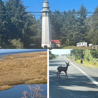
We left the park and drove through Aberdeen, which turned out to be quite a nice city. It has some very high bridges and yet they were draw bridges. I would like to see the ships that come in that need that much height. We stopped at the Lighthouse Drive In and had a very nice, classic lunch/dinner before heading to our motel. I realized we were going to get to our hotel a little bit early, so we did a quick detour to see the tallest lighthouse in WA which was being guarded by 3 black tail deer.
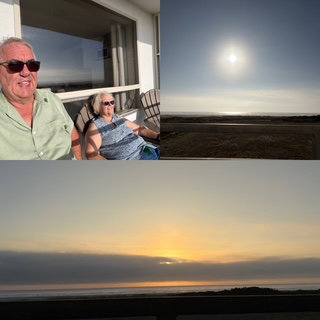
Our motel tonight is on the Pacific Ocean Beach. We have a patio which looks over the sand dune and beach and we are looking forward to hearing the ocean tonight as we fall asleep.
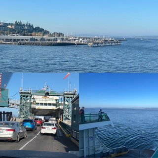
Day 15 – Wednesday – We were up and out before 8:00 as we wanted to get to the 8:50 car ferry (Edmonds to Kingston). Last year at this time, we did 7 car ferry’s so yesterday’s pedestrian ferry just seemed off. This morning, driving on the ferry, everything seemed right again. It was a beautiful sunny morning with a high of 80 expected. Should be perfect for exploring Olympic National Park, our 53rd!
The ferry was about 30 minutes and saved us about 1 ½ hours of driving through and around Seattle. Worth every bit of the $32.
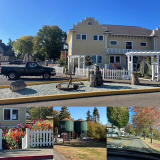
Once on the Olympic Peninsula, we headed toward the park but went to Port Gamble first. Incredible little town that seems to be from the early 1900’s with every house and building in pristine condition.
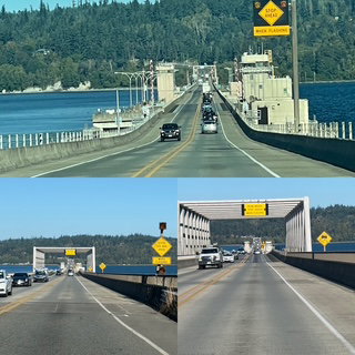
The drive from Port Gamble to the Hurricane Ridge Visitor Center of Olympic National Park was about 2 hours. Fall has just started to arrive here. Much of the scenery reminded us of Michigan but the fall leaf colors, so far, are just versions of yellow with a tinge of orange, very little red. Saw many Maples but the ones that had started turning were always yellow. We crossed the Hood Canal Bridge, a floating bridge, 1.5 miles long and the third longest floating bridge in the world. A 16.5-foot tide and salt water both caused a lot of concern with the design, but it worked great from 1961 to 1979. Unfortunately, it sunk during a storm in 1979! The new one is doing much better and seemed fine to us 😊
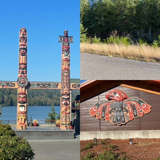
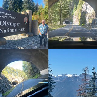
Our first stop in Olympic was Hurricane Ridge. At the end of a 17-mile drive of switchbacks, you arrive at the top of Elk Mountain (6,772 feet) which provides an incredible view of the surrounding Olympic mountains. The highlight of the drive was when we came around a corner and entered a small tunnel, as we exited about 100 yards away was a 2nd tunnel and then 100 yards later, a 3rd tunnel. Very cool!
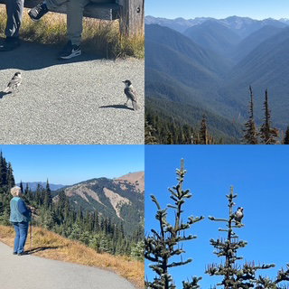
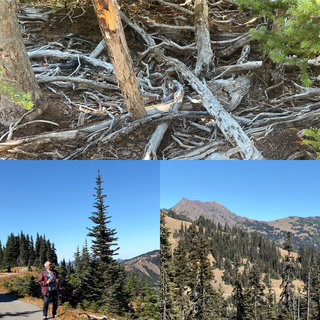
On top, we did Hurricane Rim Trail, wow! The sky was so clear so we could see Mt. Baker 90 miles away! We had leftovers so we sat on the ridge and had a nice picnic while we enjoyed the views of the glaciers and what we learned was the Salish Sea (Strait of Juan de Fuca). While I am still waiting to see my first Hoary Marmot, we did see a lot of Canadian Gray Jays today.
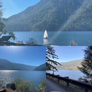
From Hurricane Ridge we headed toward our destination of Forks, WA. Forks was made famous for being the setting of the Twilight book and movies. On the way we drove along Lake Crescent which was beautiful and amazing that it was not surrounded by houses.
Since we had some extra time, we drove a small loop in the Quillayute Rain forest and then went to La Push – a tiny town but the de facto capital and main population center of the Quileute Indian Reservation. It has a classic WA beach with lots of “haystacks” along the beach which refers to dramatic basalt sea stacks and rock formations
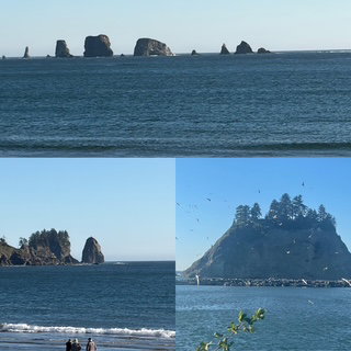
Like all of the rest, it was a very good day.
Day 14 – Tuesday – When I used google maps yesterday to provide an estimate of our drive into Seattle today, it stated 35 min to 1 hr. 15 minutes. A big spread. When we entered our destination today, it reported 47 minutes. Not bad at all. We followed the map and went through a lot of northern Seattle neighborhoods. It was a nice drive and interesting to see the areas.
If you haven’t been to Seattle, it is hilly! If you don’t use some sort of parking app when going to big cities, you should start. For Seattle we used SpotHero. It found us a parking garage right across from the Space Needle / Chihuly Museum and Gardens for about ½ the regular rate. We arrived at 10:00 and the Chihuly Museum opened at 10:30 which gave us time to buy our tickets, walk around the park and enjoy the view of the Space Needle.
If you had asked us in January if we would be able to see a Chihuly exhibition, we would have said, probably not. Things change and our visit today was marked our THIRD! As nice as Oklahoma City and Meijer Gardens exhibits were, they are not a museum dedicated to his art. In addition to his pieces, it has 2 other features: A theatre and glass blowing demonstration. The theatre showed 5-minute documentaries on about 7 different aspects of Chihuly’s life and style. We watched all 7. During the glass blowing demo, they went through the entire process of making a vase.
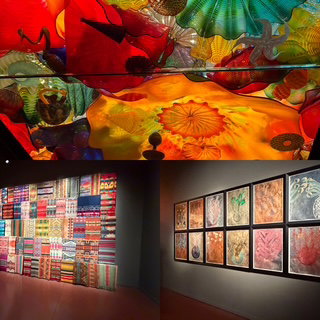
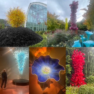
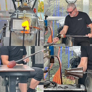
As part of our admission tickets, we were allowed to go to the IMAX next door and watch a movie. When we came out of the Chihuly museum, it happened to be 5 minutes before the next IMAX show, so we said, what the heck! The movie was Dark Sky which was a 30-minute film on the James Webb Space Telescope. Great film and certainly perfect to watch on a 6-story high screen.
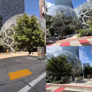
Next on our itinerary today was to drive by the Amazon Spheres offices. The Spheres are home to more than 40,000 plants from the cloud forest regions of over 30 countries and are Amazon’s HQ. It is amazing engineering / architecture, but they are only open to the public 2 Saturday’s a month so we drove around and took some pictures the best we could.
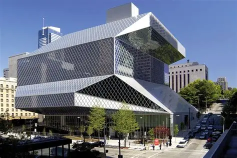
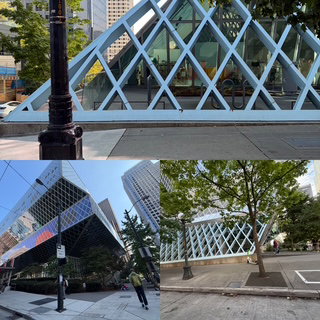
Next was another incredible engineering marvel. Chris and I saw an episode of How Did They Build That for the new Central Library in Seattle so we had to go see it. 😊
We found our own parking near the Ferry Terminal, but when we saw the price of $25 per hour and $9 for each additional ½ hour (total not to exceed $100, YES $100 a day). We immediately reached for our SpotHero app. It located a garage a block away for $15 for 3 hours.😊 We had an hour before the next ferry, so we took the time to walk among the piers and get a good look at the Seattle Great Wheel.
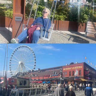
We took the ferry to Bainbridge Island. Why? Same reason we took the Staten Island Ferry, because we could! It’s a great way to see the Seattle skyline, visit the nice town of Bainbridge and re-enact your favorite Seattle based TV show experience, Gray’s Anatomy. If that isn’t enough, we also saw sea otters. I saw the first one, Chris the second one, so I challenged her to see who would see the third. She kicked my butt almost immediately. ☹
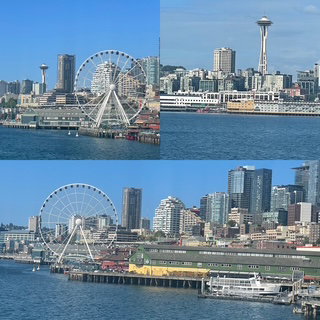
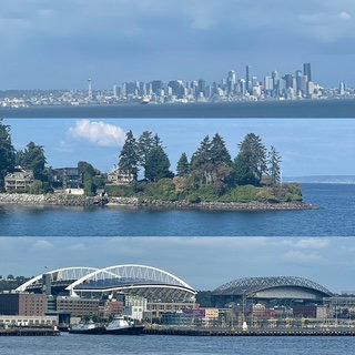
When we made it back to the car, it was about 5:00 so the primary concern was how long a drive we were looking at. Google maps reported 42 minutes! Yeah.
Last note to share about yesterday we went to a local restaurant, The Family Pancake House. Their food was incredible and priced great. So tonight, we said, why even consider somewhere else? First time we have ever eaten at the same place twice on a trip.
Day 13 – Monday – FYI: Yesterday and today were the ‘riskiest’ days of the trip as there are many fires in this area and the air quality (AQ) has been horrible which is not good for anyone, let alone Chris. Based on the rain earlier this week, I decided to stay with this route as it routed us entering the east side of the Cascades and out the west. ‘Good’ air quality has a score of 50 or less. This area has often been as high as 300+ and, occasionally, less than 50 the past few weeks. With the all-day rain yesterday, the AQ was only 39 yesterday and today, it was 15. 😮💨
Today, we got an earlier start as the forecast was for some sun in the morning with clouds later so we were out the door by 7. Of course, clouds were of no issue as we had a serious fog bank in the valley. 😊 That’s okay, we could see about ¼ mile, so driving wasn’t affected much. About 30 minutes later we were graced with rays of sunshine – wow, what a scene.
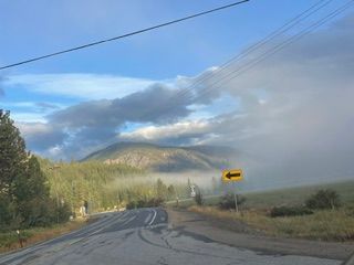
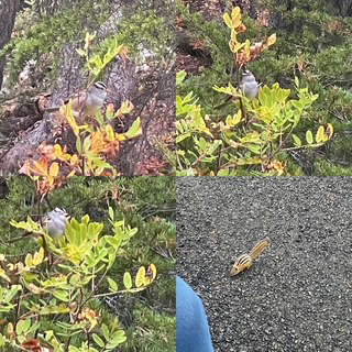
Very quickly the fog was just gone and we had some sun. It really helped illuminate the east facing sides of the mountains. Chris spotted our first coyote, but we didn’t get a picture. Later she spotted a ground bird, blacktail deer and a chipmunk came around to say hi.
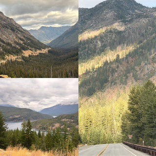
#52!
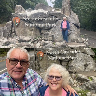
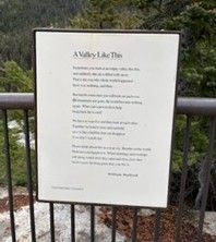
Our first stop was a hike at Washington Pass (5,000 ft). It came with a poem, provided stunning views and introduced us to the White Throated Sparrow – Morphs. We learned about it and it is a strange bird as it has 4 sexes (thus Morphs). Want to know more? Go Google it!
The poem:
A Valley Like This
by William Stafford
Sometimes you look at an empty valley like this,
and suddenly the air is filled with snow.
That is the way the whole world happened-
there was nothing, and then...But maybe some time you will look out and even
the mountains are gone, the world become nothing
again. What can a person do to help
bring back the world? We have to watch it and then look at each other.
Together we hold it close and carefully
save it, like a bubble that can disappear
if we don't watch out. Please think about this as you go on. Breathe on the world.
Hold out your hands to it. When mornings and evenings
roll along, watch how they open and close, how they
invite you to the long party that your life is.
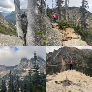
As the fog was gone, as had been predicted, clouds began to move in. Luckily the clouds stayed reasonably high which left a lot of great views – just missing the tops of mountains.
There are 3 dams in the North Cascades which produce 3 eye-catching emerald, green lakes. We hiked around one power plant (the location the water comes out from the dam) which had a great walking suspension bridge, a old steel girder bridge and a waterfall.
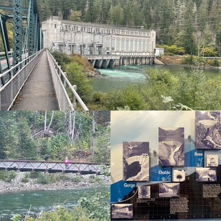
Waterfalls, Rivers, Tunnels and Trees...
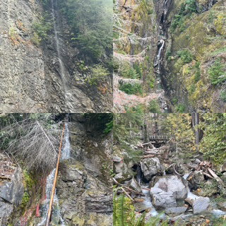
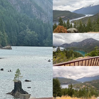
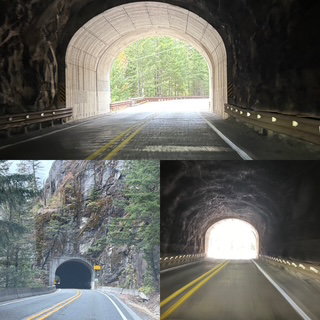
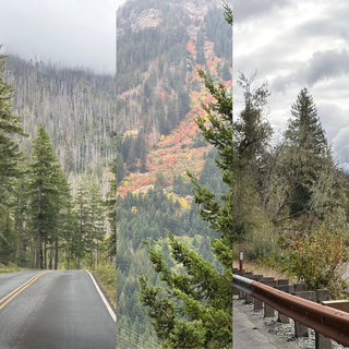
With all the rain yesterday, we were expecting to see more waterfalls but while we did see some nice ones, we saw MANY that were totally dry. Guess that ties into all the wildfires this year ☹ The drive out of the park was about 1 hour of forest and rivers and then 1 hour if I-5 into the Seattle area. The forest and trees were better. Halloween is coming it seems.
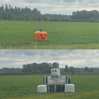
Day 12 – Sunday – Today was the first day of the trip where I hadn’t had any outdoor activities planned. I expected we might discover one along the way but nothing was on the books. Well, that turned out to be a very good thing as it started raining last night around 9:00 with the forecast for rain all day today. They got that right! It rained all day and not just sprinkles, good ole rain.
Today’s jaunt across WA was intended to fill in for a previous vacation for Chris that never occurred. In 2019, I had planned to go to our WA facility in Quincy, near Wenatchee, for a week and Chris was going to go alone and enjoy the area while I was at the plant. It included a plan to catch the westbound Empire Builder in Wenatchee early in the morning to Seattle to see the Chihuly Museum and then ride back from Seattle on the westbound Empire Builder – all in one day. Unfortunately, work plans changed and it didn’t happen, but I have always wanted to finish those plans, so today was the day to start.
We left Yakima and drove to Quincy which is where Amway has an organic farm processing plant. The drive was beautiful even with all the rain. Traffic was good and along this section of drive, we had 2,000-foot rolling hills that had either scrub brush or burned vegetation. It morphed into farming as the area flattened out and we were back to huge buildings storing “hay” and much more green as the irrigations across this part of WA are amazing. One of the items I was hoping to see were the ‘blue signs’ that they post along the road stating what crop is in the current field. I really love these signs. Happily, they still use them. A sample of what we saw: potatoes, field corn, timothy hay, alfalfa, wine grapes, Mystic-Fuji-Gala-jJuici (yes Juici is a real apple and as we learned of today). In fact the Juici was bred in Wenatchee - between a Honeycrisp and a Braeburn.
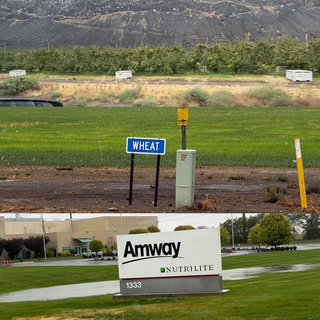
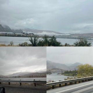
Quincy was short visit as it is a very small town. I verified that, sadly, the lunch spot I often visited, the Pita Pit, was gone but Amway’s plant is right where I left it. The drive to Wenatchee is about 30 minutes and goes from agricultural and then drops into the Columbia River Gorge where the road travels right along the river It was nice showing Chris the drive I always talked about.
In Wenatchee I took Chris to one of my favorite food places. The Pybus Public Market. It is repurposed steel plant hosting many restaurants and art type booths/stores. We had an excellent gelato and then my tour continued. I took her along the park that is on the Columbia River, pointed out the motel I always stayed at and then headed out of town, to Leavenworth.
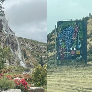
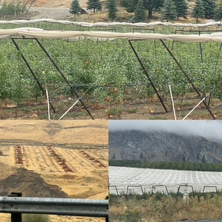
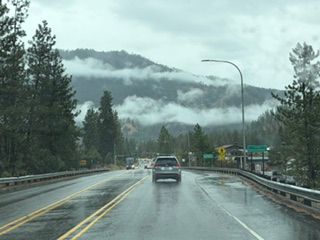
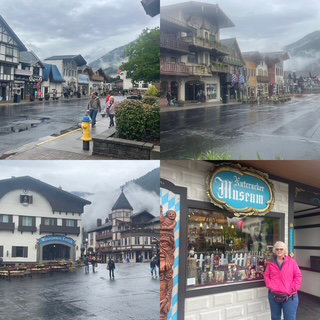
Leavenworth is an incredible town which takes the Bavarian Village to the limit. If you know Frankenmuth MI, multiply it by about 20 as it is much, much bigger. Even though it was still raining, we just ignored it and walked around the town and enjoyed it.
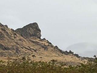
Our final destination for the day was Winthrop WA. A small town near the eastern entrance of North Cascades National Park. It was a little more than 2 hours away and required us to drive along the Columbia River north for about an hour and then into the Cascades. Even with the rain it was a great drive. There were extremely low clouds hanging over the river and valleys which often looked more like snow. We saw the Lincoln Rock (a rock which seems to have a profile that looks like Lincoln) but we thought it looked much more like a Groot Rock.
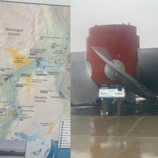
As we moved further into the Cascades, I realized I had forgotten to download the google maps for offline usage. So, we are driving on a road with zero cell/internet service and without a map wondering, how do we find our way to our motel? Chris remembered the highway number we were supposed to turn on but we still needed to know where that turn was located. As we drove and brainstormed our next move. I saw a viewpoint of a dam ahead and stopped. It was raining hard but I quickly went over to the restrooms and sure enough, they had a map of the dam so I took a picture of it (I wasn’t going to stand in the rain and read It and I need a few more seconds so I could take a picture of one of the turbine blades they use in the dam! 😊 I went back to the car and sure enough, that map showed the highway Chris remembered. Crisis averted. NOTE: About 2 miles down the road, cell/internet service came back for a few minutes and confirmed what we thought we knew. Love our ongoing adventures!
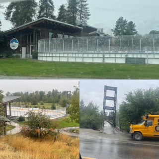
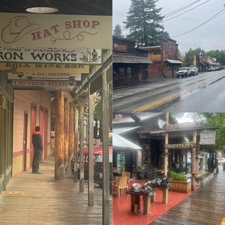
We arrived in Winthrop and checked into our room. Our room is like a log cabin but instead of the logs being their natural shape, these have been squared off and have a sort of tongue and groove assembly. Since it was only 4:00, we decided to see what else Winthrop had to offer. We were SHOCKED at what we found. They have an incredible hockey rink outside, a nice walking suspension bridge and then we saw the town. We thought we had already seen the town but around the bend came 3 blocks of the Old West. Wooden board sidewalks under the building overhangs, it was more Dodge City or Tombstone than either of them is! On top of that, those overhangs over the front walks work well when it is raining. It was a nice surprise to the end of our day.
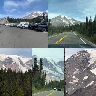
Day 11 – Saturday – Mt. Rainer National Park, our 51st park. Everything I read warned about the lines that can form at the park’s entrances, especially on the weekend. Well, today was Saturday and the forecast was decent (high in low 50’s with rain starting late in the afternoon) so we decided to get up a little early and be on the road before 8:00. Which would get us to the entrance around 9:30. The drive was nice with reasonable traffic except there is always someone who wants to go faster. We were passed by a black truck who seconds later just missed hitting a black-tailed deer. The deer was fast and appeared to be a deep reddish brown. As we approached the entrance, we saw signs that were 6 miles from entrance, waiting 6 hours. Every mile we got closer, it was the same thing, of miles = # of hours wait time. Can you imagine? When we passed the 1-mile-away sign, we started to count down the tenths and are thrilled to say we only had a 6-minute wait! WOO HOO! The weather was looking good, and we had a full view of Mt. Rainer.
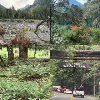
The #1 place to visit is Paradise’s Henry M. Jackson’s Visitor Center, which is 5,400 feet and has several great trails that start at the center. This results in the parking lot, which is about 1 hour in the park, being the most likely problem spot in the park. Even so, we decided to just top and enjoy the viewpoints and Longmire Museum along the way and not worry about parking. My favorite stop was Christine Falls :-)
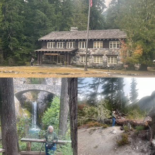
Well, guess what happened when we arrived at the parking lot? Yup, the main lot and the overflow lot were full, but I had a plan. I was going to follow the road out of the lot and around to the Paradise Inn (National Park Lodge) and miraculously, I would find a spot. Well, that plan didn’t work as the road to the Inn that I THOUGHT I was on, was actually a 2.2-mile one way road out of Paradise. Whoops! But it turns out that road was gorgeous with incredible views of fall color foliage and Mt. Rainer.
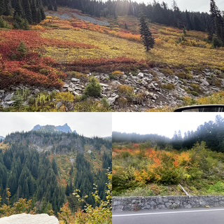
As we exited the road, I simply turned and headed right back to the Visitor Center. This time, we decided to go for it and skipped the overflow lot and went straight to the main lot and either we would find a spot, or we would skip it all together. Of course, we found a spot right away. The visitor center was very nice and with the smell of fresh pizza, we decided we had to have some. We shared a $9 slice (yup, $9 for a slice) of cheese pizza which really was good. Next, we decided to take the Myrtle Falls hike as it appeared to be the flattest and was just .5 mile. Again, the plan seemed good until we went around the bend and found out it was all up hill. Heck, that didn’t stop us! It was a lovely hike and it was exciting to walk among all the fall colors. Oh yeah, we saw 3 rangers working on meadow restoration. They loaded their backpacks up with several trays of plants and then had to hike into the meadows where they were to be planted.
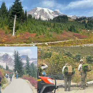
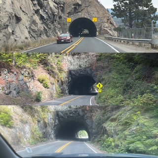
Following the hike, we headed to the west exit and, eventually, Yakima, WA. The drive out of the park did not have as many viewpoints as the drive in but it did have 2 tunnels, and the clouds were really starting to move in so most of the viewpoints were limited as the top of Rainer was hidden. Unlike the pictures below that we took earlier.
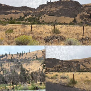
The surprise of the drive was after we left the park and headed into Yakima. It turns out we were driving down a valley that has wonderous walls / columns made up of volcanic rocks of two different origins: a geologic meeting of east and west. Tieton Andesite poured out of vents in the Cascades, sending lava flows down into the Tieton River valley from the west. The Columbia River Basalts (CRBs) travelled hundreds of miles from the east to deposit thick layers of basalt in the Tieton area. If that were not enough, we were driving right beside the glacier fed, whitewater Tieton River.
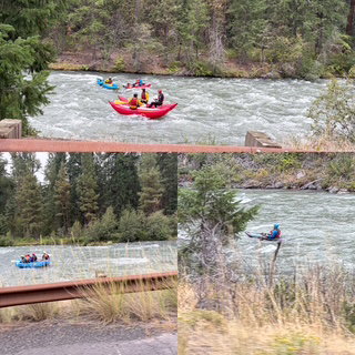
The beauty of the drive would have been plenty but, since it was a Saturday, the river had a lot of rafters and kayakers on it which were fun to spot and even exchange waves as they went by places we had pulled off to watch. Nice way to end the day.
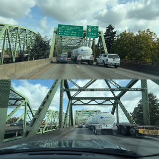
Day 10 – Friday – Before I get started on today’s drive, I wanted to say that we finished our 1st audio book a few days ago and now we are listening to 2 new ones in parallel. We are not getting through as many books as we have in the past as this trip has many more short stop and go type visits. The drive today from Salem to Mount St. Helens went smoothly. The majority were on I-5 and even though it went through Portland, the traffic was fine. The one thing we learned today was that I-5 has a drawbridge. Who knew? The good news is that it only shut down the expressway for 15 minutes, so it was not that bad really.
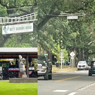
Our first stop was at Costco for gas ($5.09) as well as a few odds and ends. The only stop we decided to make after that was in Longview, WA. Home of the Nutty Narrows Bridge. Never heard of it? I bet not, even though it was installed in March 1963! Local citizen, Amos Peters, got tired of seeing squirrels hit running across the road to the city park and designed and installed a 60-foot catenary structure resembling a miniature suspension bridge. It has been so well loved, the town now has built additional squirrel bridges and, of course, has created a yearly Squirrel Fest.
After all that fun, we headed to Mount. St. Helens National Monument. Our first stop was the WA State Park dedicated to Mount. St. Helens. It was set up very nicely and provided lots of information on the eruption including that it occurred on Chris' Birthday, 1980. The best part of the exhibit was a video history of the mountain. Outside, there was a viewpoint of it.
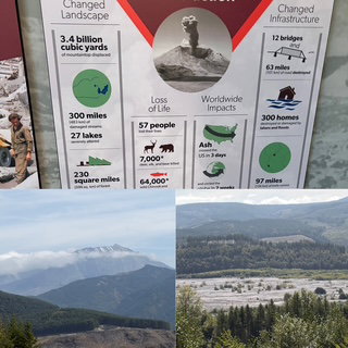
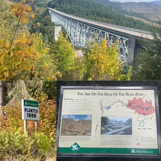
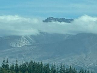
The drive into the Monument is 39 miles and highlights the many different aspects of the eruption. There are signs stating what year different forest areas were replanted. Weyerhaeuser made a deal with the U.S. government to allow them to harvest the trees that were destroyed by the eruption and in return, they planted over 18 million samplings to replace them. Having just spent time at Lassen Volcanic and Crater Lake, it was unique to see an area where it all happened just 46 years ago. As it was the last time I visited, there were a few clouds around the top of the crater of Mt. Saint Helens which affects the overall view, but we were very happy with what we had. It was mostly sunny, mid 60’s, it could have been much worse.
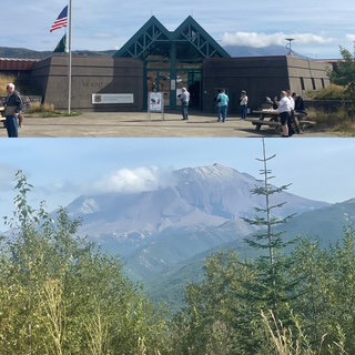
They had their first snow flurries just a couple of days ago! Speaking of which, the rain we arrived to in Portland a week ago produced the first snow flurries in Crater Lake this year which averages 44 feet a year. A few facts on Mount St. Helens:
- It was the largest debris avalanche in recorded history.
- The mountain lost 1,312 feet of elevation in just 2 seconds.
- The total eruption energy was about 1,600 times the yield of the Hiroshima bomb
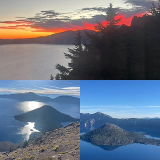
Day 9 – Thursday – Today was the first day where the emphasis was getting to our next location, Salem OR, and to see what there was to see along the way. We left Crater Lake but not before we watched an incredible sunrise and stopped at Watchman Point one last time.
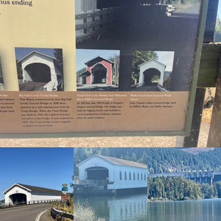
Our trip today was about a 4-hour drive, with our first planned stop around the 2-hour mark. Originally, we were going to Bend OR, but there has been a LOT of fires in that direction so, to avoid high smoke content we went to Salem. As we drove we could see off in the far distance, smoke plumes so I think we made a good choice. The drive was very nice coming down from the Crater and we had a nice section where we drove along a couple of nice lakes and then Lookout Point Lake Reservoir. The Reservoir was beautiful and 14 miles long. We had a nice view of the dam and a very nice, covered bridge. The surprise with the bridge is that it was from 1945. Info at the site explained that Oregon continued to make covered bridges into the 1950’s because of the availability of timber. Since some are not that old, they built them with logging trucks in mind so in one picture you will see a very large opening which would be worrisome if that was for horses.
The drive also provided some oddities along the way – wood piles, the largest do not enter sign we have ever seen and smoke plumes.
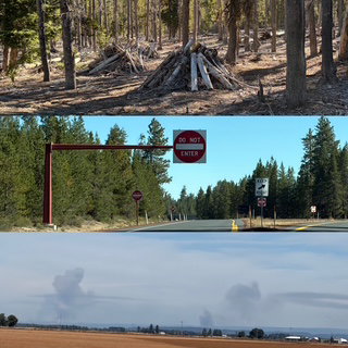
Regarding smoke, there was seriously bad air quality as we arrived on this trip but the 2 days of pretty solid rain which did an incredible job cleaning things up and helping the firefighters. So far, we have had extremely good air quality every day. Ironically, the only time Chris had any issues with her asthma was hiking among the Sequoia’s! It turns out they have an overpowering scent.
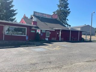
We arrived at our first stop at what I refer to as our Hollywood Tour. The Dexter Lake Club. The name might not ring a bell, but it is the place they filmed Otis Day and the Knights performing during Animal House! Sadly, this shrine closed in January of this year so possibly the only time I would have been willing to do karaoke just slipped away.
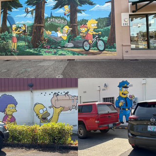
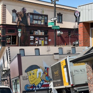
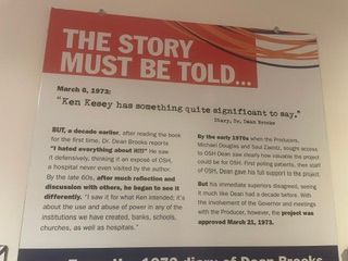
Next up on the Hollywood Tour, Springfield OR. The ‘real’ home of The Simpsons. It was fun driving around looking for all the murals painted in their honor. In addition, there was a two story mural of Ken Kesey, the famous author. His most known work is probably One Flew over the Cuckoo’s Nest.
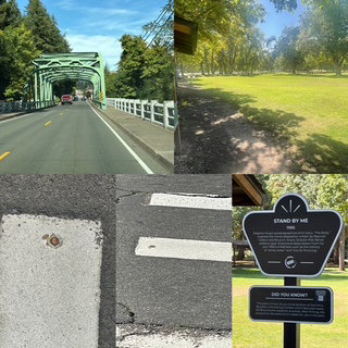
More Hollywood you ask? Of course! On to Brownsville, OR. This location is where the movie based on Stephen King’s novella, Stand By Me was filmed. There are 3 sites to see. The bridge entering town, a penny in the road where Vern found it, and the park where the blueberry pie eating contest incident occurred. It was fun, the little town was nice.
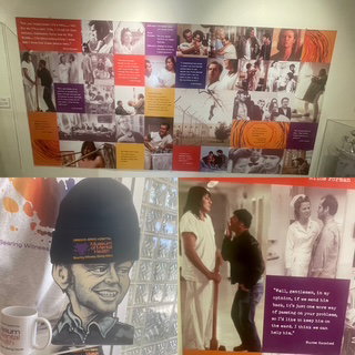
Yes, one more! We then made it to Salem where we went straight to the Oregon State Hospital Museum of Mental Health. Yeah, sure, make some jokes! This is a very famous place from a mental health perspective and on top of that, the location they filmed the Academy Award winning film, One Flew over the Cuckoo’s Nest! The museum was fascinating and had a section dedicated to the movie.
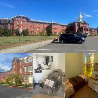
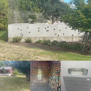
In addition, they built a Cremains Memorial to honor the 3,600 cannisters of remains. The memorial was incredible. They have put all the remains into “tubes” in a wall and, happily, as families come forward to claim remains, they leave a “hole” in the wall, letting people know they have been claimed. The original remains were held in copper cannisters. Today, those cannister are on display but all remains have been put into specially designed porcelain tubes.
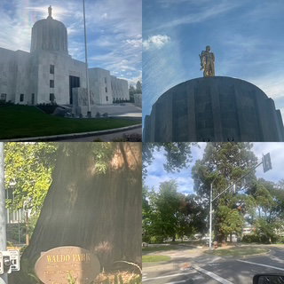
To finish the day, we saw the Oregon State Capitol – very unique – and the One Tree Park. Judge William Waldo planted a giant sequoia sapling on his Oregon property in 1872. He liked it so much that when he later sold his land to the town of Salem, he made the town promise never to harm the tree. Salem agreed and made the tree and the land immediately around it a park in 1936 -- but it probably wishes that it hadn't. The town has grown into a city much faster than a giant sequoia grows into a giant. "Waldo Park" -- all 12 by 20 feet of it -- is gradually becoming a traffic hazard, encroaching into the lanes of busy Summer Street. The tree currently stands over 80 feet tall, but giant sequoias reach hundreds of feet and can live for over a thousand years. This is one attraction that promises to stick around for a long time.
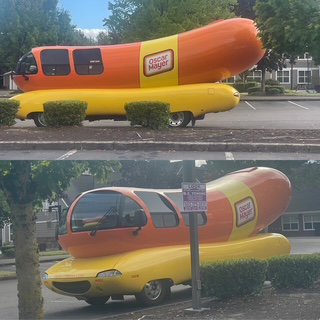
Lastly, as if the day wasn’t enough fun already. Look what we shared in our motel parking lot!
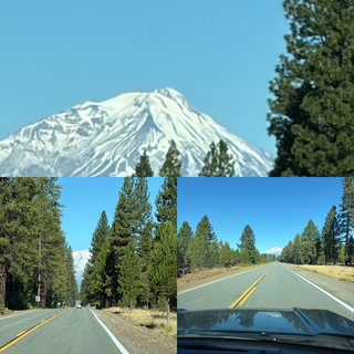
Day 8 – Wednesday – Crater Lake here we come! We left Burney for the 3.5-hour drive north. Not surprisingly, the drive was beautiful and with little traffic. The first ½ hour of the drive was like driving down a canyon of Ponderosa Pines. Unlike a tunnel of trees, these trees go straight up and as we had the sun directly to our back, the road was almost spotlighted as we drove it instead of in shade. Throughout today's drive, always looming, Mt. Shasta.
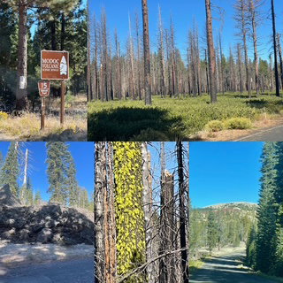
As I said, little traffic but even that disappeared when we turned onto a US Forest Service road which is part of the Volcanic Legacy Scenic Byway. It was 51 miles of beautifully desolate driving through forest (much of which had suffered a large fire but even with all the trees burnt, there was a beauty to it all). So, how quiet was the traffic you might ask? Well, we never saw a car going in our direction for the first 42 miles which happened to be about the same time we saw the first car coming at us. 42 miles, no cars! My only concern while driving was that there were many down trees and I worried that if one came down recently, we would have to turn around and go all the back.
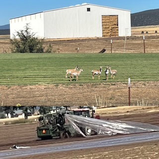
That didn’t happen. Instead, Chris spotted our first antelope of the trip. The last few miles on our Forest Service Road became surprisingly agricultural. Irrigation canals, GIANT buildings stuff with hay and the strange site of some sort of modified tractor going along the field removing a plastic sheet that was probably 20 feet wide and as long as the field. Not sure the pictures will do it justice.
We then came out of the forest into the town of Klamath Falls, OR. A cute town but it appears they don’t eat as we only saw one restaurant and it was a brew pub that wasn’t open. So it was Subway for lunch. The final 1.5 hours into Crater Lake went smoothly.
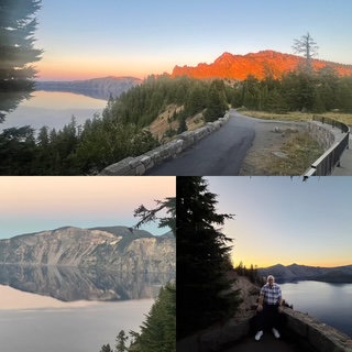
We arrived at Crater Lake National Park (#50 Woot Woot!) and went to the Visitor Center. They had a great 20-minute documentary on the park which was incredibly informative. We arrived at the rim around 2:00 and since we could not check in at the Lodge for a couple of hours, we decided to head to the Pinnacles section of the park (furthest away) and then work our way back to the lodge. Normally, the rim road goes completely around the lake. Unfortunately, they had to close one section of road for repairs this summer. Thinking about the rim road as a clock face, the road is closed between 4:00 and 6:00. Since we arrived at 6:00 we had to go clockwise and went all the way round to 4:00 and then headed down a road to the Pinnacles section. That said, we could not help but make one or two stops along the way to see Crater Lake and WOW! WOW! WOW! The pictures always show this incredibly blue lake but none of them do it justice. It is an amazing shade of blue. We stopped making stops and made it to Pinnacles and were very happy we had time to see them. The Pinnacles are volcanic spires formed from hardened volcanic matter exposed by erosion in Wheeler Creek Canyon. Basically, escaping gases from the volcano created a sort of chimney and then over the centuries erosion exposed these chimneys.
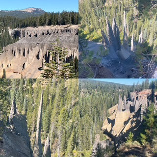
Once we saw the Pinnacles, we had the entire drive back around counterclockwise to stop and enjoy as many viewpoints as we wanted. Our only delay came when traffic and to go down to one lane for construction and then it seemed someone driving along the edges with no guard rails had a panic attack. No accident, but an ambulance was on site and we probably waited 10 or 15 minutes - which gave us the opportunity to meet Billy the road construction traffic lady. We had a nice conversation as we waited. We stopped at all the major viewpoints on the way back to the lodge. Awe inspiring.
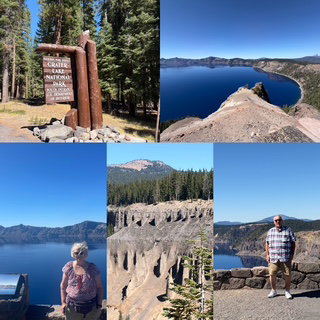
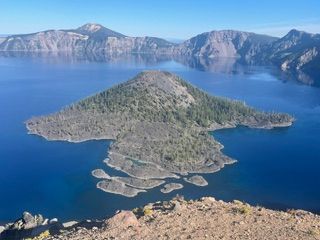
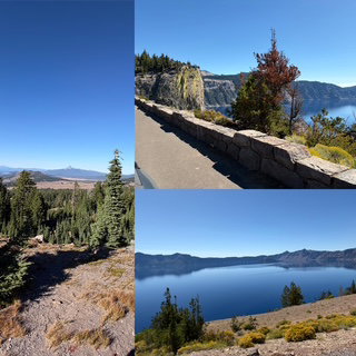
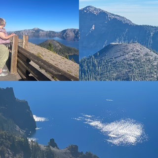
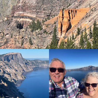
We are staying at the Crater Lake Lodge and are on the 3rd floor looking out on the lake. We made it to the lodge just before 6:00 so now we are trying to get our blog update done before we go to dinner.
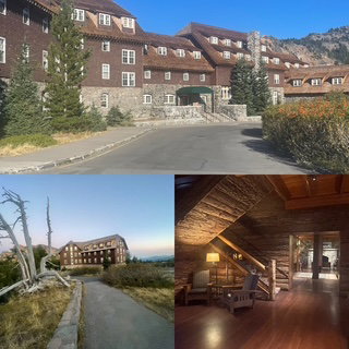
The lodge itself was built in 1915 and is a classic National Park styled lodge. Tonight we have dinner reservations and hope to see some night skies later.
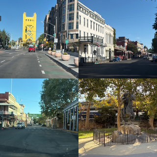
Day 7 – Tuesday – Before leaving Sacramento we did a quick tour of the downtown. The state capitol was very nice and traditional, and the ‘old town’ was amazing. It looked exactly as I wanted it to look.
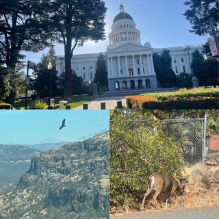
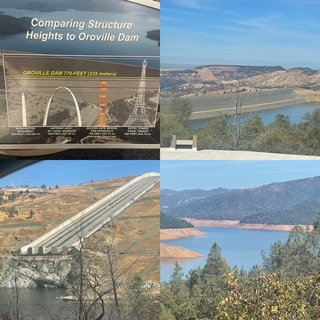
Up next was the Oroville Dam. The tallest dam in the U.S at 770 feet. Just before our stop at the visitor center we saw some deer and a very nice buck. We climbed the observation tower and then went and drove all the way across the dam (well over a mile). It is amazing history and engineering.
The drive into Lassen Volcanic National Park (49!!) was gorgeous. We climbed into the mountains and watch the terrain change into volcanic rocks and layers in the cliffs.
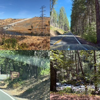
Lassen has a 30-mile-long scenic drive that goes north/south across the park. NPS provides an app that tells you about each stop along the way. There was a fire in 2021 and the damage across the park was immense. Even so, the views were just as phenomenal if it were green ponderosa pines or burned ones. Lassen is considered an active volcano. Therefore, it has thermal spas and such, like Sulphur pots like Yellowstone. I got up close and took pictures, but Chris stayed in the car as the smell was overwhelming.
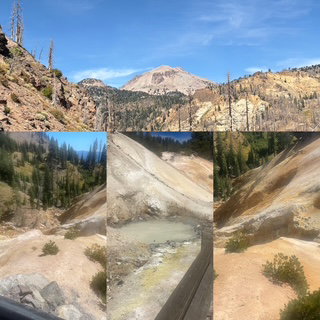
The drive has two lakes and provides sweeping vistas of surrounding volcanoes and valleys and the road reaches 8,511 feet (Mt. Lassen summit is 10,457 feet.) The views up the valleys and other mountains/volcanos were inspiring. The most unusual thing we experienced were the tortoiseshell butterflies. They were EVERYWHERE. There were times it reminded us of a light snow squall but with butterflies. We tried to get pictures, but they were hard to ‘catch’. We did get a 10 sec video and about 20 butterflies flew through frames to give you an idea. If you look closely, you will see the ‘Eye of the Volcano’ on the side of Mt. Lassen.
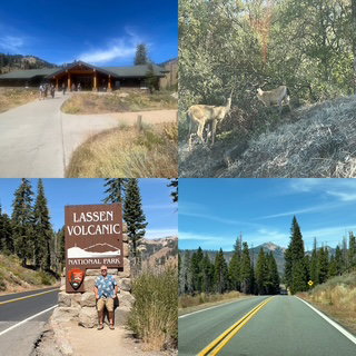
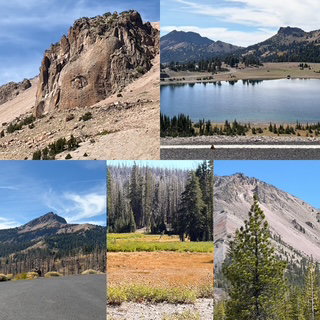
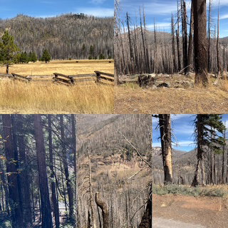
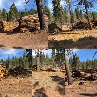
As we drove to our last stop, we had our first view of Mt. Shasta and it did not disappoint. At 14,179 feet it is the 2nd highest in the Cascade Range and one of the highest in CA. Along the way, we saw what we think was responsible logging.
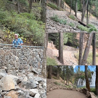
Our last stop of the day was something I stumbled across the internet. The website for our mom & pop motel tonight mentioned that they were 10 miles from Burney Falls State Park which Teddy Roosevelt once said he thought was the 8th wonder of the world. Now, we are big fans of Teddy but that seemed like an incredible statement to make. Well, it turns out Teddy knew exactly what he was talking about. The Falls are gorgeous and extremely rare. Burney Falls is fed primarily by underground springs emerging from porous volcanic rock. This groundwater system releases about 100 million gallons a day regardless of recent rain, so the falls maintain a powerful, constant flow even in dry seasons. The result is a broad curtain of water rather than a single plunging column, with moss‑covered seeps at multiple levels. In other words, an underground river just pours out the side of the cliff. The underground river does have a spring which fills a small pond about 1-mile up stream and from that pond, the water goes over the top of the falls like you would expect. However, much of the water just comes out of the walls!
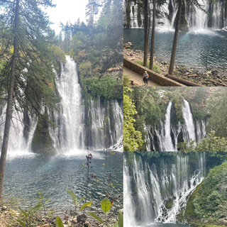
The nearly ½ mile hike to the bottom of the falls was strenuous but oh so worth it. Especially when we were about ½ way down and suddenly the water (which is usually 42 degrees all the time) made the 80+ degree day we were having feel more like 50’s – more so with the mist from the falls! It felt FANTASTIC (though Chris had to put on a jacket).
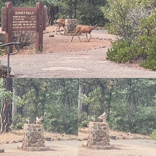
Lastly, the deer we saw today were black tail, not white tail deer like we have in Michigan. They are smart deer as you can see. Why drink out of a stream or lake when you can just use the faucet?
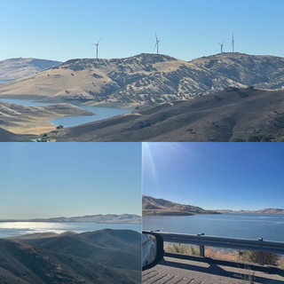
Day 6 – LABOR DAY! – Today we left Hollister (near Pinnacles) and headed NE toward Calaveras Big Tree State Park. Chris and I listened to an audio book earlier this year which was historical fiction and much of the book centered around the Sequoia trees of Calaveras. We said at the time, if we are ever near there, we need to go visit. Well, guess what? 😊 The drive there went extremely well. First, we drove about 40 miles across the Gabilan Range (highest point about 3,500 feet) which was beautiful scenery and then drove along the San Luis Reservoir. At one point, we wanted to see more of the reservoir, so we took a side road, and the mapping system rerouted us, so we said, lets see where it takes us. Well, it took us down a narrow dirt road who only other occupant was a large black bull that gave us the look of, “What the hell are you doing here?” It was a fun detour.
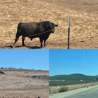
On the other side of the range, was the San Joaquin Valley - a classic agricultural area. We drove about 100 miles across the valley made up of irrigation channels and fields of red onions, red potatoes, kale, hay, etc. all sorts of nut trees (almonds, hazel, walnuts) and cattle/dairy farms. It is always amazing to see it all and even though it was Labor Day, almost everything on the road were trucks hauling produce/nuts. The towns had some nice architecture too.
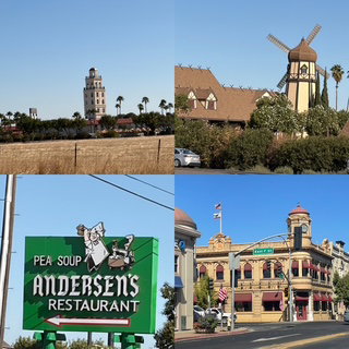
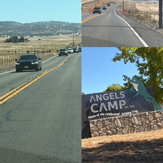
As we approached the final 40 miles into the Sierra Nevada range, we saw the most amazing thing. As it is Labor Day, I planned on seeing traffic leaving the range and hoped we would be going against the “grain”. Well, the first part of my plan worked great. Once we were on the 2-lane highway, there was a non-stop “train” of cars coming at us. We had views for miles, and it was just one long group of cars. The good news is that they were all traveling more or less at the speed limit. Eventually, we reached a small town which had a traffic light and that light, the on coming ‘train’ had to stop. This caused about a 4-mile backup. Yes, 4 miles of one lane cars waiting for their turn at the light. But wait, that wasn’t the last of it. 10 miles down the road was another light! 5-mile backup at that one!! My plan was that we would arrive at the park, hike for a couple of hours and HOPEFULLY, by the time we left, everyone else would have already gone.
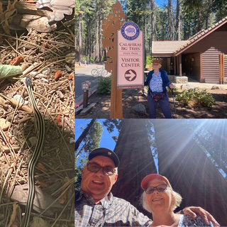
The park was somewhat buzzy but we were able to find good parking and went on the North Loop trail. Approximately a 2-mile hike among 150 Sequoias! It was spectacular! The weather at that elevation was in the upper 70’s (vs. 90 in the valley). At the very start of the hike, we saw a snake. It was about 1 foot long and is the only size snake I want to see!
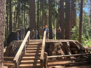
The first “stop” on the loop was the famous ‘dance floor’ stump. This was special in that it goes back to 1852 and figured predominantly in our book. With all our trips and all the roadside attractions we have enjoyed, to stand on the ‘dance floor’ just like the tourist did over 160 years ago seemed to me to be poetic.
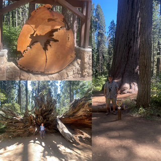
We left the park about 3 hours after we arrived and the question on our mind, “What will the traffic be like?” We headed down the mountain and what we found was sun, cloudless blue skies and ZERO wait at either traffic light! Oh, I love it when a plan comes together! Our final “stop” was in Angel Camp, CA, the ‘home’ of Mark Twain’s The Celebrated Jumping Frog of Calaveras County. The 2-hour drive to our motel in Sacramento went very well and the only real traffic being the last 30 miles when we were on an inbound expressway, but traffic was flying, no delays at all. If only every plan could come together that well.
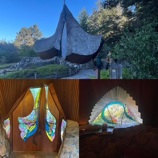
Day 5 – Sunday – Today was mostly a driving day as we moved from N. California to more central, Pinnacles National Park. As it turned out, it was “wildlife day!” We started out with about an hour more to drive along the coast and a beautiful sunny day to enjoy it. Our first stop was at the Sea Ranch Chapel. An award winning, non-denominational chapel. Next, we stopped at the 93-foot-high Bufano Peace Statue Monument (Madonna of Peace). Cal-Fire was in the area with a team of workers - but no fire!
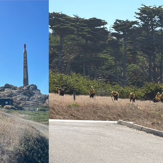
The views continued to be spectacular as we drove along the massive hills with the road just appearing to be glued to the sides.
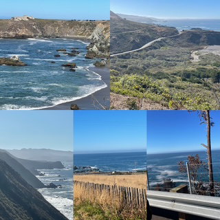
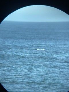
At one of the viewpoints, we pulled over and Chris immediately noticed there was a woman with her expensive camera and a very large telephoto lens on a tripod and looked at me and said, there must be something out there! We could see a few splashes and grabbed our binoculars and sure enough, there was! Whales, two! One whale appeared to be on his back waving his flippers against the water. I tried my new attachment for my binoculars which allows me to take pictures using my cell phone. While I could not get a great picture and the whale stopped waving his flipper, you can see the splash of his tail in the picture below.
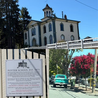
The last town along the shore was Bodega, a cute coastal town with some famous history. Alfred Hitchcock’s The Birds used a local restaurant and school in the movie. The restaurant is closed and isn’t much to take a picture of, but the school looks the same.
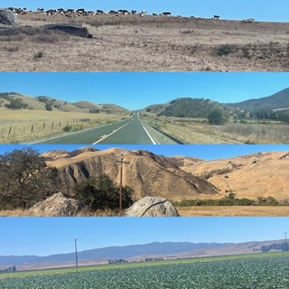
Lunch was near a pier on Bodega Bay and then we started the hour drive away from the ocean and toward the 101 and then the San Francisco Bay area. The drive was through rolling giant hills of what seemed like cattle grazing land or where they might grow the feed for the cattle.
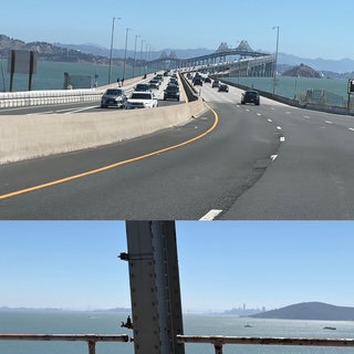
Once we reached 101 and merged onto a 6-lane expressway we had a 3-hour drive to Pinnacles. Google maps recommended we avoid the Golden Gate and so we took a 6.5-mile double decker bridge that went around they bay to Oakland and then San Jose and Silicon Valley. Since it was Sunday Labor Day weekend so traffic was a real concern. We went from 6 lanes, to 8, to 10 and eventually it went back to 6 but low and behold, the traffic only caused us to come to a complete stop once and we probably had three other “5 minute slowdowns”! A excellent drive and we even could see Alcatraz in the distance.
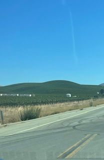
Once we were off the expressway and driving the final 45 miles to Pinnacles, we were now in agricultural lands with rolling dry hills and grape vines. The grape vines really surprised us as it seemed way to arid an area but they went on for miles.
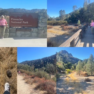
We finally arrived at Pinnacles NP, our 48th! Before we made it a mile into the park, we saw 4 small deer along the side of the road. Half a mile later, a gray fox ran across the road in front of us. (sorry, no picture). As we hiked the park, we came across a big-eared ground squirrel and a lizard (both too fast for my camera). The hike was beautiful with a surprising amount of color.
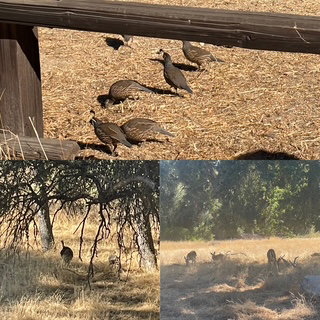
As we were leaving the park, we came across a flock of California Quail, wild turkeys and probably the same deer we saw going into the park.
I had to fill up the car for the 2nd time and only had to pay $5.53 a gallon this time. MUCH more important, we checked and the RAV4 Hybrid we rented is getting 43.2 miles per gallon! WOO HOO!
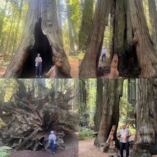
Day 4 – Saturday – OMG what a great day! We woke up to extremely thick fog, but the forecast was for it to burn off around 9:00 and by 9:30, we had sun! This was one of our most unusual driving days as the terrain we covered was quite diverse. We started south on 101 with our first place being the Avenue of the Giants. Even though this is the 3rd day of driving among Redwoods, it still just takes your breath away. There are many places to stop and explore along the Avenue. We were among the giants on our first stop.
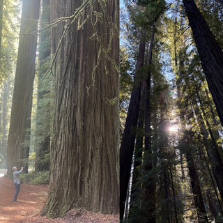
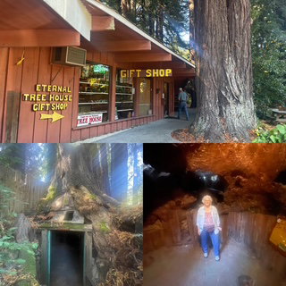
Our second stop was a gift shop which had been around for decades and had cut out a large-size room inside a tree stump.
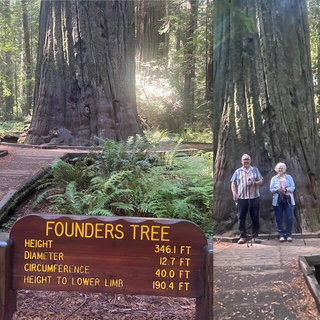
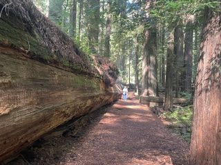
The drive on the Avenue was picturesque with continuous groves of redwoods. Here the road was very much a temperate rainforest vibe – everything is green. We stopped and hiked the Founders Loop (home of the Founders Tree) and an ancient tree that fell in 1991 - It once stood 362 ft. tall and was considered the tallest tree in the park. The redwood’s crash to the ground moved the earth so much that it registered on a nearby seismograph and one local, who heard the impact from half a mile away, thought a train had crashed.
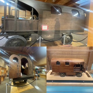
We stopped at the Visitor Center and learned of the “Travel-Log” – a vehicle made from a redwood and used to help educate people to save the redwoods.
As we left the Avenue I had us taking a CA 1 to the west to get to the Pacific. Now the road vibe changed completely from redwoods and mostly rolling hills to Ponderosa pines, cliffs and roadside wall/cliff. It turns out that when you turn west at Ligget and drive to Hardy, you are driving what motorcyclists claim is one of the top 5 rides in the country. In other words, the 11 miles of the Tail of the Dragon in NC and its 300+ curves is nothing to the 21 miles of this road. Forget 25, 20 or even 15 MPH curve signs. We had saw 10 MPH curve signs! Unbelievable! Unfortunately, like the Tail, this road didn’t have many guardrails so as we came around one corner we saw the CA Highway Patrol monitoring a tow truck that had just brought up a car that went over a ledge.
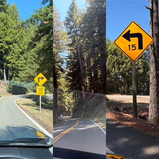
We loved the drive today but, 20+ miles of hairpins is a LOT of them! The reward was when we suddenly went over a hill and we saw the Pacific, probably 500 feet above, Boom!
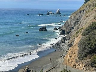
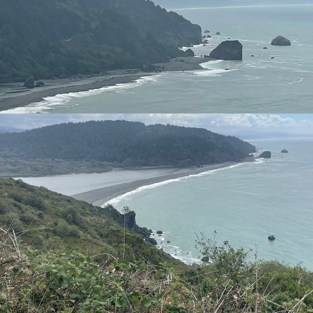
The road didn’t straighten out much as we were driving the coast for about 100 miles but now the views were incredible rocky shorelines as we hug the side of giant hills/mountains. WOW!
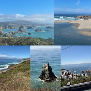
As it turns out, we had one last road vibe to go. The last 40 miles or so we would go from right next to the coast to maybe a mile or so away and the terrain changed to what we would call prairie like. Still beautiful but very different. At this point we also started noticing the most incredible pink wildflowers which turns out is not native to the area. They were introduced over 200 years ago, brought over from South Africa. They are known as the Belladonna Lily, naked lady.
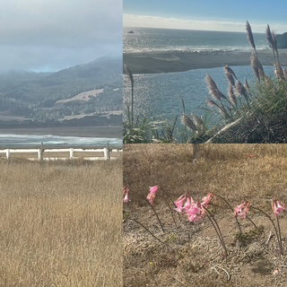
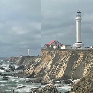
We finished the day at the famous Point Arena Lighthouse. It is one of the tallest on the Pacific and sits way out at the end of a peninsula.
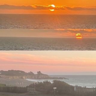
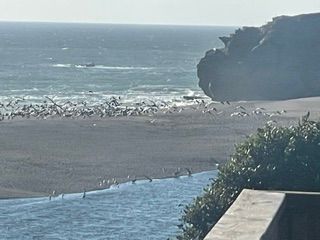
The motel we are staying at tonight is very nice and right on the coast. It is the Saturday of Labor Day weekend so my options were limited and if we were going to pay a premium, why not stay where this is an incredible view and sunset – and to our surprise, 100’s of pelicans.
Day 3 – Friday – I planned today to be a quieter travel day as I expected our first two days would be fun, but intense, and thought we might be needing a break.
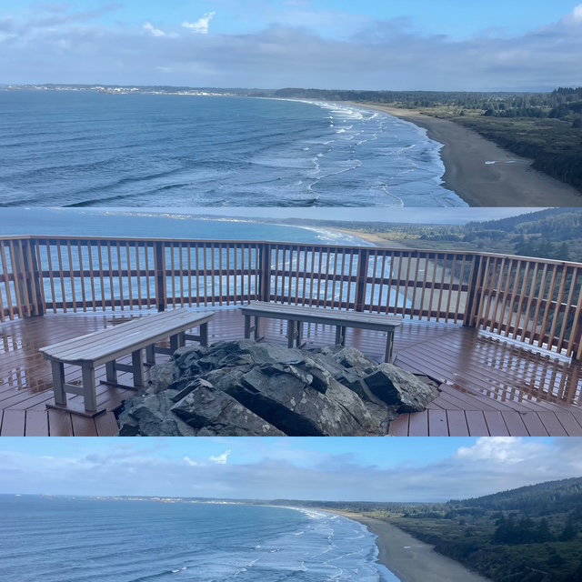
While it rained most of the night, we woke up to dry weather! Yeah! We headed to the Sea Front Bakery in the morning and took a couple of treats to the Crescent Beach Overlook for breakfast. We decided to leave our treats in the car as we walked up to the overlook for a wonderful view. As we started to walk back to the car (probably 100 yards away), the sky opened and it poured on us. Turns out leaving the pastries in the car was a very good idea – thanks Chris. We ate in the car which still had a great view and watched it rain.
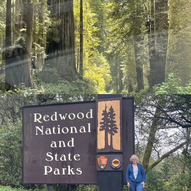
Next, we entered the Redwood National and State Parks - our 47th!
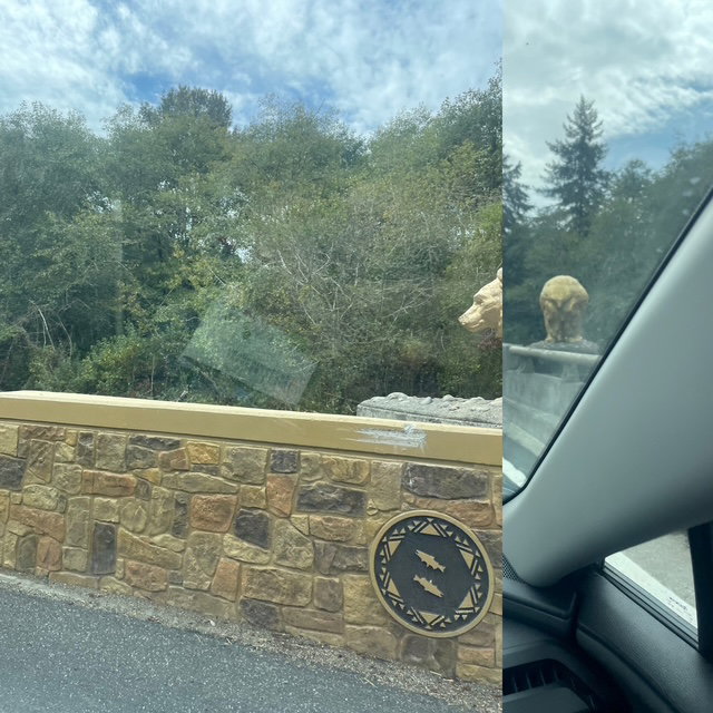
The drive on the 101 was phenomenal. Like last night’s, it was surreal driving among these giants but now we had a black ribbon of road and many more cars to compare the forest that surrounded us. Amazing tunnels of trees with occasional ocean viewpoints and on some bridges, golden bears (or in these pictures, their head and butt)
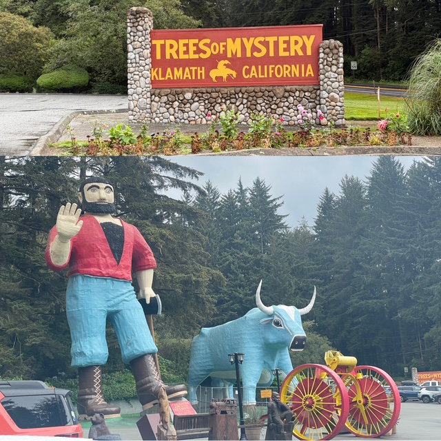
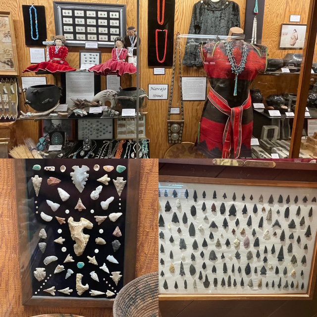
We arrived at the “Trees of Mystery” tourist spot (home of giant Paul Bunyan and Babe) and visited their very nice Native American museum.
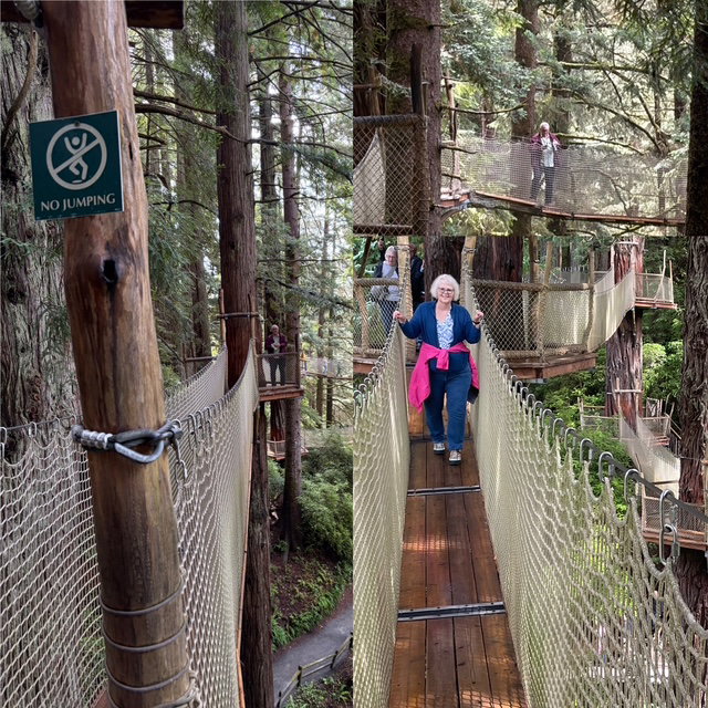
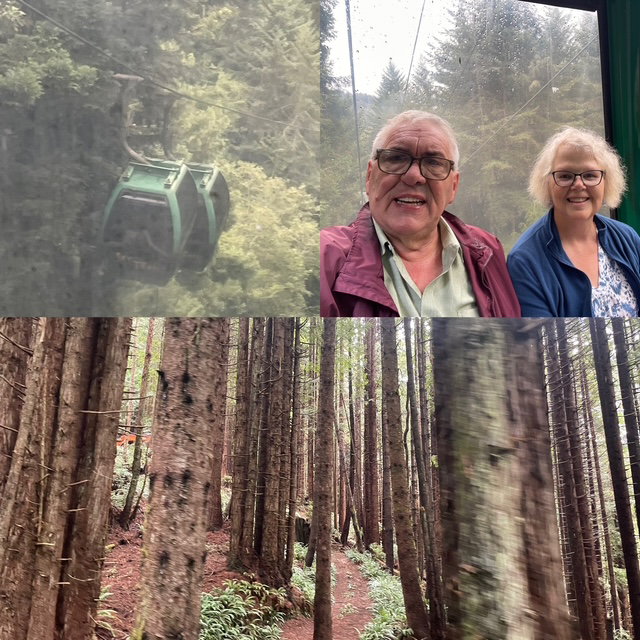
As it had stopped raining, we decided to go into the park and hike the trails, walk the Redwood Canopy Trail (walking suspension bridges 100 feet up in the redwoods!) and take the Skytrail Gondola. The hiking trail was very informative and had some great trees – including one that was hit by lightning. We climbed up to the Canopy Trail and I don’t believe Nick, Rayla or Chris, it is WAY more terrifying to walk these swinging suspension bridges than jumping out of a plane! The gondola ride was very cool as the view at the top was pretty good considering the cloud cover. Just as we were leaving, it started to pour but it was too late to get us, we were only about 50 feet from the car! The good news is that was the last rain of the day. Whew!
We drove to the Requa road, Klamath River overlook, 650 feet above the ocean / river and had a little sun to boot!
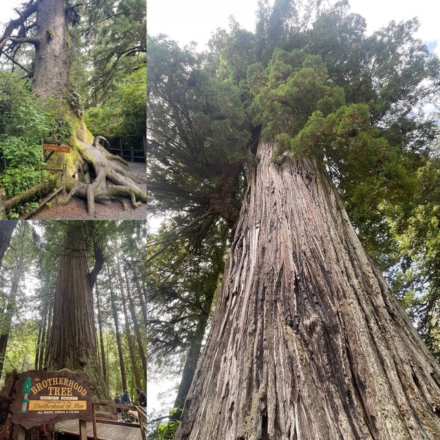
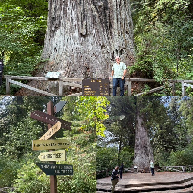
We continued south on the 101 but took the scenic Newton B. Drury Scenic Parkway (about 10 miles which runs parallel to the 101 but is in a state park). Again, just an incredible drive showing giant redwoods which can be 1,000 to 2,000 years old. We stopped to see the “Big Tree” and while it was much bigger than the huge Stout tree we saw last night (23 feet across vs 16) it was the signpost that made us laugh out loud.
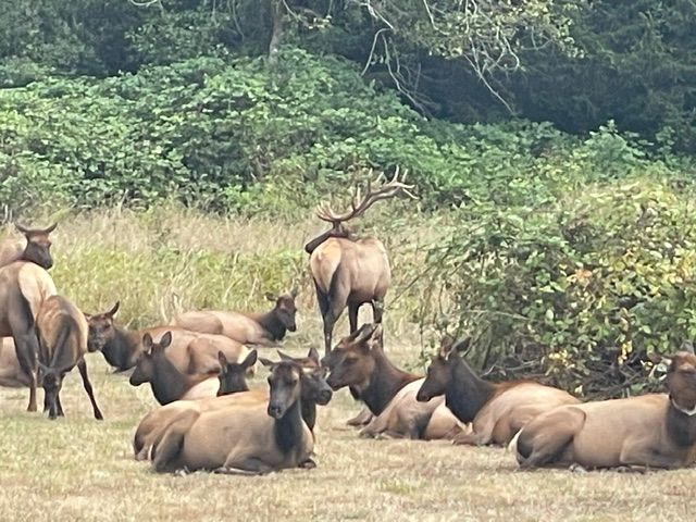
For the past 2 days we have seen about 10 different “Elk Crossing” signs which sort of surprised us and after last fall’s “Newfoundland Moose” history, we made several jokes about seeing an Elk. Well, guess what? We saw ELK!
We finished our day at Costco getting “cheap” gas. If $6.09 a gallon cheap? We met our goal for the day by checking in around 5:00 and having lots of time now to do this web update and even a quick load of laundry.
Day 2 – Thursday – After a great night’s sleep (10 hours!), we were up and out the door by 9:00 and it was not raining!
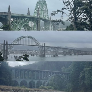
Yaquina Lighthouse and neighboring bridge were a great way to start the day, Of course, things changed so as we finished the lighthouse, it started to pour.
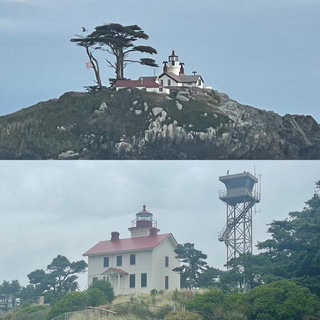
Today we are driving the rest of the central and all the southern coast of Oregon. The day was made up of repeating incredible things like tunnels of trees (unlike MI, they were tunnels of giant pine trees!) rain, incredible viewpoints of the rocky coast, cloudy, beaches, rain, lighthouse, cloudy. etc. It was amazing how much and how hard it rained and then it would stop until it started again. About 4:00, we seemed to drive out of the rain as we entered California.
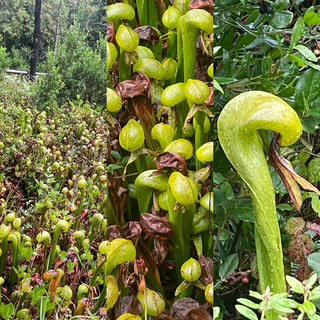
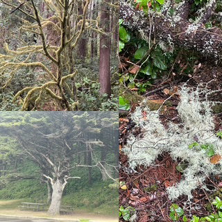
During a dry time, we arrived at a botanical reserve which has the rare Darlingtonia carnivorous plant. We took a very small hike back to their location and we were amazed. They were so weird and wonderful looking plants. They can only be found in northern CA and southern OR. Also, the reserve was a great place to see up close all the types of mosses that grow on the trees, rocks, picnic tables, everything!
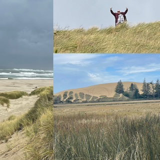
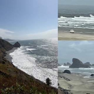
Next up were the Oregon Sand Dunes. Who knew? Turns out Oregon’s tallest is nearly 500 feet (about double MI) and they stretch over 40 miles of the shoreline. As you can see below, I climbed to the top of a dune.
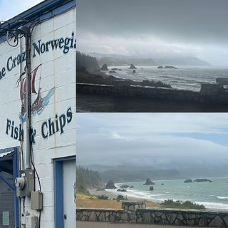
For lunch we stopped at “The Crazy Norwegian’s Fish and Chips”. They looked quite busy, so we figured they were popular, so we decided to get lunch. Fish and Chips and seafood chowder were excellent. We took them to go and ate them in the car at an overlook nearby. It was raining when we started, by the time we finished we could see the sun hitting the beaches down the coast.
To share how great the drive was, the drive time without stops was about 4.5 hours. With all our stops and lunch, we took 8!
When we arrived in Crescent City, CA for the night, it was just after 5:00 and while we were ready for a break, it was very dry and almost sunny so we decided to go see Howland Hill Road in the Jedediah Smith Redwoods State Park. It is a spectacular 7 mile long, single lane hard pack dirt road where you get VERY close to giant redwoods. According to the internet (always a bad way to start a sentence) the road is one way so we entered the park going in the “right” direction only to find out that the internet was wrong and you can go in either direction. The drive was more amazing than we could have imagined and, since it was not one way, we turned around and drove it again to get back to our motel! On the return drive, we stopped and did the Stout Grove Trail and saw the “Stout” tree (325+ feet tall and 16 feet wide). Amazing!
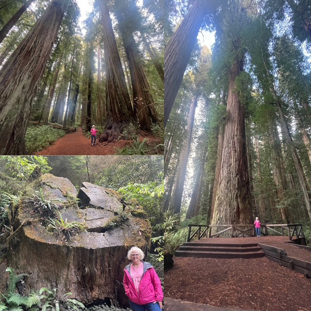
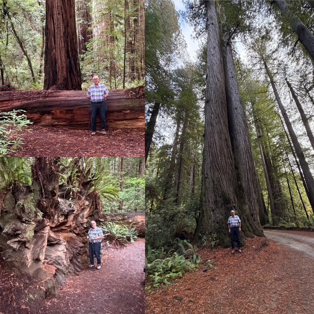
Day 1 - Wednesday - Let us start with a little background on this trip. Originally, plan “A” was to drive around Lake Superior, head to the Canadian Rockies and back. We would have visited 3 US National Parks and visited nearly every large city in Canada that we haven’t already visited (other than Vancouver). BUT, with the wildfires in Canada in July, we decided to create a new plan “B”. Fly to Portland, Oregon, visit 7 National Parks in the Northwest and then take Amtrak home. As soon as we made the decision and booked our flights and train, all of the NW started burning. UGH! We watched the smoke maps for the past month and kept our fingers crossed. When we arrived today, the big question was, “will our visibility be hampered by wildfire smoke?” The answer? I can honestly say that we had ZERO issues with smoke. Of course, that is because it was raining so hard!
We woke up at 4:00 am so we could be at the airport by 5:00 (THANKS, Steve for picking us up and dropping us off). The 1.5 hr. flight to Minneapolis went well and the 3.5 hr. flight to Portland went even better as we had First Class! It was the first time we have flown since Feb. 2020 (COVID) and the changes we noticed all seemed to be improvements to the flying process.
Today we drove for about 3.5 hours from the airport to Newport OR (town on the central coast). The first hour was mostly city driving with LOTS of rain. Along our path, we saw the North American Aerospace Museum. While we didn’t have time to go in, we did have time to view some of the outdoor exhibits including a 747 on top of a building with a water slide coming out of it!
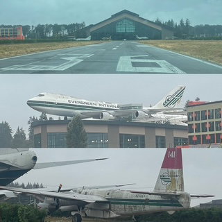
As we approached the coast, we drove through an area identified by Oregon as a “Forest Corridor”. It was fantastic. HUGE tress (though not Red Woods) and different types of moss covering all parts of the forest and surprising to us, lots of “fog” in the hills much like we see in the Smoky Mountains. As we arrived at the coast, the rain more or less stopped but the Gale warning on the ocean provided incredible waves and surges.
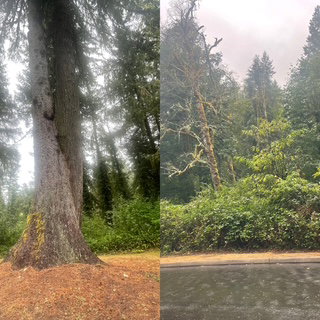
We saw the claimed World’s Shortest River (440 feet) and had many great views of the coastline. In one spot, a Bald Eagle flew about 15 feet directly over our heads! Sadly, missed the picture.
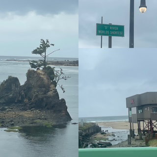
We visited the Devil’s Punch Bowl around high tide so we could see it fill up. At low tide, people walk around inside the bowl on the sand like a beach. It reminded us of the Hopewell Rocks we saw last year in New Brunswick.
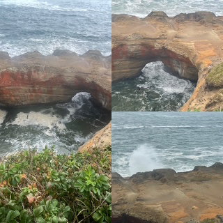
We finished the drive with a stop at Yaquina Head Lighthouse. Again, just an incredible view up and down the coast.
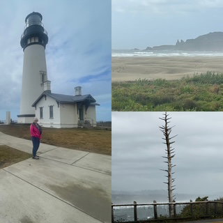
Well, we have been up for about 19 hours so signing off.