Oh Canada (and Acadia)!
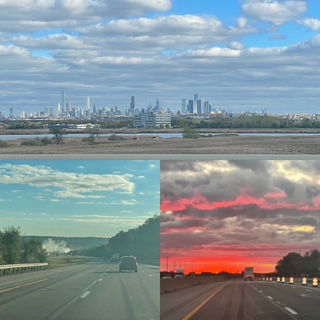
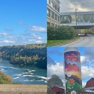
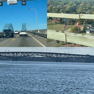
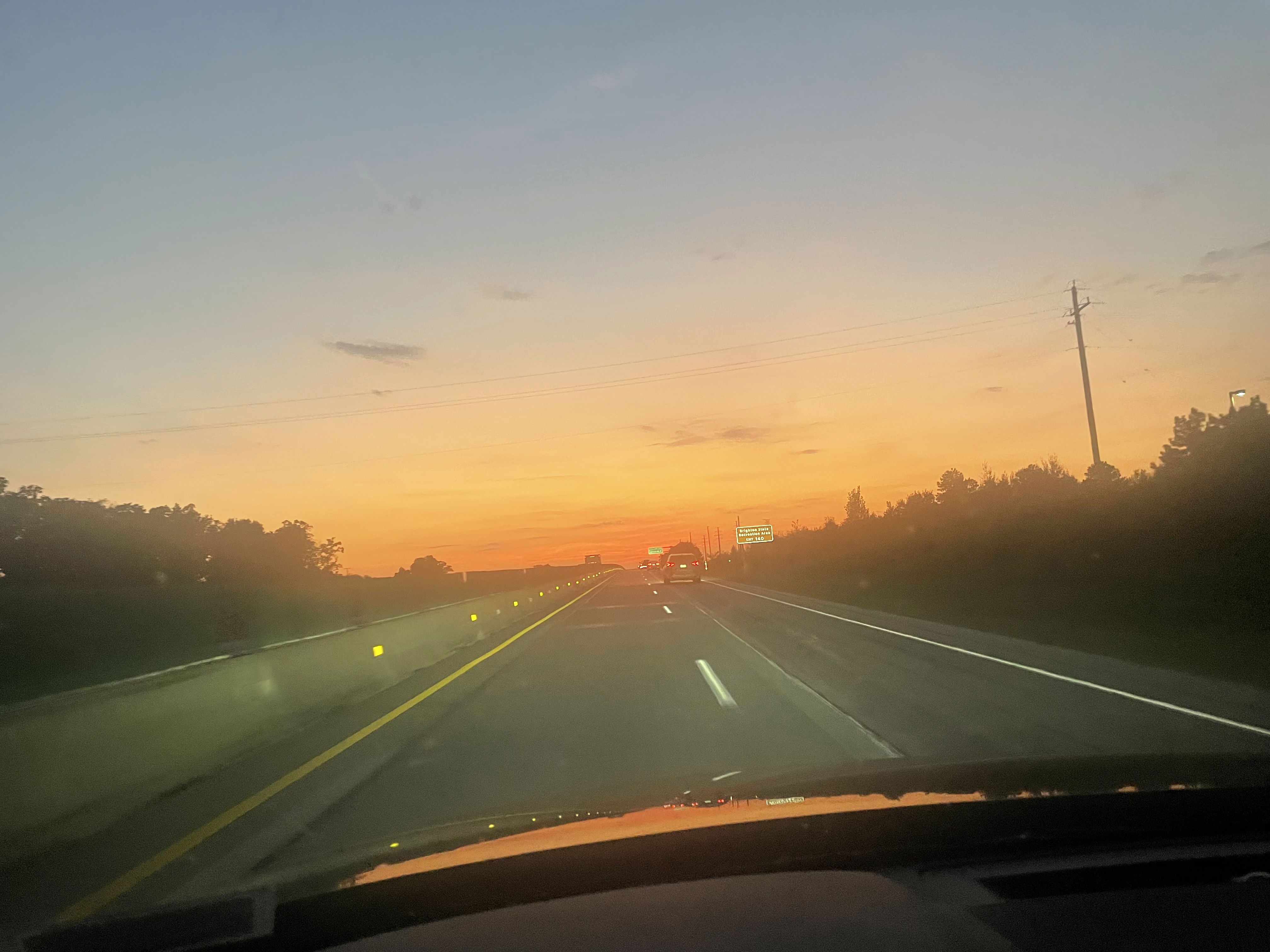
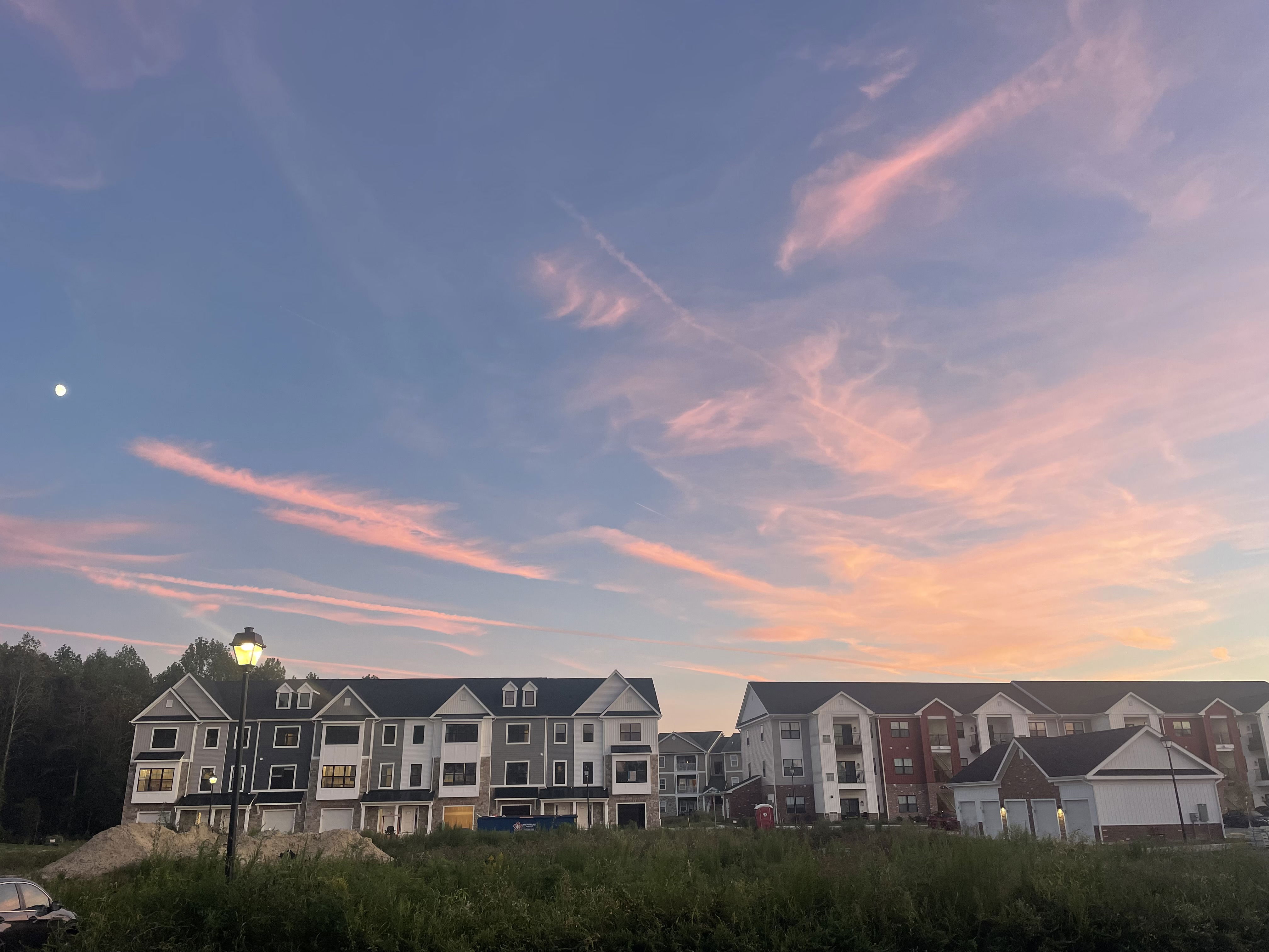
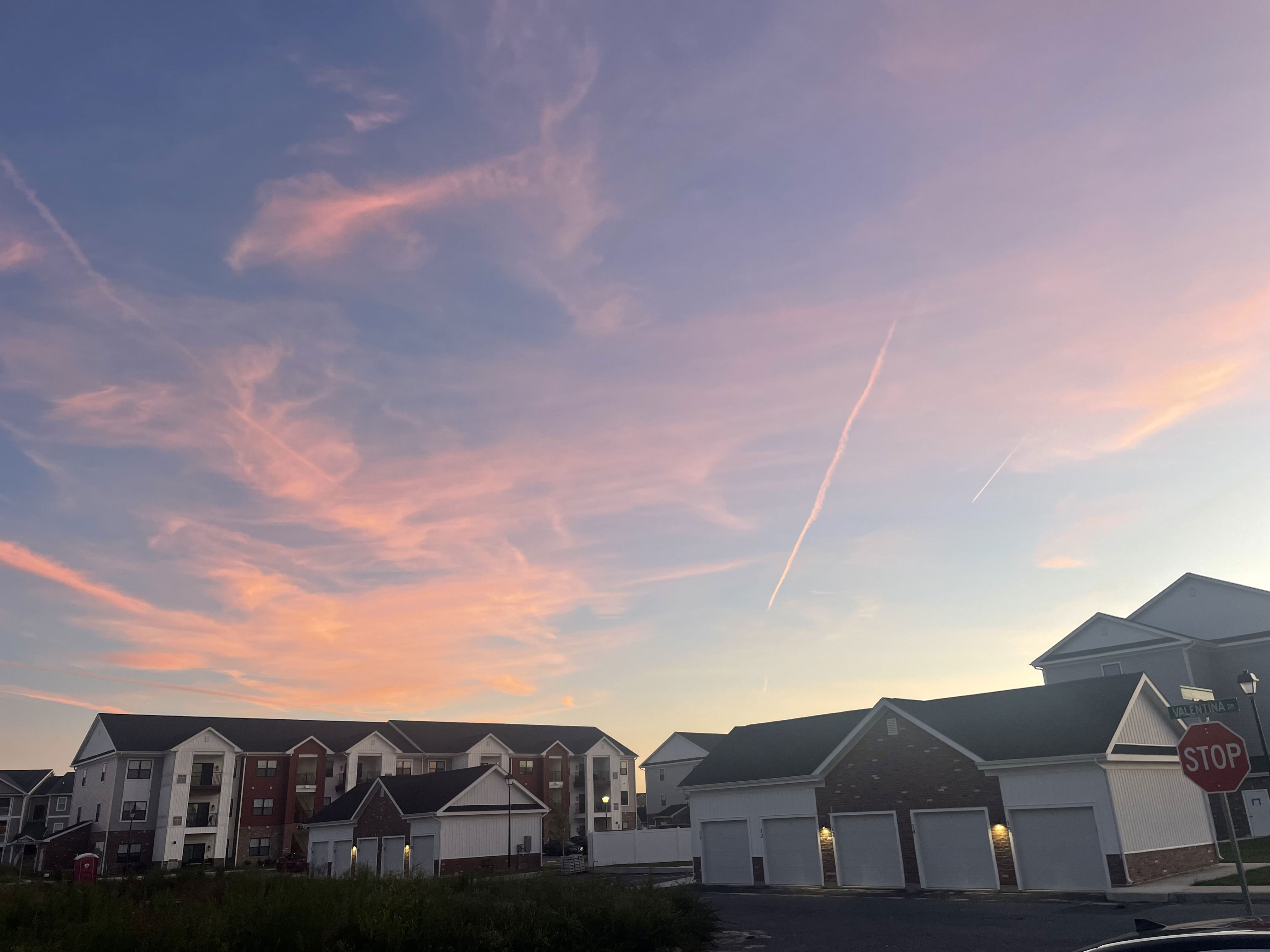
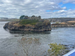
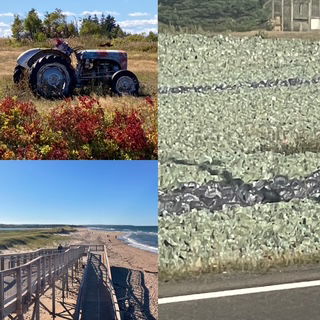
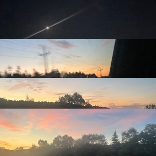
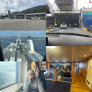
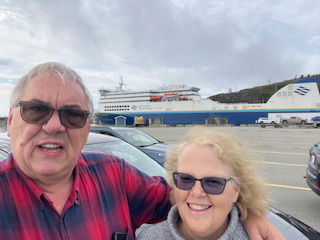
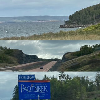
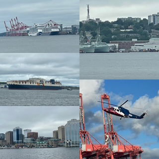
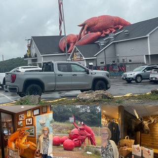
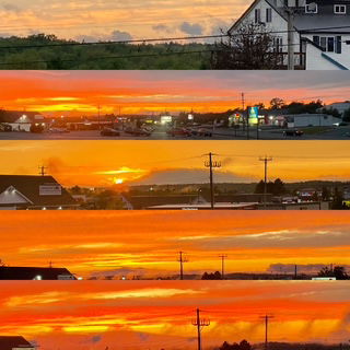
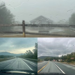
Day 42 Sunday - ADDENDUM - Originally, I wrote the vacation ended on Day 33 and that was sorta true and yet not. While I returned home on Day 33, Chris stayed with the new family to help out anyway they needed. I then drove our Tesla back to Maryland (leaving Wed. afternoon - Day 38), staying in Perrysburg OH) and starting again at 7:00 am on Thursday. The drive went great with a beautiful sunrise over the Ohio Turnpike, nearly all of the chargers were along the tollway and when I had to actually exit, the charger was at Sheetz (my favorite convenience store) and barely hit any traffic near Baltimore. Friday we drove to Poughkeepsie NY for a Saturday funeral. Google maps said it would take 5 to 8 hours and it took us 7+ so it could have been better but it was sunny, we had nice views of Manhattan and we started a new audio book. After the funeral, we had two choices, drive through PA and Cleveland or drive through NY and cut through Canada. We ruled out PA because we would have to stop for the night near State College (home of Penn State) and one of the last places you want to try and find a room at the last moment on a Saturday is a college town that hosts 100,000+ fans for their game. NY was beautiful and we took the opportunity to drive cross country (shocked, right?) and saw Ithaca NY - home of Cornell - and drive along one of the Finger Lakes. Sunday we have a 8 hour drive from Weedsport NY, through Buffalo to and thru Canada, crossing at Sarnia and then straight to home. Weather was great, We crossed on the Rainbow bridge so we could see the falls and Niagara River and happened on to a Costco in London ON so we stopped and picked up Halloween candy as Canada's chocolate is way better. At the US border there was a 4.5 mile, 2 lane backup of semi's! Wow! For cars, we had about a 30 minute delay crossing. The Michigan drive was smooth and fast and we had one last nice sunset to end the trip.
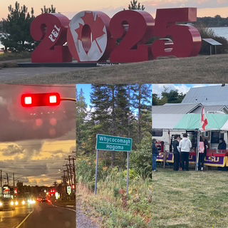
So, the "new" final stats:
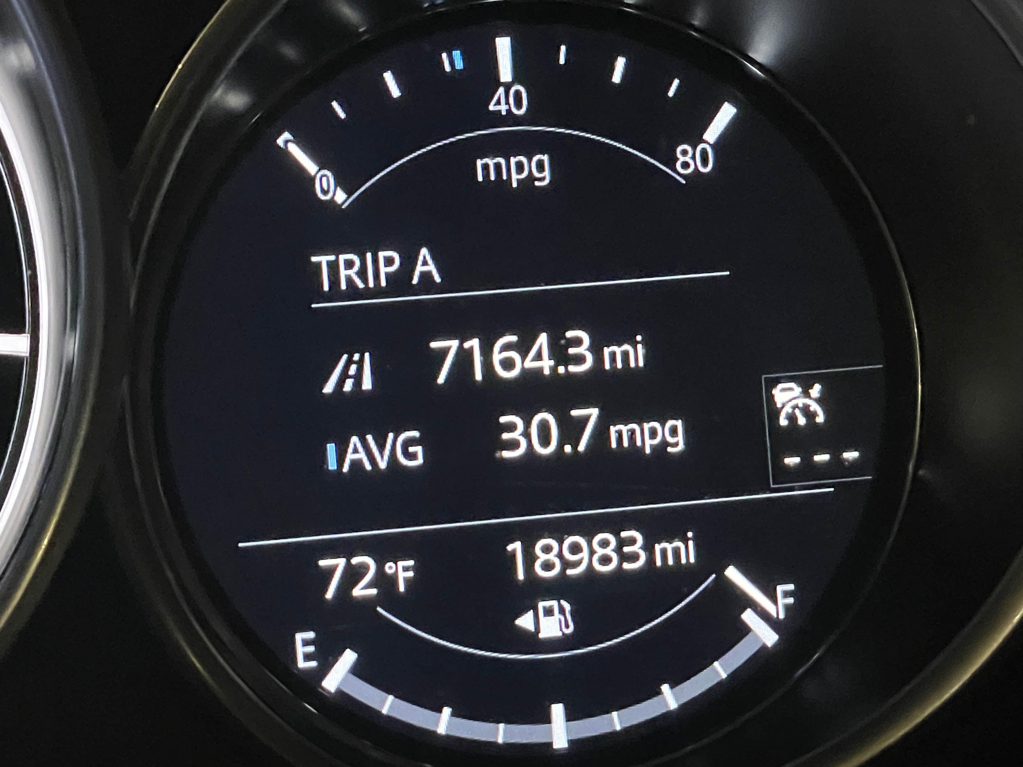
9,074.3 miles (7,164.3 + 1,1910)
42 days
8+ Audio books completed
A personal best! But for how long, you just never know...
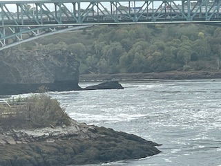
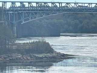
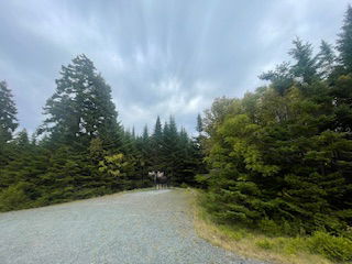
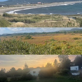
A few more pictures to enjoy from the remaining days. First, sunrise over the Ohio Turnpike, morning fog rising over the mountains and the NYC skyline.
Silo in Finger Lakes, Cornell building and Niagara River
Drive home, crossing back into Michigan
Final sunset of the trip.
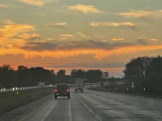
Day 33 - Friday - Woke up this morning with dual plans. I would drive home and turn in the rental car and Chris would stay for another week because she could. :-) The drive home went exceptionally well. Traffic was smooth. There appeared to be one serious accident on the PA turnpike but it was eastbound and I was westbound. Even the sun was on my side as it set just as I was turning northbound on US 23 toward Ann Arbor so I didn't have to drive into it and as I drove by Brighton, I was treated to the best part of the sun setting.
Final observations:
- The air quality in Canada was gloriously clean! Best way to try to describe is to point out that when we went by a dead skunk the stink would almost overwhelm us, the contrast made it seem that Canadian skunks are 10x more pungent than in the US but then we realized it was the fact the air smelled so sweet until a skunk.
- Tim Hortons is a Canadian staple for good reason. Crazy fast, good food/coffee and located EVERYWHERE.
- For the most part, Canadian's seem to drive the speed limit voluntarily. We drove thousand's of miles and probably only saw a police car a few times (outside of city limits) and yet for the most part, traffic moved at +/- 5 mph of the posted speed. Contrast that to the 3 hours of expressway driving in NY after leaving Lake Placid and we saw 6 state troopers.
- If we were ranking the provinces, #1 Newfoundland and Prince Edward Island, #3 Nova Scotia, #4 Ontario, #5 New Brunswick and #6 Quebec (the French do what the French do!)
- Best Natural Wonder? That is incredibly hard to pick. I guess I would pick the reversing rapids river in Saint John and Chris would take Acadia, in particular the views from the top of Cadillac Mountain.
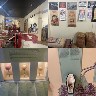
- Prince Edward has the best potatoes - and the best potato museum!
We had many days that we went to bed exhausted and had to think, are we nuts? Well, we can be nuts either way I suppose. That said, it was a great reminder for us when we stayed with the new family and we went to bed exhausted - so as long as you are having fun, exhausted is just fine!
The final stats:
7,164.3 miles
33 days
7 Ferries - 5 Car Ferries (29 hours), 2 pedestrian (1 hr)
7+ audio books completed
6 Provinces & 9 states
1 US National Park, 5 Canadian National Parks, countless state & provincial parks.
0 Moose 😡 - Though lots of others including caribou and seals
1 Grandson 😀 - makes up for the moose big time!
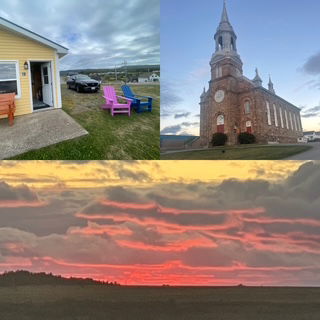
Day 32 - Thursday - A very nice day indeed. Grandson is doing well and eating more each day. Things appear to be falling into a rhythm. We went out tonight to pickup pizza and opened the door of their townhouse to this..... All is good.
Day 31 - Wednesday - A nice day hanging out with family, running some errands, helping with baby things and Chris making us a great home cooked meal. Everyone is doing well.
Day 30 - Tuesday - We arrived at our new destination: Maryland! For those of you who haven't figured out why we detoured south from Ottawa yet, the answer is we are now grandparents!
We got up today, took a lunch order from the new parents and when they returned to their house from the hospital, we met our grandson and had lunch. The rest of the day you can safely imagine revolved around feeding, changing and holding the new guy. It's been great! As many have told us, being a grandparent is the best, we wholeheartedly agree.
In case you are wondering, no we haven't decided what our "grandparent" names will be. We will probably trying names out and then our grandson will begin talking and we'll get called something completely different.
I have a feeling we will be taking many of road trips this way so I am going to have to determine alternate routes to Maryland. I am ready for the challenge!
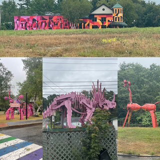
Day 29 - Monday - Before leaving Scranton, we went to it's biggest city park, Nay Aug Park. Why you might ask? To see a large treehouse that stands 150 feet over a gorge of course! Well, not quite a "treehouse" but it was still pretty cool. The park was located around a pretty gorge and after reading so many historic markers, we had to laugh at the one we found on the treehouse. We have found that sleeping in a little seems more valuable now than at the start of this trek. Go figure!
After leaving the park, we entered the Pocono's. In the morning it was partly cloudy but it didn't really matter as the leaves are not changing much in the Poconos. The views and drive were still grand but it was kind of weird to be back among the green trees again.
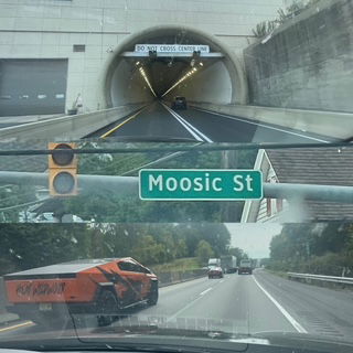
There isn't a lot of scenery to share but we still had our moments. First off, Scranton was toying with me with a street name I thought was Moose but a closer inspection it was Moosic. We were pleasantly surprised with a tunnel on our drive and we saw a very ugly cyber truck (that's saying something considering how ugly those things really are).
The drive today ended with finally having pasta. Chris mentioned wanting it earlier in our trip and I was surprised to learn most of the restaurants along the ocean coast wasn't big on pasta. We were able to enjoy all the seafood we want, but no pasta. So today I decided she waited long enough and found a pasta place. An oldie, but a goodie, an Olive Garden. It was great, it really hit the spot!
We finished our 6th book of the trip and jumped right into #7.
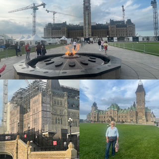
Day 28 - Sunday - Last night we decided to take a detour from the rest of our Canada exploration and "turn left/south" at Ottawa. While standing in front of the Parliament, we took out our phones and made a new reservation by the US border. This morning we had to decide where to go. With a great weather prediction of sun all day and reports that leaves were at peak in the Adirondack's, it seemed like a good choice. When I noticed that Lake Placid is in the heart of the range, it was a no brainer. We went southwest and drove through the range. The color was incredible as were the mountains. First, we had to cross over to the US and see if they would let us back in.
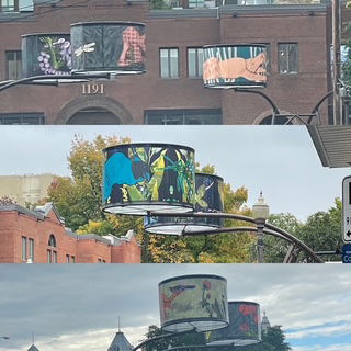
Along the way, many small towns had some very nice murals.
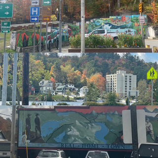
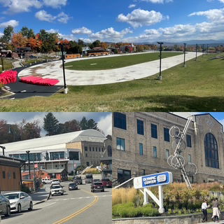
It is amazing to think of the Olympics being held in Lake Placid. It is so small and so far from anywhere. It is hard to imagine the Miracle on Ice happening in such a small arena.
Once we were through the Adirondack's, we decided we also wanted to see the Pocono's so we changed direction to the southeast (yes, this is truly a zig-zag pattern) to tonight's location, just outside of Scranton, PA. Along the way we drove through the edge of the Catskills and the difference between them in the Adirondack's were quite apparent. Rolling mountains with rather large valleys versus the Adirondack' more "rougher cut" with many rugged creeks/brooks cutting through the rocks.
We arrived at our motel tonight after a 7 1/2 hour drive. Yes, we did one of our classic's - if we would have simply driven straight to Scranton, it would have been about a 4 hour drive. But where's the fun in that? :-) Tomorrow the Poconos!
Oh yeah, we rolled over the 6,000 mile mark late this afternoon. :-)
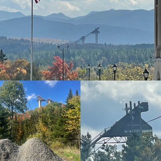
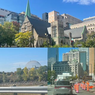
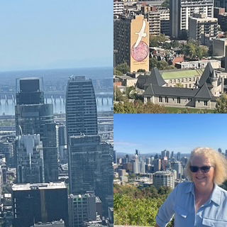
Day 27 - Saturday - Today was jam packed. We drove about 3 hours to Montreal, arriving around 11am. Originally we planed on spending an additional day in Montreal but plans changed so we thought we might play another game of "HoHo to Go" to see the Olympic Stadium (cool cantilever support), Biosphere, Leonard Cohen Mural and Mount Royal.
The drive went smoothly and as we entered Montreal, we drove right by the Olympic Stadium and the Biosphere so we checked those off. Then as we drove further into town we literally drove right up to a Costco so that took care of when to get gas for the day.
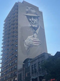
Our first stop was to see the Leonard Cohen mural. We have become fans recently of the former Singer/Poet and when I saw the mural online, I had to see it in person. It is on the side of a 20 story building! We followed Google maps to the address and there was a parking garage under the building so we just paid the parking and then went out on the street to see it. Amazing! Since we paid for 3 hours and it turned out to be the "fashion" district of Montreal, we took a nice 10 to 12 block walk around the area - very neat and at 65 and sunny, a GREAT day to walk the streets.
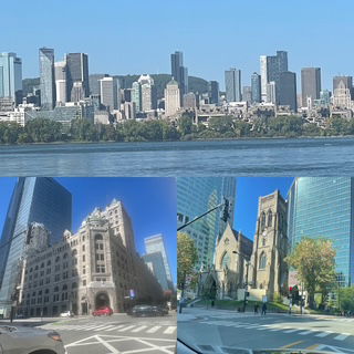
We left for Mount Royal park. It is a park which reminded us of Central Park other than it rises over 750 over the city so it provides great skyline views. Looking it up tonight, I found out the park that was designed by the same man who designed NY Central Park so that explains why it seemed so similar to us. The views were worth the hike to the Mount Royal Chalet and to see the Leonard Cohen mural from a distance.
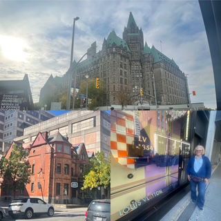
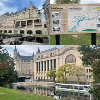
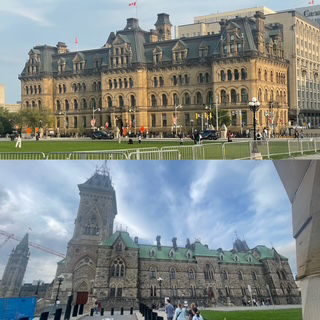
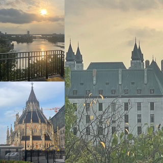
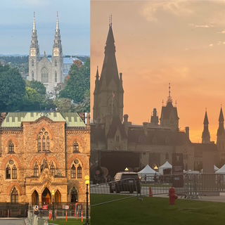
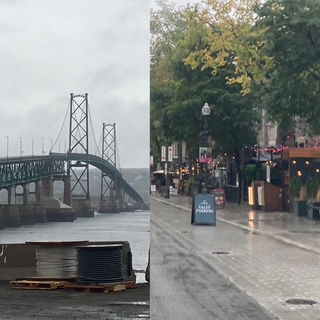
From Montreal, we headed 2 hours to Ottawa, the capitol of Canada. I've always wanted to see the Parliament Hill. We took the first parking garage we found near by, at the National Arts Center and then started walking around town. It turned out we parked right by the UNESCO site, Rideau Canal, so we walked along it toward Parliament Hill. The canal is the one you see pictures of people skating to work in Ottawa during the winter. It is 125 miles long and an engineering marvel. Next, the "hill" and it didn't disappoint. We saw the House of Commons, Parliament, Senate, Library of Parliament and several statues. There was a lot of construction going on which had me worried as I had learned that the walk behind the Parliament was special. Luckily the path was open and we saw some great views of the Ottawa river, the National Gallery, the Notre Dame Cathedral Basilica and the Indigenous Experiences building. Of course, that was a lot of walking so we were both amused and dismayed when after walking 95% of the circle around the Parliament, we came to a locked gate. The good news is that walking back around the building a second time came with some sundown pictures and we heard the bells of Notre Dame too! What a day.
Day 26 - Friday - Quebec City here we come! I had a lot planned for today but the weather forecast was for rain from 12 to 4 so we were racing against the clock to hit the sites.
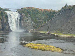
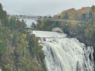
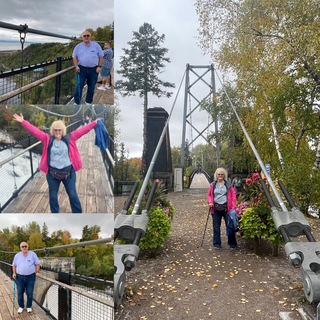
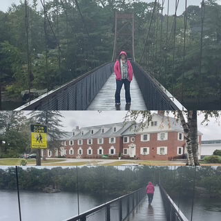
First, we went to Montmorency Falls. This is a 275 foot falls (100 feet higher than Niagara) which includes a gondola ride to the top, a suspension bridge over the top of the falls, and a stairway down the side (487 steps). We took the gondola and walked the bridge but decided against the stairs as Quebec City is very hilly and we to save our legs for later. The falls were excellent and the suspension bridge didn't bounce as bad as others we have walked (including the one in Maine which bounced a lot).
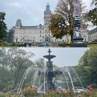
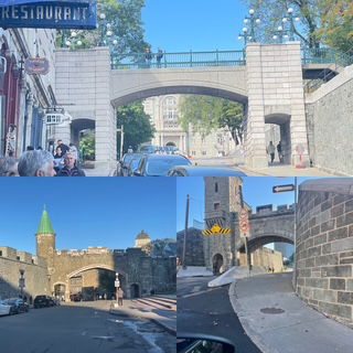
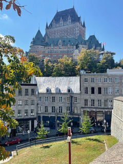
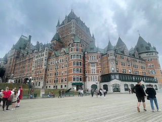
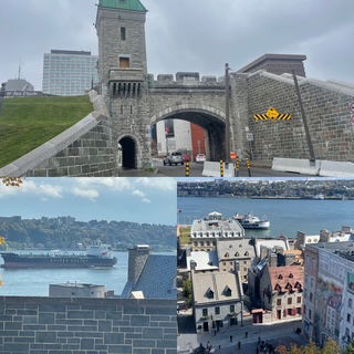
Into the old city (UNESCO site) of Quebec City we drove and I had already learned that a 400 year old city doesn't usually have a master parking plan! :-) Therefore, we went straight to the world famous Fairmont Le Chateau Frontenac Hotel and parked in it's basement for $50 CAD. It was a the smart move as it put us in the heart of the old city. On the drive in we went through one of the 4 remaining main gates into the old city. We also saw part of the remaining walls that protected the city and the Fontaine de Tourny out in front of their House of Parliament.
Note: While there are 4 main gates remaining, we drove through 5 or 6 so evidently there are main and submain gates or the people of Quebec need to update their math skills. :-)
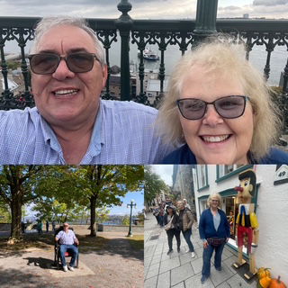
We walked the boardwalk in front of the Fairmont and saw their toboggan slide (currently closed, duh!), the American Consulate and fabulous views of the St. Lawrence River and surrounding city.
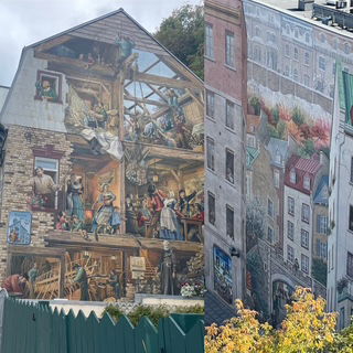
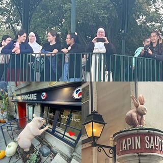
We took the Funicular down from the boardwalk to the Rue du Petit Champlain which is the historic / famous pedestrian shopping/cafe street that makes you feel like you are walking in any ancient European city. The street included music buskers and beautiful murals. It was awesome.
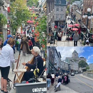
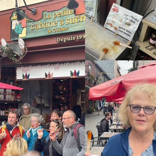
Along the street, maple taffy and "arts" and even a couple of nuns!
Instead of taking the funicular back up, we walked up via several different streets with amazing views and another one of the city gates. At one point, we just sat on a bench in a park, looking out over the river and people watched and while I didn't say it out loud, I thought, "Boy, blue skies, 66, they sure got the weather wrong, thankfully. We started the walk back to the Fairmont and by the time we got there, the skies had turned very dark - guess my thoughts alone were enough to jinx us. We thought we should get to the car, but not without stopping for a gelato! :- As we pulled out of the parking garage, it started to rain. How's that for timing?
The only bad part of the timing was we were not ready to go back to our motel which has about 125 channels, 124 of which are in French so we invented a new game - "HoHo to Go". The game is taking a brochure from the Hop on / Hop off (HoHo) tour bus and driving to nearly everyone of it's stops and seeing what is located at the stop! With Chis having the brochure in one hand, cell phone in the other, we were off zig-zagging across the city.
It was so much fun and while several stops were already on my list, (Citadel) some where not (Plains of Abraham). One such unknown stop was Avenue Cartier. When we arrived, we found this incredible shopping/restaurant street with the best street lights ever! By now, the sun was back out so we found parking on the street (everything is in French so this was NOT a small task!), and went to have an early dinner. Restaurants looked great but all of their menus were in French. We finally found one that said they had an English menu inside so we just went in with the plan, "we'll find something". As it turned out, we did.
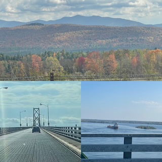
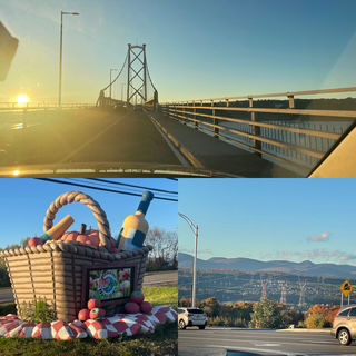
Finally as we headed back to the motel, it was still early so I said to Chris, "You know that big bridge near out motel that goes over the island, lets drive over it." Chris agreed so we drove over to Île d'Orléans (20x5 mile in size). It was quite nice and gave us a marvelous view of Quebec City with the mountains behind it, a massive picnic basket and one last stop, a gelato stand. :-) A crazy busy day but fun, fun, fun.
Day 25 Thursday - Today was a driving day, 6+ hours to the northwest corner of New Brunswick and then into province #5 on this trip, Quebec. During our long drive, we went over the 5,000 mile mark and finished our 6th audio book. :-)
The drive went well but it was overcast nearly all the way until the last hour or so when it turned to rain. The forecast for tomorrow is dry so if it was going to rain, so be it. Even with the clouds, the leaves just became more and more colorful.
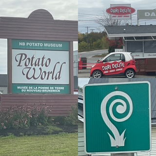
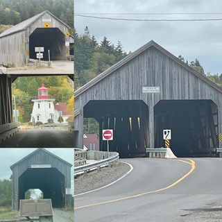
While we only had two stops planned today, they were doozies: The World's Longest Covered Bridge and Potato World!
As we were approaching the covered bridge exit, Chris noticed there was an exit for Woodstock. I asked if we should take the exit and check it out. With out any delay, Chris said, "Yeah!" Anyone still wondering how we have made it 40 years?
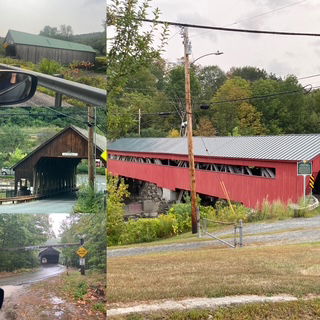
Woodstock #4 of this trip was very nice and even had us turning around to get a picture of the Dari Delight. :-) Given what we saw, Woodstock NB is a solid #3 out of 4 of the 'Woodstock's we saw on this trip. Additionally, this detour gave us the chance to drive along 15 miles of the Saint John River until we could see the covered bridge.
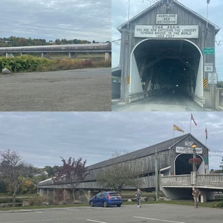
The bridge was awesome and easy to see why it is the longest, 1282 feet! Of course, we drove across it cause that is what we do.
Tide Update: One item I forgot to mention in yesterday's update was the high tide reaches up to 80 (yes 80!) miles upstream. We were reminded of that as we approached the covered bridge because it was low tide and there was a lot of river bottom exposed.
Next was Potato World. It seems New Brunswick isn't ready to hand over the mantle of best potato (or best potato museum) in Canada to PEI. It was a nicely done museum but if we were the judges, PEI's museum was the winner. It also had a nice restaurant but we didn't order anything as it was to early in the morning.
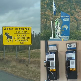
We knew when we entered Quebec (not just the sign) because for 2 weeks or so we have been seeing road signs in both English and French. As soon as we entered Quebec, the English stopped! Oh boy, this might be a little more of an adventure than we were anticipating. I mean, they even still have pay phones!
We drove into Quebec City a little before rush hour and Google maps took us right down the boulevard toward the old city and along the waterfront. I couldn't have asked for a better, more scenic route. We didn't get many pictures as we were dealing with "translating" and it was raining but the city looks terrific. We drove down one street full of sidewalk cafes which I think would rival Paris. We saw one of city's famous fountains as well as one of its 4 gates and part of the wall that surrounded the city and saved it from the U.S. in the war of 1812.
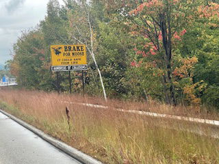
Still no moose (and there was a LOT of moose territory and signs on today's drive). One last thing, is it me or in the moose picture above does the moose have an air about him (nose up) that might fit the reputation of Quebec? Just saying,
Day 24 Wednesday - A quiet day was the plan as our next stop, Fredericton was only 1 hr. away. We actually slept in till 8:30!
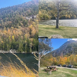
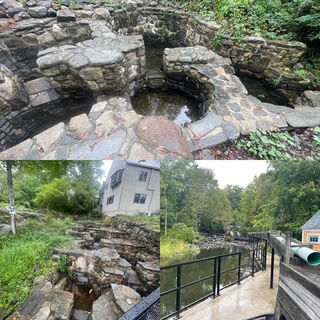
We had a nice breakfast at the motel and then we headed straight to Fallsview Park (aka Stonehammer UNESCO Global Geopark). At this park, you can view the Saint John River as it enters into Fundy Bay. What makes this worth seeing is the 28 foot tide as the river literally reverses from flowing into the bay to flowing out of the bay at every high tide (approx. 2 times a day). We arrived about 2 hours after low tide so the river was still clearly going toward the ocean and looked more or less normal. We took plenty of pictures and also video and then we were going to come back to the park around 2:00 pm, at high tide, to see the flow of the river. When we returned, it simply blew our minds! The water was racing up river, a large rock (15 feet out of the water) this morning, was under water. It is one of more spectacular natural phenomena we have seen. As a bonus, we were able to watch harbor seals feeding in the high tide. Below is an island in the morning (low tide) and then again in the afternoon
Below you see a rock that has broken off the cliff. At this point in the morning, it's highest point is about 15 feet above the water, below that, you see it is just a ripple.
I don't have time to put our videos out on the web yet so here is a link to one I found on YouTube that does a great job showing the change. https://youtu.be/RvLslMFBZvg
What did we do for 3 hours in between viewing the river? We did a classic 'Parry & Chris' tour. We drove downtown to the 149 year-old City Market - right across from the King's Square Park. Nice market and square which reminded us of Charlestown SC.
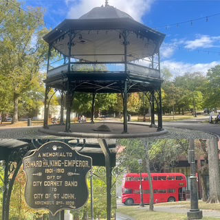
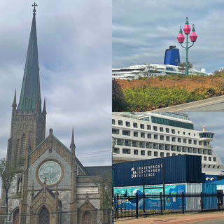
From the Market we headed to the Waterfront Container Village which is a bunch of shipping containers, painted wildly and turned into shops right at the port where the Cruise ships dock.
Then we went to see the Three Sisters Lamp which are in direct line with the steeple of Trinity Church, so that sea captains were able to navigate their way safely into Saint John Harbour at night.
As we continue on our 'tour' we were laughing as we kept crossing the Hop on / Hop off bus so we knew we were getting the highlight locations.
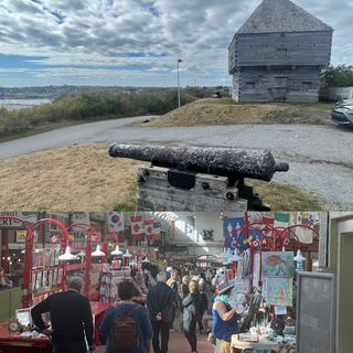
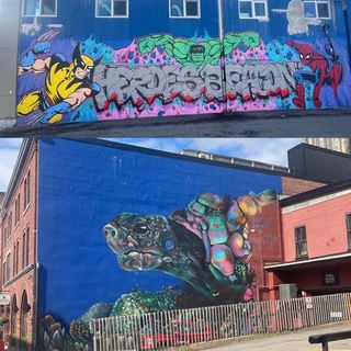
Next up was the Cathedral of the Immaculate Conception - the nearly 200 year old church in the center of the city. It was undergoing renovations so we could not enter it. Finally we went to the highest point in the city, Fort Howe National Historic Site, for some nice panoramic views. Throughout our 'tour' we are always on the lookout for murals.
The drive to Fredericton was nicer than expected as it was quite sunny and the color that wasn't popping yesterday, was popping today! Of course, the extra light did not help us find a moose. :-(
Day 23 Tuesday - it was supposed to be cloudy and rain. The good news is while it was cloudy all day, only the last 15 minutes of the drive to our night stay did it rain (hard too).
Moose!?
Our day began with a bit of uniqueness with today's first highlight when we came across a vintage VW bus fan. In his yard he had 3 VW buses, 1 VW bus/truck and he even had one bus incorporated into his garden!
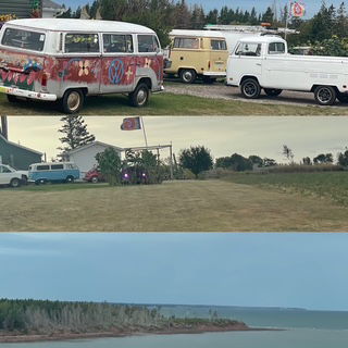
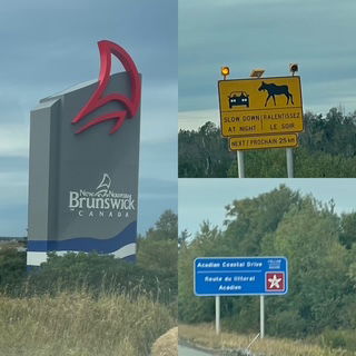
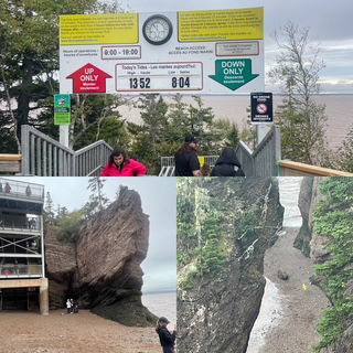
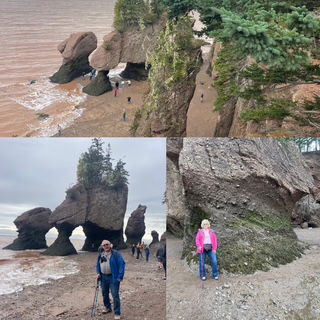
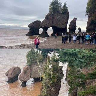
Just around the corner from the VW fan, we drove on to the Confederation Bridge, the World's Longest bridge over ice-covered water (8 miles). It reminded us of the bridges in the Keys but those were relatively easy to build compared to this one. As we left the bridge, we entered New Brunswick, our 4th province on this trip.
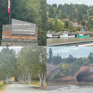
On the way to the Hopewell Rocks Provincial Park, we stopped at a German bakery along the way, which was housed in a church. Yum! Hopewell Rocks has a tide change up to 52 feet. We arrived while the tide was coming in but it was only about 1/2 the way to high tide. This gave us time to take the 99 stairs down to the "ocean floor" and walk around while the water was out. An hour later, we went up the 101 steps (yup, more up than down) as our dry ocean floor was disappearing rather quickly. We stood up on the observation deck for a while and watched as nearly all of the beach disappeared - and there was still about 6 feet more of tidal rise yet to complete the cycle. It was captivating to watch. NOTE: Chris impressed me, as well as herself, when, as we were standing on the observation deck we saw a couple of birds darting in the trees near by and with just a glance she said, "I think those are Juncos". We used our phone app to identify the bird by it's song and guess what? It was a Dark eyed Junco!
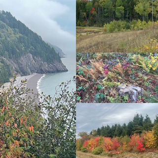
Next on our hit parade was Fundy National Park (our 5th Canadian National Park). The hike we had planned was cancelled as it was under construction. We were still able to visit the park but the major event was the Fundy Trail Provincial Park. This park is made up of hiking trails and an incredible scenic road which hugs the Bay of Fundy coast with stunning views in every direction for 20 miles. Also, the fall colors have officially arrived in Fundy. Most trees are at least starting to change but because of the clouds, we couldn't get any really nice pictures of a hill side. But, as you see below, up close the color shows up well.
As we headed a little bit more inland, we came across 4 different covered bridges, including one that was over Vaughan Creek. My maternal grandfather last name was Vaughan, Gilbert Vaughan.
We didn't get much of a view of Saint John as we drove through to our motel as it was raining quite hard and we were in a construction zone through the heart of the city.
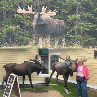
As you look closer at our Moose, you will see that he was carved out of wood but if you can't find a real one, you start accepting other options. :-)
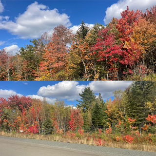
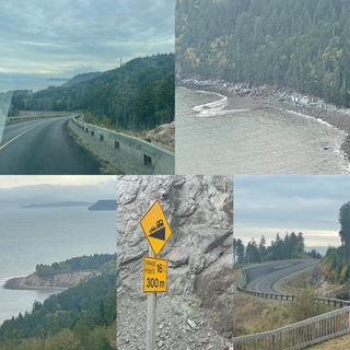
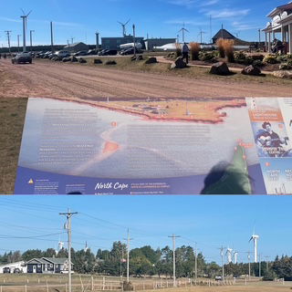
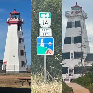
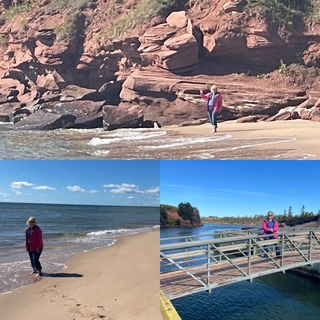
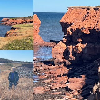
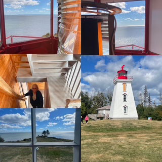
Day 22 Monday - Today we left the provincial capitol, Charlottetown, and headed north west to the most northern point on PEI. It was about a 2 hour drive to the tip of the cape which is home to one of the more advance wind energy sites in the world. Of course, there is also a lighthouse. While the Wind Energy Interpretive Centre was worth the drive itself, we had the bonus great views of red cliffs, the ocean and the fall colors seemed to have turned on last night (at least in this part of PEI). By no means, full color but now along many stretches of road we are seeing a nice mix of reds and oranges.
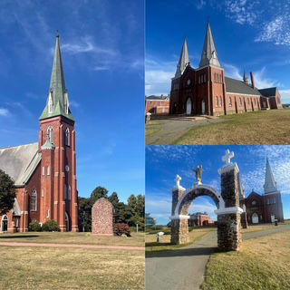
Next, we saw the largest church on PEI, built in 1860. In addition to many beautiful brick/stone churches throughout PEI, it seems nearly every intersection has a nice white church. We have probably seen nearly 100, and while some need some upkeep, most of in great shape, built on a hill, and look picture perfect.
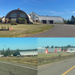
If you ever wondered where Quonset Huts went to retire, its PEI. They are everywhere in all kinds of shapes but they are most certainly still very important to the farming industry.
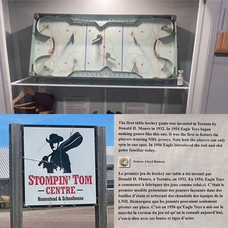
Driving down the western coast, we stopped at a beach near the one of PEI's most famous singer's museum, Stomping Tom Connors (we actually know him from his "The Hockey Song" https://www.youtube.com/watch?v=UxJvrD80nJ4) and not only was it a great view, it was an incredibly red sand beach, way more than yesterday.
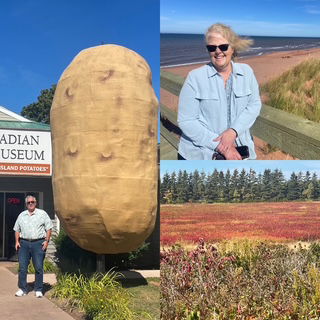
Lunch was at the Canadian Potato Museum. Chris had baked potato lobster and I had pulled pork poutine. PEI claims to have the best potatoes in Canada and after our lunch, we would not argue the point. In particular, Chris' baked potato was simply amazing, it melt in your mouth. After lunch we went through the museum and it was unexpectedly enjoyable as it covered potatoes as well as 'local' history
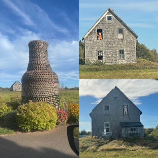
On the final part of the drive to our Motel in Sunnyside (beach community) we visited 2 more lighthouses and while we did not have time to get up close to the Glass Bottle House, we did see a giant glass bottle make up of glass bottles! In a rundown barn nearby there were two 'bears" watching us from the upper floor.
Day 21 Sunday - After yesterday's great dinner, we had leftovers so our plan was to get a late lunch in Cavendish at Boom Burger. Why? The burger place is located in a renovated historic church (the author of ‘Anne of Green Gables’ attended it)!
PEI has 4 scenic trails/roads. They all start from Charlottetown (as it is in the middle of the island) and then cover about 1/4 of the island (SE, NE, Central Coastal & NW). We arrived yesterday in the SE corner and drove some of that section.
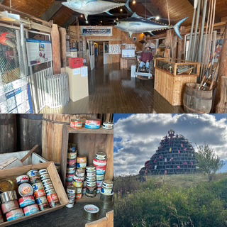
Today we headed out on a beautiful sunny day (temp 63) to see the NE and most of the Central Coastal route, about 4 hours of driving. We started at the Basin Head Fish Museum and Beach Provincial Park. Seeing the evolution of fishing in this region was fascinating. The beach was eye-catching with a red cliff at one end and the "singing sand". Yes, singing sand. The sand "sings" or squeaks when walked on due to its high silica and quartz content. You could easily hear it but now, of course, we can't wait to walk a few beaches next summer in MI to see if they sing as well. Chris walked in the surf and reports it is as cold as Torch.
Next was the East Point Lighthouse - most eastern point in PEI. It was nice but we have seen so many lighthouses, they are stating to blur a little :-) It stands on a cliff and from the cliff we could again, see grey seals fishing. Then, in the middle of nowhere, in the middle of a triangle type intersection, miles from any town we could see, what did we see? A very nice outdoor hockey rink! You got love Canada.
We drove across the central northern coast stopping at the PEI National Park (both the east and west ends). Views were great and now we can add to our list of sands we have seen on all our trips: Black (Hawaii), White (White Sands NP), 'Sugar' (All over MI), singing (PEI) and now, the red sands of Cavendish Beach, PEI. Who knew there were so many natural color sands? It makes colored sand in bottles way more sense.
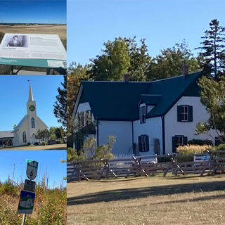
Finishing off our drive, we stopped to see the 'Anne of Green Gables'" house. Funny story. Several times before we left on this trip, we told people we were going to PEI and to our surprise, many said, "Oh are you going to Green Gables?". We both knew about the book, but neither had read it. So, after finishing our 4th audio book on this trip, we started to listen to Anne. Turns out, neither of us are pre-teen girls so we toughed out 4 of the 10 hours but then skipped to the last chapter and finished it. :-) We are glad that we tried and it did give us a lot of insight to the fans of the book and the history/area of PEI but we are also glad we bailed after 4 hours! Not sure if that means we have finished 5 books but I know it does mean we are starting #6.
Overall these two areas had a lot of farm lands with rolling hills and gorgeous blue water lakes. They seemed to be growing many crops, though PEI potatoes are the #1 crop. As i looked across the landscape I couldn't help but notice some fields were very blond/yellow and others were very red and so I wondered, are those where golden and red potatoes come from? :-) Lastly we saw a very leafy plant and could not tell what it was until near the end of the day, we came across a field of it with stripes of purple and then we knew, cabbage!!!
The color is definitely starting to change. Nothing big yet but more and more everyday for sure.
Day 20 Saturday - Today's adventure was to head to Caribou, Nova Scotia for our 5th car ferry to Prince Edward Island (PEI). It only takes 7 minutes and you can see both provinces all the time. This ferry departs every couple of hours so we decided we would just take our time in the morning and take the 1:30 ferry as it was a 3 hour drive to the port. The drive was still the Cabot Trail so the scenery of cliffs and HUGE waves smashing the rocks were incredible.
As it turned out, traffic was light (pretty much has been the entire trip) and we realized we were going to reach the port 20 minutes before the 11:45 departure so we crossed our fingers and we were able to basically drive right on the ship. That saved us 2 hours!
The ferry was the roughest of the 5. not bad but there were times when you got picked up and placed back in your seat! I went to get a picture of the coastline and the next thing I knew both of my feet were no longer in contact with the deck. No biggie, I had a hand on a pole and then I just grabbed it in a hug. I should have been given tips considering I was providing onboard entertainment.
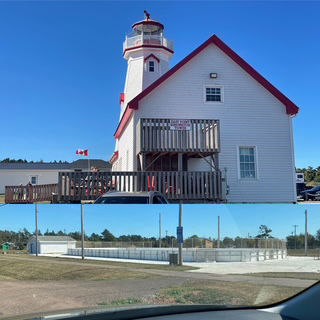
Once on PEI, we headed to Cape Bear Lighthouse and Marconi Station. We climbed to the top and the view was incredible. Back on the ground, we went out on a point (not near the edge!) and we spotted 5 grey seals (can't be positive they were grey but pretty sure).
It turns out today was the PEI 70 Mile Coastal Yard Sale. We just left the port property and traffic stopped as a big field had been setup for vendors and people were parking everywhere! We didn't stop at that one but you KNOW we had to stop eventually and see how Canada junk compares to US junk. Answer? Pretty much the same junk. :-) In fact, one vendor had all his tables covered the the same "throw blanket", purple and yellow LSU Tigers (Louisiana State University). I wanted to ask him, "WHAT?" but he was busy.
We arrived in Charlotteville (capitol PEI) late afternoon and saw that near by was the MOO MOO BBQ (best Texas style in PEI) and it just called to us. Unfortunately, it was a takeout place and we wanted a sit-down. So, looking on google we found Montana BBQ (not kidding). Can't explain it but my ribs and Chris' chicken and waffles were incredible.
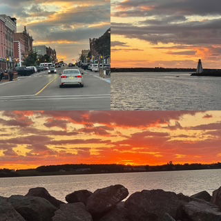
To finish our day, we drove to downtown Charlottetown. Wow! Great downtown, shops, LOTS of pubs and restaurants, historic building, harbor walk, just about everything. Nicest town we have seen on the trip by far. In addition we saw yet another unusual road 'sign', square (yes square) red lights. NO, not all the lights were square, just the red ones. WHAT? As we meandered downtown, we ended up at Victoria Park just in time for a wonderful sunset.
Day 19 Friday - Maybe it was the 7 hours swaying on the ocean, lack of sleep the night before, or 18 days on the road? We were tired! Whatever the reason, we had a great 10 hour night sleep. Then, our hotel came with a hot breakfast so this morning was a satisfying morning.
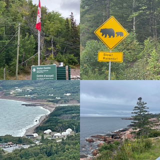
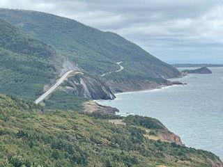
Today's drive was the world famous Cabot Trail. The forecast was for cloudy and rain most of the afternoon but we got lucky, cloudy but little rain. The drive lived up to all the hype. The drive around the Cape Breton Highlands National Park is one everyone should get a chance to complete.
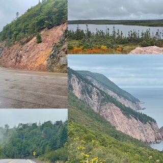
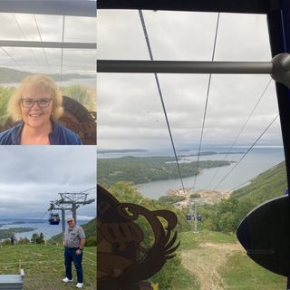
Since the rain stayed away, we stopped while on the Cabot and took a gondola to the top of one of the mountains for some great (but grey) views.
Of course, have to have a moose update so here goes, Nova Scotia is just making fun of me as they are now reminding me that we haven't seen a bear yet either!
The 'picture' that people have seen (maybe they don't know where it was taken) of the Cabot Trail is the one below
As great as it was, its almost unfathomable to think of it in full color. We saw just a little color today and to imagine these valley and mountains covered, wow!
As we arrived at our destination, Cheticamp, we saw a small bakery which I read about on the web. How to tell when a bakery is as good as it's reviews on the web? It was 3:45pm and every parking spot in front was taken AND we saw that it has it's own overflow parking lot across the street! Well, here comes a shock. We stopped. Good, you ask? Spectacular!
We went into a store in town and immediately heard the people speaking French. Not a surprise as this coast of Nova Scotia has a lot of French history. Following that thought, we went to a French restaurant for dinner. We had a Lobster & Crab roll and Haddock and Chips and then split them. Both were very good. Highlight of the experience though was our waitress who when she spoke to us sounded just like us, no accent. Then a table of French customer's came in and she started speaking English with a very French accent and then, of course, we heard her speaking to another table in English with what we think was an Irish accent. Very talented!
Finally, we went for a drive to see if we could get a good view of a sunset over the water. (reviewing this post, I realized I just wrote that while we were on our epic road trip and after dinner, we took a drive for a sunset. We might have a problem. ha ha ha) On the way, I saw two large birds in a person's yard and I thought they were turkeys. To my shock and awe, they were seagulls. GIANT seagulls! Also there was an inspiring Catholic church in town made of stone cut 'bricks' with a granite steeple. Never saw such a work.
As for the sunset, we sat for about an hour as things were looking good and then, very quickly the clouds moved in and it was basically going to be gone so we headed back to our cabin. When we got back to the cabin, we were shocked by a incredible red/purple cloud burst. You just never know what is next, eh?
Day 18 Thursday - This morning started early. The apartment we rented had recently had a smoker (against the rules) and the left over smell wrecked havoc with Chris' sleep. Thus, at 5:00 AM we stared our morning with a clear night sky.
Not all that bad considering we needed to get to the port for the ferry back to Nova Scotia by 9:45 so we were planning on leaving around 7:15 anyway. Besides, leaving in the dark, driving slow, we might see a moose.
The drive went well, we were able to find a gas station open 24 hrs. and fill up and head to the port. A big 4x4 truck came up behind us so I let him pass and then we realized he had a LED lightbar across the top of his truck so when he used his high beam lights, it was like he lit up a football field. At that point, I simply stayed behind him a good distance and let him light the way on until the sun came up. It really worked well.
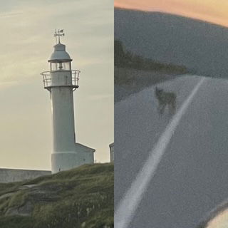
The sunrise was quite nice and while we could not enjoy the scenery as much in the dark, it was kind of a nice change. As we drove we saw a flash of a mid size animal zoom across the highway. We were not sure what it was but when we came up to the crossing point, it was still there. A nice size coyote!
Needless to say, we arrived at the port a little early (ha ha) so we just drove up and down nearly every street in the town and enjoyed what we could see.
The ferry went smoothly. It was foggy out on the open water but there hasn't been any icebergs in a couple months so not much of a concern.
We arrived back in North Sydney NS (same as where we left from to Newfoundland) and drove to our motel. It looks nice and all is good. Oh, the moose update? Yeah, like we would see a moose on our last 2 hours of a 6 day drive in Newfoundland! Moose - 0, SO FAR! Lots of good moose hunting ahead.
Day 17 Wednesday - Today was planned to be somewhat of a down day. Tomorrow we take the 7 hour ferry back to Nova Scotia so the plan today was to spend a little more time in Gros Morne and then head to Stephensville (2 hr. away and 2 hr. from the ferry port). Our Airbnb has a washer/dryer so we want to have time to reorganize the car, do laundry and generally get everything organized and clean.
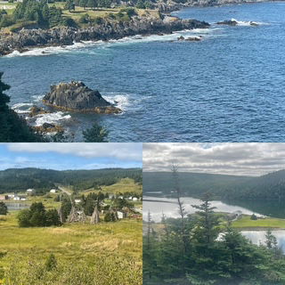
In Gros Morne we started the day on a hike which ended at the mouth of a river, emptying into the Gulf of St. Lawrence. In the background were the Long Mountain Range, the last mountain range of the Appalachian Mountains - who knew the Appalachian's went all the way to Newfoundland? Not me! The hike was the first one where we didn't have to navigate tree roots and rocks. Much more enjoyable walk. Of course, the views on the way up the coast and then on the hike were incredible and the fact that it was very windy gave us great waves crashing on the shore. Unfortunately, the same weather really fogged off the view of Long Mountains. No moose but we did see 2 nice toads on the trail!
Next was a visit to the historic Lobster Cover Head Lighthouse. It was a nice slice of history and, of course, it is a lighthouse so the views are 180!
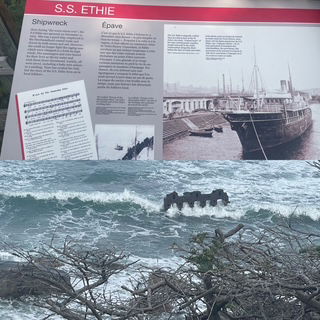
As we drove toward the exit of the park, we stopped to see the remnants of the 1919 shipwreck of S.S. Effie.
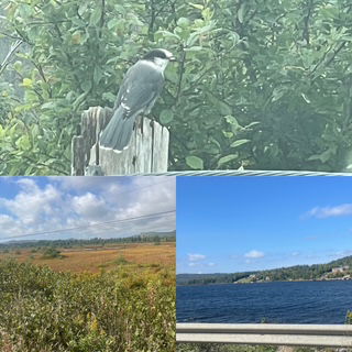
The drive out of the park, like all of this trip was wonderful. All of the lakes are just so navy blue in color and even the bogs are starting to change and are very colorful. At one viewpoint, we saw our first 2 gray jays which flew right up to the car.
We arrived in Stephensville and while it's location was geographically perfect, it might be the least exciting place we have visited which made it even easier to do laundry and organize the car. But, not to sell it to low, it still has a coast and the sunset out the back window of the apartment were still nice.
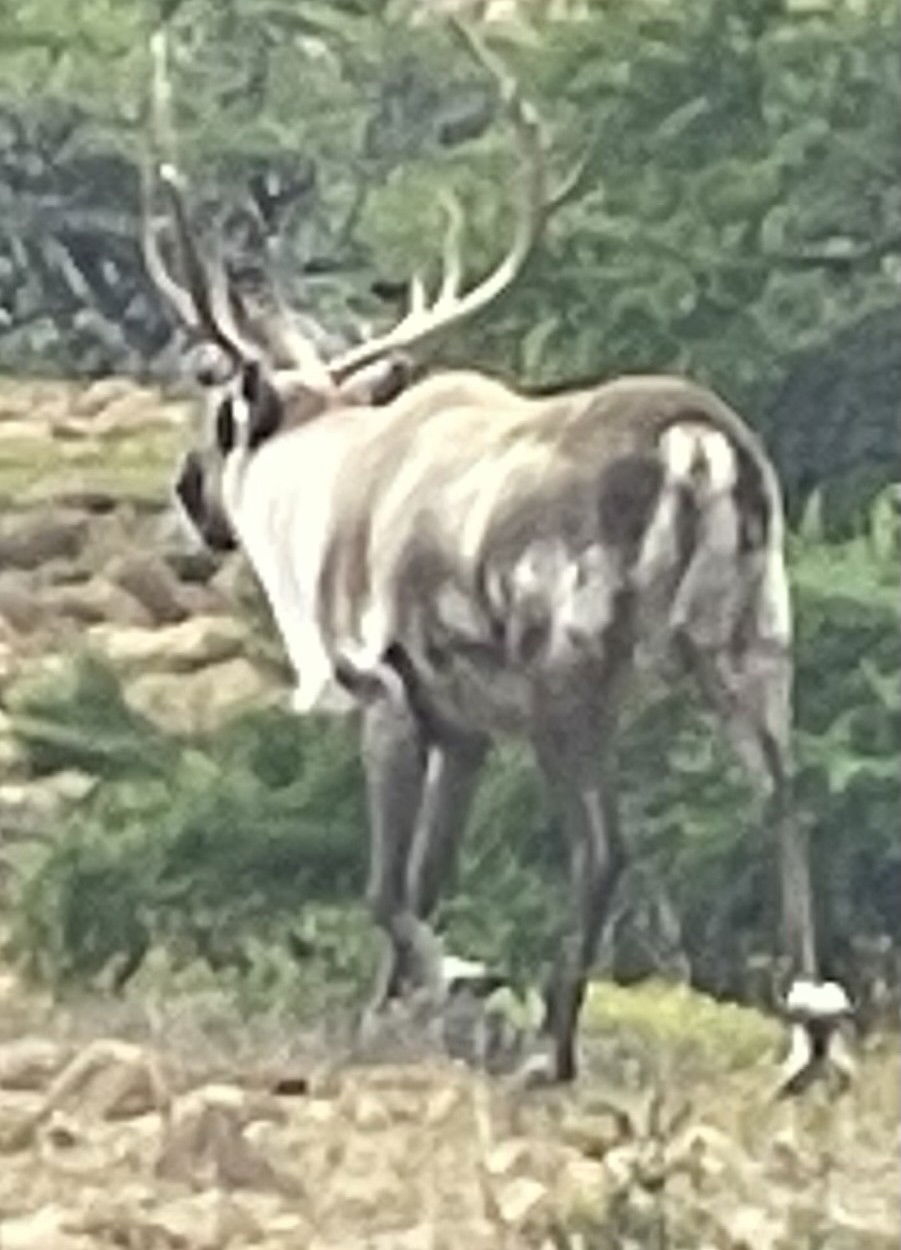
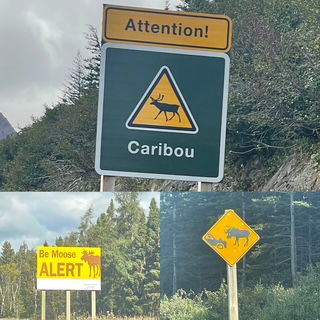
Day 16 Tuesday - Finally, MOOSE!
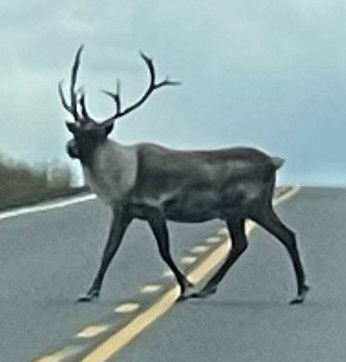
😊 Okay, maybe a “Newfoundland Moose”? Alright, it’s one of the 2 caribou we saw today in the Gros Morne National Park. I do have an observation though. We see our first Caribou Crossing sign and shortly thereafter we see 2 Caribou. Following that simple math we have seen a couple hundred Moose Crossing signs so we should be way past 0 moose. Here is the other one.
Today we had an easy drive to Gros Morne (2 ½ hours) with cloudy but dry weather and continuing great views.
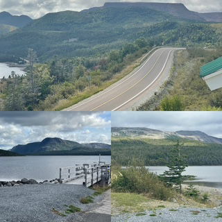
When you enter Gros Morne, you have two roads that ‘Y’ around a very large harbor. Today we took the road to the left and headed to the visitor/discovery center.
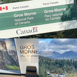
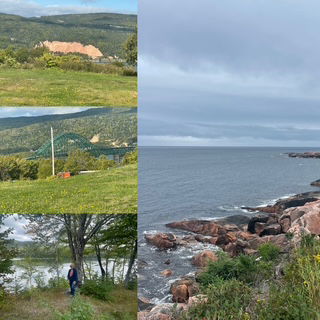
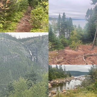
Gros Morne is a geological wonder and as such is also a UNESCO site. What we learned is that there is a region, Tableland, one of the only places on earth where the earth’s mantle was pushed to the surface. It is yellow brown and nearly nothing grows on it because of all the toxic metals in it and as you can see in the pictures, it is almost a clear line between the Tablelands and the next mountain ridge (yellow on one side, normal green on the other.) This Tableland was the missing link. It has changed the geological world as it supported the hypnosis of Tectonic Plates. The region is 500 million years old! Until this area was researched and analyzed, it was thought the oldest “rocks” were limited to 200 million years old. We were planning on hiking the Tablelands trail before we arrived but after learning all we did and talking to a ranger, we HAD to do the trail. The trail was about 3 miles long and was so unique that if seemed as if we were walking on the surface of the moon.
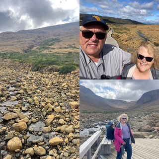
After the hike we got into the car and almost immediately we came across one caribou out in a field and after we drove away from that one, a very large caribou came out of the brush and walked across the road in front of us. So cool!
We left the caribou and drove to the end of the road to Trout River and some viewpoints.
Now, we turned around and drove back to the beginning of the Y and started up the right side to our cottage in Rocky Harbor. On the way, we stopped and did one more hike to see the 120+ feet Southeast Brook Falls.
Our cottage is very nice, across the street from the harbor and we had a nice sunset today.
Today is nearly the ½ way mark of our vacation. A few things from the first half of the trip. We have: Driven over 3,400 miles. Been on 3 car ferry’s for a total of 20 hours. Completed 4 audio books. Seen zero moose.
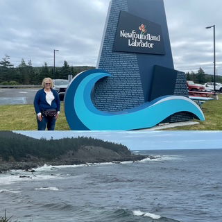
Day 15 Monday - Today was a driving day. We left St. John's and headed mostly west. We stopped at Costco on the way out of town as their gas prices are much better overall then they even are in the states. In Newfoundland gas prices aren't controlled like it is in Nova Scotia. It was easy to track our day as we started at Mile 0 of the famous Trans Canadian Highway (TCH) and by the time we made it to our exit, I remember seeing the 500 KM (300+ miles) mile post. Currently, the plan is to (mostly) stay on the TCH from here to Soo Saint Marie Ontario. Earlier this year, we started at Mile 0 of the famous US 1 in Key West through FL and on this trip drove most of the end of US 1 through much of Maine.
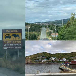
The scenery along the way was indescribable. We drove through Terra Nova National Park with rolling mountains like the Virginia Appalachian's covered in evergreens. Nate asked yesterday about leaf color and today we realized that so far, all we have seen are some sort of evergreens. Pictures just can't seem to capture the views. There are so many ponds (they don't call them lakes) that are rimmed by boulders and so many have "islands". Also, we saw another 100 or so Moose signs but not any moose. The habitat certainly screams moose and in some stretches they have 10 foot high fences for a few miles to stop the moose from crossing so we don't think they made up all the moose stories.
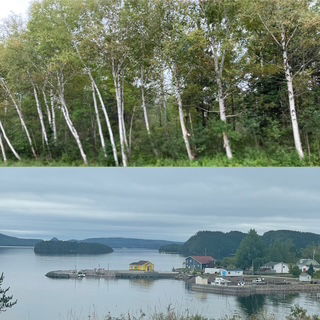
After about 150 miles or so, the terrain started to change, with more non-coniferous trees mixed in with the evergreens and then we drove into a long stretch of birch trees like we have never seen before. It was like a tunnel of trees (though not with the whole canopy covering a divided highway) with nearly all of them birch trees. Beautiful!
The only real stops I had planned were to see Glassy Beach and Rattling Falls and both of those were within 10 miles of our destination. We needed to hike to get a better view for both of the places but the Glassy Beach trail was tree root/rock trail that we now think is a "Newfoundland standard". It wasn't a long hike and we were doing well but as we neared the end, there was a large drop-off / hill that we both decided we have too much trip left to die on that hill. Next we drove to the 800 ft high Rattling Falls which was a simple boardwalk to a nice view.
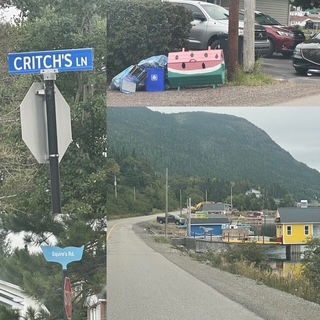
Some unique things we saw today - a Critch's street sign (we are watching the comedy "Son of a Crtich" on Netflix right now because it is based in Newfoundland). Everyone in Nova Scotia and Newfoundland have octagon shaped trash containers (bear proof?) which many decorate, in King Port (gateway to the Whales) their street signs look like whale tails and finally a group of "tiny homes" being built along the inlet.
Tonight, we were talking to the bartender/waitress/motel manager (yup does all 3) about our lack of moose sightings and she suggested we simply go for a short drive tonight (slow and careful) as she sees moose or bear nearly every night on the way home. Off we went into the dark! We drove about 7 miles to the nearest intersection and then turned around, driving only 35 with the high beams on and all we learned was that it is just as dark here as it is at the cabin. No Moose. No Bear - at least not yet!!!!
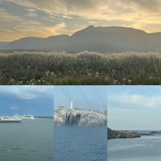
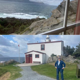
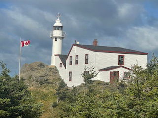
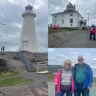
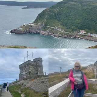
Day 14 Sunday - It was cloudy this morning and we were tired so getting up at 5:30 just didn't seem like a "vacation" activity to us! We headed to Cape Spear National Historic Site - the most easterly point of land in North America around 9:00. The drive was pretty but the view was the light house location on the cape was spectacular. We learned about the history as a lighthouse and as a WWI and WWI gun battery protecting the harbor and the gateway to North America.
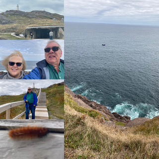
From there we drove through downtown St. John's and on the way to Signal Hill, National Historic Site on the other of the port (also located at the very highest point in the area). The views were just as spectacular and we learned about it's history from 1700, it's use as a gun battery for both world wars and that the first successfully received transatlantic wireless Morse code signal by Marconi from Cornwall England.
As for wildlife we are still waiting to see our first moose but we have observed many types of birds enjoying the updrafts and one wooly caterpillar (see above). I wonder, if you can trade 4 houses for a hotel in monopoly, can you change 100 warning signs for moose for just 1 real life moose in Newfoundland?
Next up was a drive to Half Moon Brook Cove for a highly recommended hike. The hike was a little slow going considering the path was either FULL of roots or rocks. However, it didn't stop us! We wondered if the view would be worth the hike, it was!
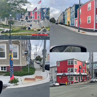
Last thing for the day was to go downtown and visit George street to see all the colored buildings, pubs and stores. St. John's is a beautiful city. There is color all over with the colorful houses nicely situated throughout the entire town.
Day 13 Saturday - The shipped rocked us all night long and we slept like the sweet babies we are. We finished our 3rd audio book and the ferry delivered us right on schedule to Newfoundland. We drove off the ferry at 10:00 AM sharp!
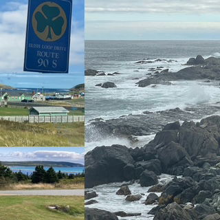
The first decision of the day was, drive straight to St. John's (1.5 hrs.) OR drive the Irish Loop (4.5 hrs.). Well, that was a no brainer! So as we headed off to the start of the loop, we picked the road that would get us to the start point straight away. The problem was that the road went from beautiful new pavement to some sort of gravel that reminded us both of a road we drove in Alaska. It was like driving on a washboard. Redo, back to the beginning, or almost and started audio book #4.
Once we restarted our drive, things really improved fast. The drive along the coast of Nova Scotia was nice but was a little bit of a let down from our expectations. We were worried about the same thing happening in Newfoundland. Boy those were unfounded worries.
The drive was simply spectacular. I would say about 3/4's of it we drove right next to the water (lakes, estuaries, rivers, ocean) or high in the hills looking down on the water. The other portion of the time we drove over what seemed to be an incredibly sparse plateau of short vegetation, lots of areas of junipers and plenty of water - we both thought it looked like a great place for a herd of elk or caribou.
We tried to finish our loop by driving to the Cape Spear National Historic Site - the most easterly point of land in North America - but as we were about 5 miles from it, there was a serious motorcycle accident so we turned around and went to our apartment. Now our plan (unless we come to our senses first) is to get up tomorrow around 5:30 and go watch the sun come up before anyone else in North America! FYI: forecast is for cloudy skies so maybe not.
Day 12 Friday - Note: I am writing this from the ferry to Newfoundland sitting in the lounge with Chris while a band is playing classic rock and Newfoundland songs. It will be posted on Saturday evening when we have internet again.
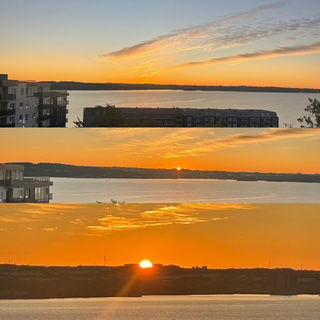
After our “quiet” day yesterday and a good night’s sleep, we woke a little earlier (6:40ish) and Chris noticed the light in the room, went and looked out the patio and asked when the sunrise was today. I grabbed my phone and said 6:51 and joined Chris as we both stood and watched the sunrise over the harbor in Halifax.
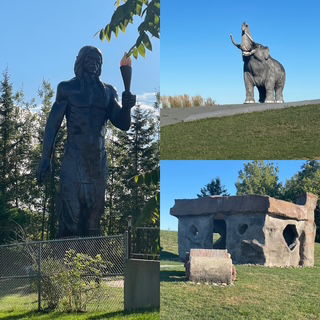
Alas, we got an early start on the road for our 5-hour drive to the north end of Nova Scotia to the ferry terminal to Newfoundland. Our first stop was the classic “road trip stop” 1) It has a sign stating the location is ½ way between the north pole and the equator (which is hilarious as there are at least 3 of those signs around Torch Lake) 2) It had a 22 foot replica of a Mastodon and (3) Because Canadians seem to have similar sense of humor as us, they added a house and car from the Flintstone’s Bed Rock City. Just down the road, an indigenous group has a 40-Foot-Tall Indian – a stature of one of their “creators” (Glooscap) who legend states gave the tribe fire and canoes.
The drive seemed to be made up of 4 sets of terrain. The first set was as we drove out of Halifax and continued to be much like the UP of Michigan. The second was when we entered the lowland valleys with lots of agriculture. Through these 2 areas we saw 2 deer (large like in MI but were very grey) and 1 person out in a field managing a buckboard / horse setup. It didn’t appear to be Amish but was a very strange site. The third part was very large rolling hills covered by thin forests.
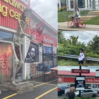
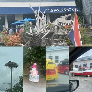
The "big surprise" of the day was the little town of St. Peters. It turns out they have a annual Pirate Weekend and they keep all of there decorations up until Halloween. BOY did they do it right
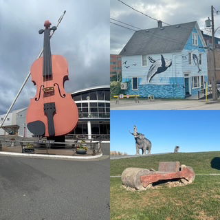
The last part was driving along the shore Bras d’Or Lake – which is actually more of an inland sea. The views were incredible and include a bald eagle soaring over a cove. We arrived at the north end with plenty of time to spare so we had to go see the World’s Largest Fiddle! 60 feet!
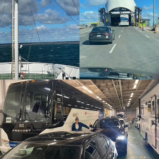
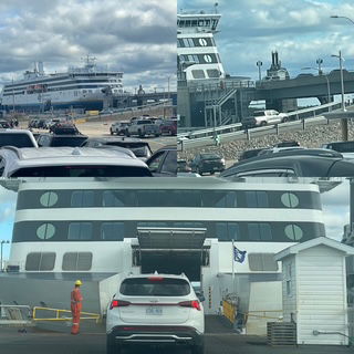
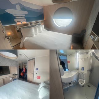
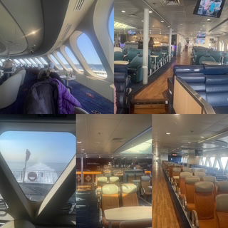
We grabbed a light snack and headed for our ferry. Our ferry today is a serious ship, it can have up to 1000 passengers, has 177 cabins, and can transport 120 trucks or 470 cars (or a combination of vehicles). It was a 16-hour voyage to Argentia (east end of Newfoundland). We had a nice surprise as we checked in at the dock. Originally, I could only reserve a cabin with 2 bunk beds which was going to be strange to say the least. However, I put us on the waitlist, and we ended up getting our choice, a deluxe cabin with a queen bed. COOL! We departed right on schedule, and the ride was smooth by boat standards. 😊 That said, we are rocking and swaying and look forward to a very good night’s sleep.
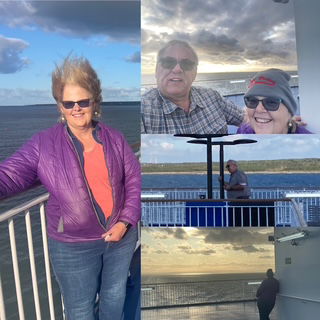
We were on the deck before the sun went down and had some nice views as we exited the harbor, including a lighthouse on the point. We were headed into a 20+ mph wind so I got some nice “Chris hair” pictures too!
Day 11 Thursday - Today was a take it easy day. We stayed in Halifax so no need to pack everything up and hit the road. In fact, we drove less than 25 miles total and didn't even leave the apartment till after 10:00!
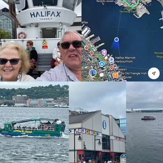
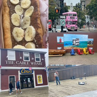
Halifax is on one side of the harbor and the much smaller and more quaint town of Dartmouth on the other. There is a passenger ferry which transverses between them. My plan was to go to Dartmouth first, get lunch, take the ferry over to the harbor walk in Halifax - which I thought might be a little boring - and then the ferry back to Dartmouth. As it turns out, Dartmouth was nice but sort of boring so we took the ferry straight away. There were two large cruise ships in port. The harbor walk was great with lots of food spots and shopping. We had a nice lunch indoors and then for desert we had a Beaver Tail (aka Elephant Ear to those of us from MI).
We also decided to visit the Maritime Museum of the Atlantic. It was informative and quite nice with some great exhibits on the Halifax Explosion and the Titanic.
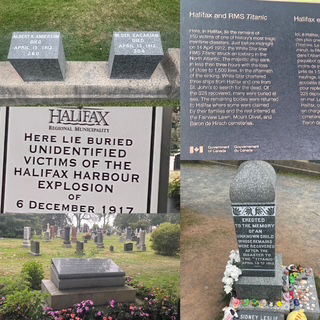
FYI: The Halifax explosion was a collision between two boats in the harbor, one of which was packed with munitions for WWI. At least 1,782 people died with over 9,000 injured. It devastated the Mi'kmaw people community who were residing in Dartmouth, near the blast. The explosion was the largest human-made one until the invention of the atomic bombs.
We walked the harbor front and made several Christmas gift purchases, got an ice cream cone from the "best ice cream in Canada" - Cows, and Chris found a nice set of indigenous made earrings.
As we rode the ferry back to Dartmouth, a container ship came into the port which was neat to see from a size perspective to other ships. This harbor is the base for the Canadian Atlantic Fleet so plenty of other ships as well. It was a very nice day, just like I planned!?!
After the harbor, we went to the historic Citadel from the 1700's but once we arrived we decided not to tour it as it was the same design as the one we toured in St. Augustine this past winter, instead we went to the city's Pleasant Point Park. A very large green area with many trails and the end of the peninsula so it has water on 3 sides and great views of the boat traffic. While we were there we saw a helicopter land by the dock with an ambulance waiting and someone got rushed to the hospital. We also were graced with hearing the theme of the "Love boat" over an incredible loud sound system from the cruise ships that were quite far away shortly before each cruise ship leaves the port.
Tonight we pack up not just to get back on the road but specifically for our 16 hour ferry ride to Newfoundland tomorrow evening. We have a 4 hour drive to the northern shore of Nova Scotia and then the ferry departs at 5:00 pm. Once we park our car on the ship, we can't go back to it so we need to pack the "right" things. By the way, I am assuming we won't have internet on the ship so the next update will likely be Saturday night.
Day 10 Wednesday - Today's drive was just under 5 hours heading east around the southern tip and then north to Halifax. The majority of the drive was enough inland that we couldn't see the ocean. It reminded us as if we were driving across the upper peninsula of MI. For entertainment we played "Road Wordle". The game has two parts: 1) See how fast you can decipher the non-verbal Canadian road signs. 2) See how fast you can translate French road signs. We are very good at #1, nearly useless on #2.
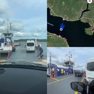
As we got closer to Halifax we headed for a couple of fishing villages and roads directly on the coast. The first village was La Have which I picked because it had a small car ferry (about 15 cars) across a harbor. We timed it perfectly as we arrived and drove right on to the ferry - about 8 minutes before it departed.
Next was Lunenburg which was the biggest of small towns and was very busy and extremely colorful.
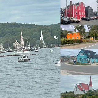
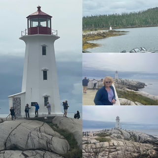
Mahone Bay looked to be very nice but had some serious construction going on it's main street so we made the executive decision to take what we saw at that point and head to Peggy Cove, our last destination before Halifax.
Peggy Cove is considered the #1 place to visit outside of Halifax and has one of the most picturesque lighthouses in Canada. A working fishing village with a the lighthouse situated on gargantuan wave-washed boulders.
Believe it or not, our first stop in Halifax was Costco.😊 The primary reason was for cheaper gas, we also had a few items we need to buy/replace. Unfortunately, Costco doesn't sell gas in Nova Scotia because the gas prices are set by the provincial government.
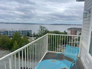
We checked into our apartment which is on the 4th story, has a Washer/Dryer and balcony over looking the harbor.
After dinner, we went to the Fairlawn Cemetery to view the memorial and 121 headstones for the victims of the Titanic (1912) and while we were there, we also saw the memorial for the "Halifax explosion" (1917) - clearly a bad 5 year period for Halifax.
Google map doesn't appear to be as accurate in Nova Scotia, as it is in the US AND Nova Scotia road signs have problems. There has been several times where the direction from Google and the actual road didn't match up. i.e. Google tells us to get into a particular lane and to turn from that lane but that lane is not a turning lane! Or how about this one. Google says "Stay on Petite Riviere" and you get to a "Y" in the road and the road sign states "Petite Riviere" and points in BOTH directions!?!? UGH! Also frustrating for the "drive 5-10 over the speed limit driver" is that drivers in Nova Scotia seem to think that the top speed they can drive is the posted speed limit!!! Shocking!
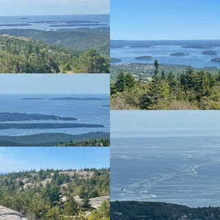
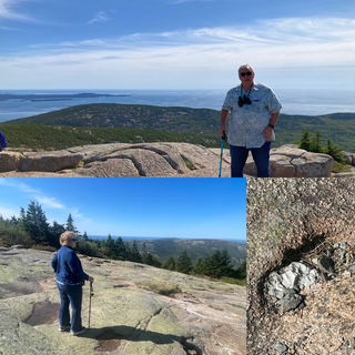
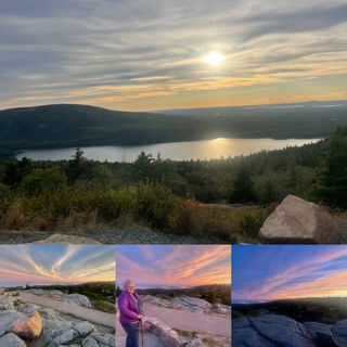
Day 9 Tuesday - Canada! But first, we spent the morning on top of Cadillac Mountain. We had such a great time last night, we just wanted to go back and soak it all in. Nearly cloudless skies and very comfortable temps made for a very nice morning.
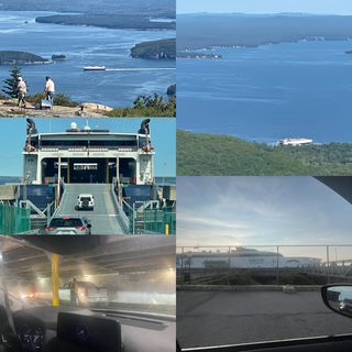
We headed to "The Cat" catamaran ferry to Yarmouth NS around 1:00 and by 2:20, the ferry was leaving the dock (40 minutes early!). The ocean was incredibly calm so the ride was very smooth. Not to say you couldn't feel the swells, you certainly could, but they were far more relaxing then frighting. Arrived tonight around 6:00, found our Airbnb (very nice) and then grabbed a quick bite from the Pita Pocket to take back to our apartment and relax. When filling out the customs declaration, we had to state how many days we would be in Canada and the total was 24! Nice!
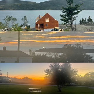
Our first sunset in Canada.
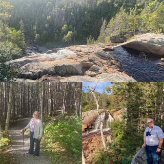
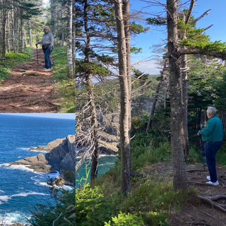
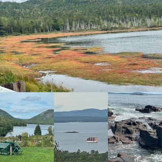
Day 8 Monday - ACADIA!!! Cross off our 38th National Park! We arrived at the park at 8:30 - just as the visitor center opened and spent about 10 hours in the park. The weather was supposed to be dry and cloudy but was dry and quickly turned mostly sunny. The views were incredible as was the weather and while the park loop road is only 27 miles, we took about 6 hours to complete it. So many viewpoints of cliffs, beaches, "thunder hole" and the Jordan Pond House's famous Popovers. While we were out of the park getting checked in at the ferry and motel, we pickup up a Chicken BBQ Pizza and took it back in the park with us as we drove to the top of Cadillac Mountain for the sunset.
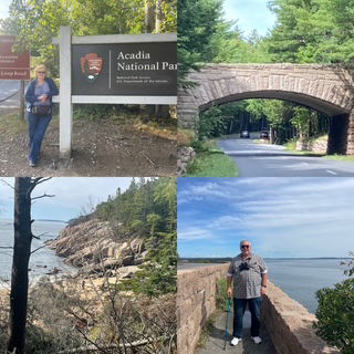
We planned for a Monday arrival hoping to avoid crowds and while the crowds weren't too bad, we can't image the park in July or August. We were told parking can be very difficult and can sometimes take an hour just to find a spot at a premier viewing location - they weren't kidding! We were lucky in that we found spots (often the only one) in nearly all the spots we wanted and in those rare occasions, still found parking in overflow lots.
Bar Harbor is beautiful and is a very nice "resort" town if you are into shopping and buying lots of arts, fudge and souvenirs but we just didn't have enough time to explore. Not even for a cup of tea or a soda. Turns out we may only spend an hour or so tomorrow in the town as we wait to board the ferry for Nova Scotia. The Cadillac Mountain sunset was so spectacular we plan to go back up tomorrow morning and explore the mountain top a bit more for our remaining 1/2 day. Acadia has set the bar VERY HIGH for Nova Scotia, Newfoundland and beyond!
We had an aha moment today. On one of my last trips to Hong Kong several years ago, I bought two extendable "hiking poles" as I knew they were a great deal (I love deals!) and I knew they would come in handy. Well, today they FINALLY did. That begs the question, why did I wait so long? Was I being stubborn or am I getting old? Probably both!
Our only hiccup for trip so far occurred at check-in. The Days Inn didn't have the type of room we reserved so they apologized profusely and shifted our stay to a resort across the street and on the water. Same rate, but a much nicer room and a view of the bay!
Day 7 Sunday - And the rain continues.... However it was mostly just a constant sprinkle so that helped. We left Gorham and headed to Woodstock ME - YES, yet another Woodstock. The results for the best Woodstock is #1 - VT, 2 - NY and then ME a distance third. As for "why Woodstock ME?", because it is home to the world's largest phone!
From Woodstock we headed to LL Bean in Freeport. The drive was very nice as we crisscrossed ME but we learned that a 75 mile drive across country in ME means we drove on probably 30+ different roads! No kidding! Later in the day we did another set of roads that was probably 50 miles and 20 roads. Thank goodness for google maps! As we drove, we passed by Hebron Academy (which we had never heard of but it is a boarding school started in 1804) that had a campus any tiny college would be proud to call their own.
Freeport is such a cool little town with all of it's stores and LL Bean. Chris purchased a vest and a lined flannel shirt and made a beeline to the Carter's store 😊
From Freeport we went to Bath and found the Bath Iron Works and the building Chris and I interviewed in many, many years ago. When we saw the giant lobster on top of the restaurant, we knew it was time for lunch: Clam Chowder & Lobster Casserole.
Next, Brunswick and the 133 year old Androscoggin Swinging Bridge.
As we continue up the coast the next stop was the Damariscotta Mills Fish Ladder (for Alewife). It is a fish ladder built in 1807!!!
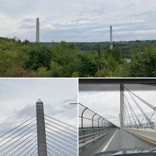
Our final stop along the way was the Penobscot Narrows Bridge. The granite used in part of it's construction came from the same quarry as the Washington monument and what the two towers are modeled.
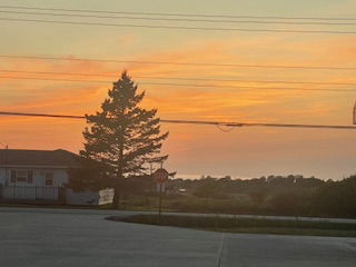
Maine is certainly a colorful place both manmade and natural as you can see. The sunset below is from our hotel and the parking lot of a laundromat.
A few general updates, so far, we are on our 3rd audio book of the trip (though the first one we had about 1/2 done before we started). and we have traveled just over 1,900 miles.
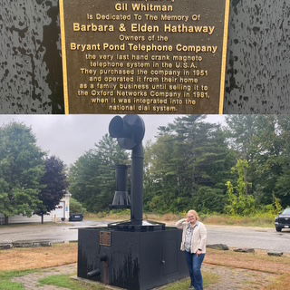
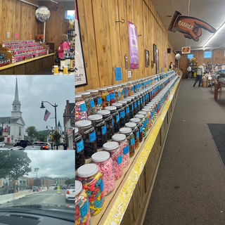
Day 6 Saturday - The good news starting out this morning was the rain that was expected held off until we had loaded the car and started our drive, leaving Glen Falls, NY heading to VT and NH. The bad news was when it started to rain, my oh my, did it rain! We had sprinkles, many torrential downpours, lightning but also a few breaks, including when we arrived in Littleton NH and went to Chutter's, the home of the World's Longest Candy Counter (124 feet!!!)
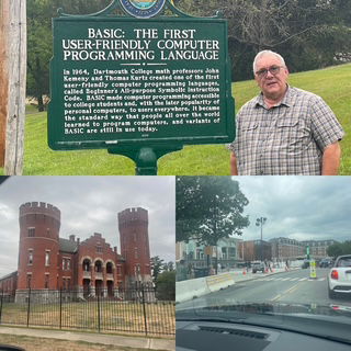
On the way to our first stop, we drove through Woodstock VT and with all due respect to Woodstock NY, the VT one is way better. Our first stop was at a historical marker (GEEK ALERT) at the location where to Dartmouth students invented BASIC programming language and started the whole personal computer revolution. I HAD to stop! This led us to drive through Hanover NH, home of Dartmouth. What a nice town and incredible campus.
From Dartmouth we went to Littleton for candy and then to Lincoln, NH as it is at one end of a 35 mile stretch of road to Conway, NH which is considered one of the very best scenic road in New England. It was incredible but the sky also opened up so the views from the overlooks were nearly non-existent at times.
The final part of the drive to Gorham NH took us by the Mt. Washington Mountain Road entrance but we decided not to drive to the top as the view can be as far as 60 miles and today, we guessed out visibility would be about 500 yards.
Today's drive was about 6 hours total drive time. We were surprised to see "Watch for Moose" signs in VT and even more surprised to see many "Moose" signs throughout NH. Unfortunately, no actual moose yet. A bonus view, we saw 5 covered bridges!
Day 5 Friday - A long day of driving planned today (7 hrs.). From Delmar MD, through Delaware, New Jersey and about 1/2 of New York (Glen Falls, NY) I have waited till tonight to comment on the traffic as I did not nt to jinx us but now that we have completed the section of the trip with the historically worse traffic, I can share that are drive has been terrific. We have driven at the speed limit nearly the entire trip with the only "traffic" occurring today outside of Albany as it was 5:00pm and we had some end-of-workday traffic. Even so, our navigation reported the delay was only 15 minutes! Woo Hoo!
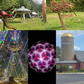
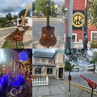
As we rarely drive point to point, today we detoured into the Catskill mountains to see the world's largest Kaleidoscope (housed in an old grain silo), one man's sculptures of UFO's and similar and a stop for a bite to eat in Woodstock!
So far, we have driven through parts of the Allegheny, Catskill, and Adirondacks. Tomorrow we will add the Green (VT) and White (NH) ranges.
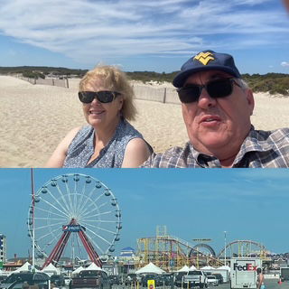
Day 4 Thursday (Finally as well!) - Nate and Andrea worked while we went out to explore the "eastern shore" as it is called here. First we went to Princess Anne, a beautiful small town and home to University of Maryland Eastern Shore campus and Andrea's office. From there we drove to the coast to visit the Assateague National Seashore, hoping to see it's famous wild horses
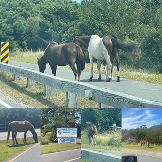
As you can see, we saw many and it was a perfect day. We even spent time just sitting on the beach. After the beach, we headed to to Ocean City which is a "classic spring break" type beach town.
Below are pictures from the sites between the seashore to OC, including a "car???" driving on the highway at about 20 to 30 mph that must have a story behind it but all we know about it is what you can see in the picture below.

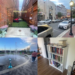
When we returned to the apartment, we had some extra time so Chris and I assembled an IKEA bookshelf which was actually kind of a fun, quick project. We took Nate out to dinner as Andrea had to go to Baltimore. After dinner Nate took us around Salisbury and as we walked around the downtown, we found a bar that had an outdoor seating area and took advantage of it. Our time with Nate and Andrea made for two very nice two days.
Day 3 Wednesday (Finally!) - Finally, you ask? Internet issues which is why this post is a couple days late. The drive to visit Nathan & Andrea was a relatively short one, only 4 hours or so. We took our time, because they both were working. First we went to Wilmington DE to see the historic old town and their river walk. If that sounds familiar, that is because during our trip to Key West earlier this year, on the return we stopped in Wilmington NC and did the same 2 things. 😊
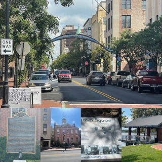
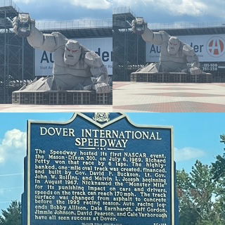
From there, we went on to Dover to see the Monster Mile (Dover International Speedway). Why? It seemed like the thing to do since we appeared to be "copying" some parts of our Key West trip and had visited Daytona race track. But, the real reason was to see the Monster itself. We also saw the DE historic capitol. We took Andrea out to the Old Mill Crab House for dinner which was extremely good and Andrea was patient with us learning how to eat crabs. It was a great ending to a good day.
Day 2 Tuesday - Today was for a "driving" day. We drove about 6 hours across Ohio and Pennsylvania to Harrisburg. We took a more scenic route through central PA and included a detour to Happy Valley - the home of Penn State University. I have always wanted to see Beaver stadium (their version of the big house) as well as campus and the route in and out of the area. It was a great detour! While the football, basketball and hockey venues were nice, the campus was phenomenal (so hard to write that) It was a beautiful sunny day and as we drove through the heart of campus, around 1:00, students were everywhere. It was a classic college vibe.
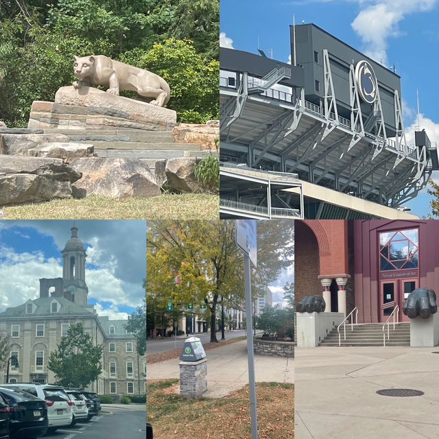
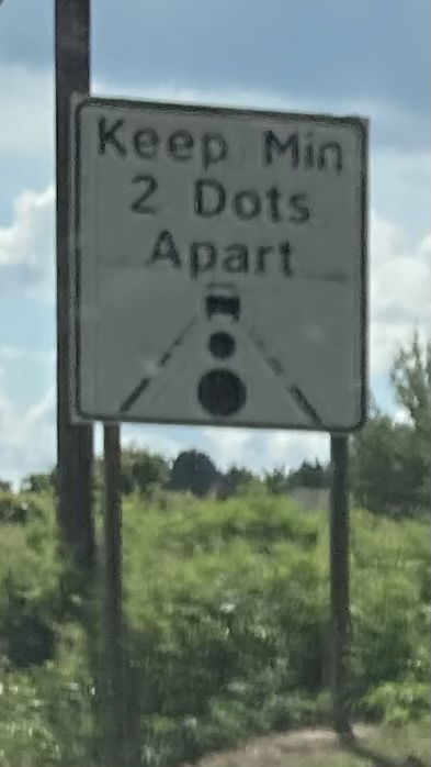
With all the road trips we have taken, it is rare for us to see something driving related we haven't seen before. BUT, that happened today as we saw "road dots"! The roads going in and out of Penn State can get crazy busy traffic on a football Saturday. The solution is putting giant white dots on the road (4 feet in diameter?) at equal distances apart and then post a sign like this one. Seems like a great idea to us.
Day 1 Monday 9/1 - We begin with picking up our rental rental (Mazda CX5 small SUV) at noon, brough it home, packed it up and were off by 1:00.
An easy day for the beginning of our travels. A beautiful day, lovely weather, good cloud formations. A pleasant surprise for Labor Day traffic, it was very light. No delays, no problems!
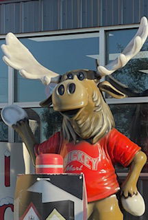
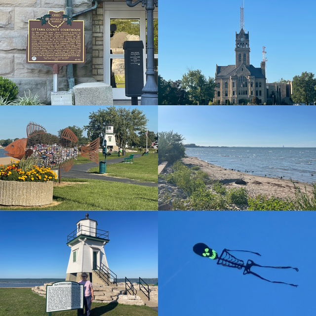
Our first moose sighting, even though it was at the Mikey Mart, we hope it will be a good sign. Our first night is at Port Clinton, OH, a very nice town on the shores of Lake Erie. I wasn't thinking about it at the time, but sort of perfect 1st day location as this trip will be weeks of driving along the shoreline all across the NE USA and the maritime provinces of Canada.
In addition to our "moose" sighting we saw our first Lighthouse, fish sculpture aka bottle recycling holder, a gorgeous courthouse and a flying skeleton kite (and it's not even March.)